12 US Road Trip Routes That Were Iconic 10 Years Ago
A decade ago, the American road trip still held a special place in the travel calendar. In 2015, cheap gas, social media travel culture and a growing appetite for domestic getaways helped make a familiar set of drives feel especially iconic.
What stood out then was not just the scenery, but the mix of freedom and accessibility. These 12 routes were the kinds of trips people planned with paper maps, playlists and a full tank, and many still shape how Americans think about summer travel now.
Pacific Coast Highway, California
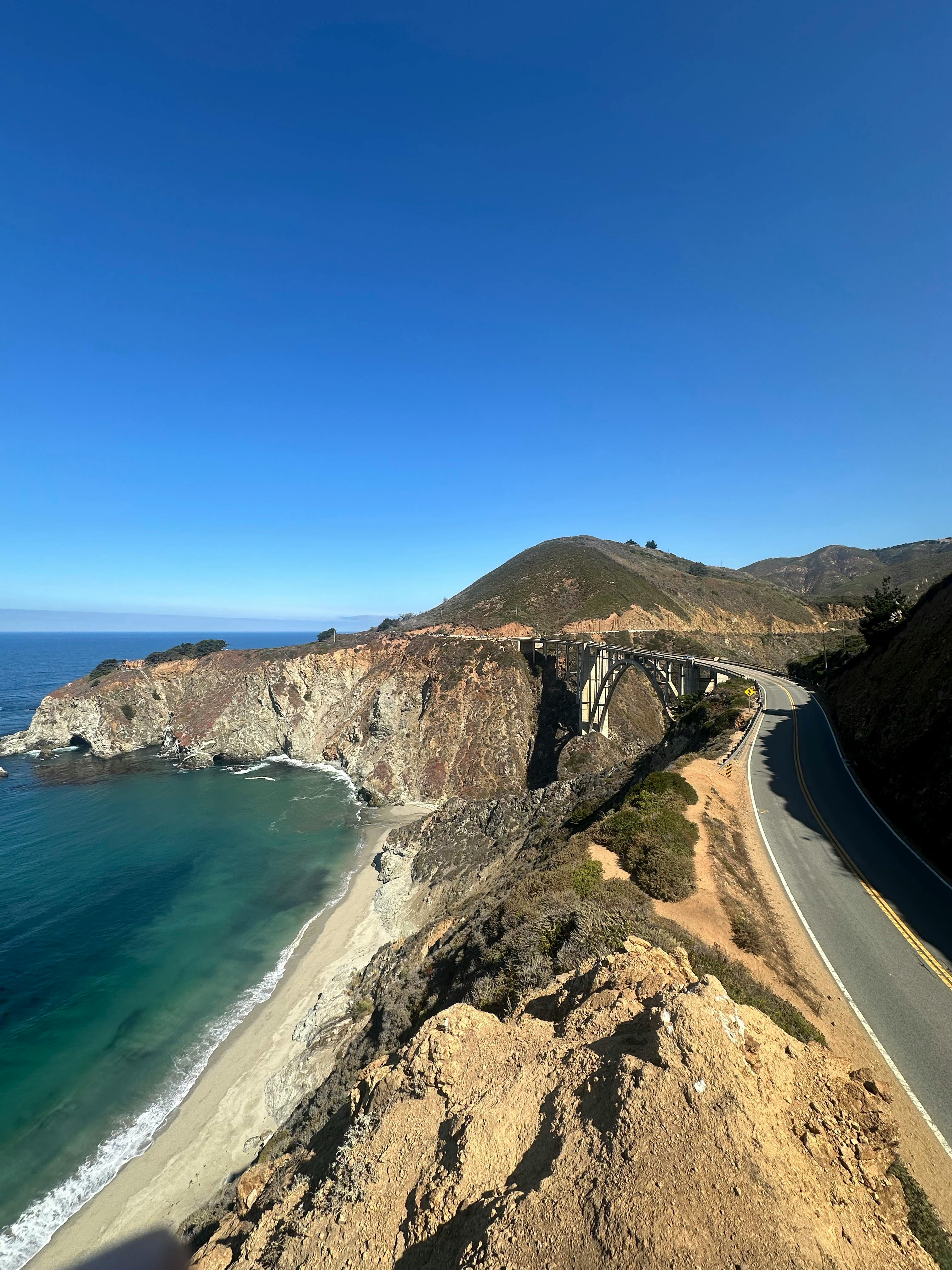
California’s Pacific Coast Highway was arguably the signature US road trip route of 2015. The stretch most travelers talked about ran between Monterey, Big Sur and San Luis Obispo, where Highway 1 hugged cliffs above the Pacific and delivered one overlook after another.
Travel guides and state tourism campaigns regularly featured Bixby Bridge, McWay Falls and Hearst Castle as anchor stops. According to Visit California material from that period, the route was prized for combining ocean scenery, small-town stops and easy access from major airports in San Francisco and Los Angeles.
The appeal also matched the travel mood of the time. Instagram was reshaping vacation planning, and few US drives photographed better than this one. A quick coastal loop could feel cinematic without requiring weeks off work.
Even then, the route came with practical limits. Landslides and seasonal construction were recurring issues along Big Sur, something transportation officials had long warned motorists about before setting out.
Route 66, Illinois to California
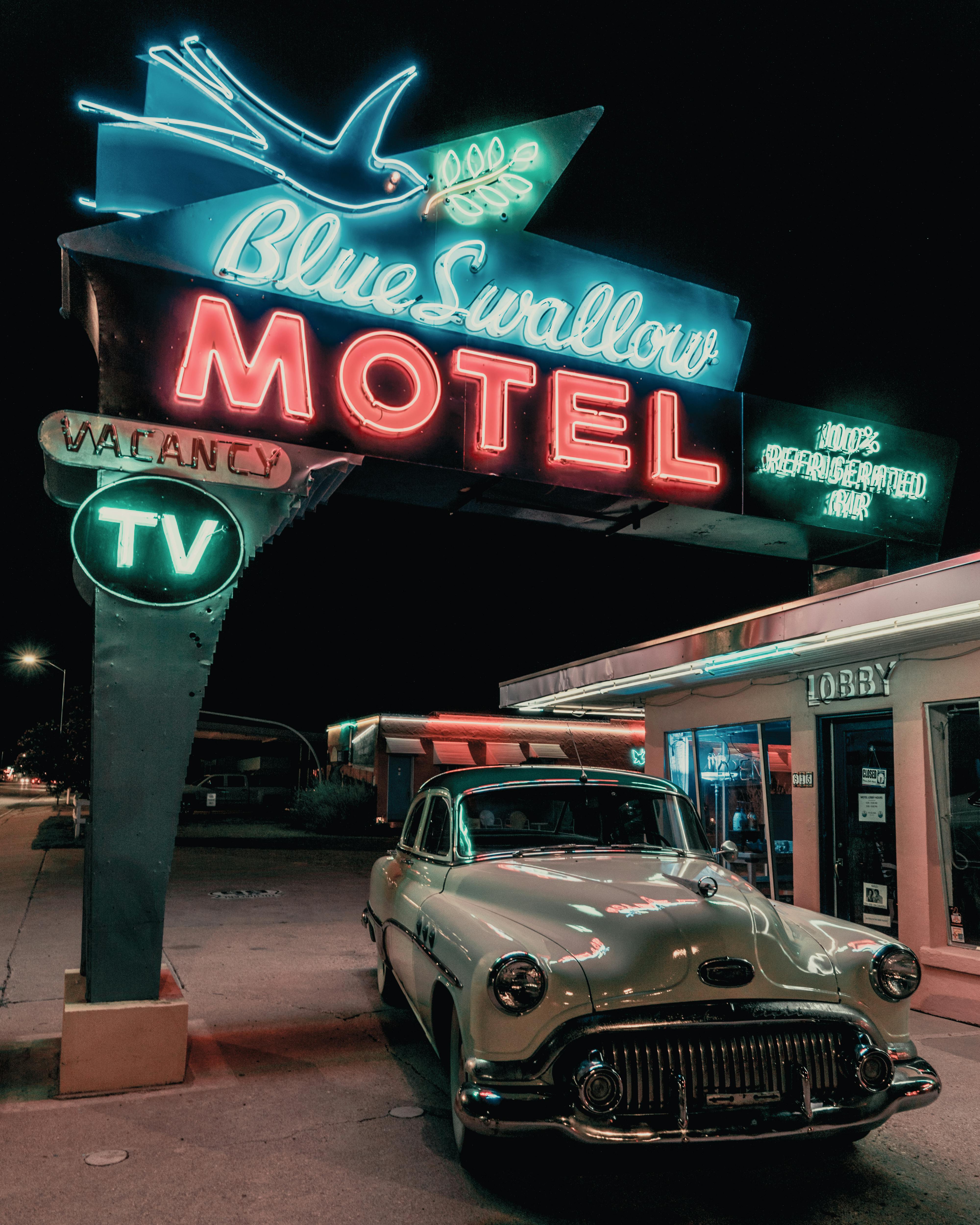
If one road defined American nostalgia in 2015, it was Route 66. The historic highway had not functioned as a single official road for decades, but its identity remained powerful from Chicago through the Southwest to Santa Monica.
Travelers were drawn to old diners, neon motel signs, kitschy roadside attractions and preserved stretches of two-lane pavement. State tourism offices in places like Oklahoma, New Mexico and Arizona continued promoting Route 66 heavily because it blended history with an easy, stop-and-go travel style.
The route also fit a recession-era habit that lingered into the mid-2010s. People wanted trips that felt meaningful without relying on expensive international flights. Route 66 offered a long domestic journey packed with landmarks that were more cultural than luxury-focused.
Its staying power came from story as much as scenery. Families could say they had followed America’s Mother Road, and that phrase still carried weight with travelers 10 years ago.
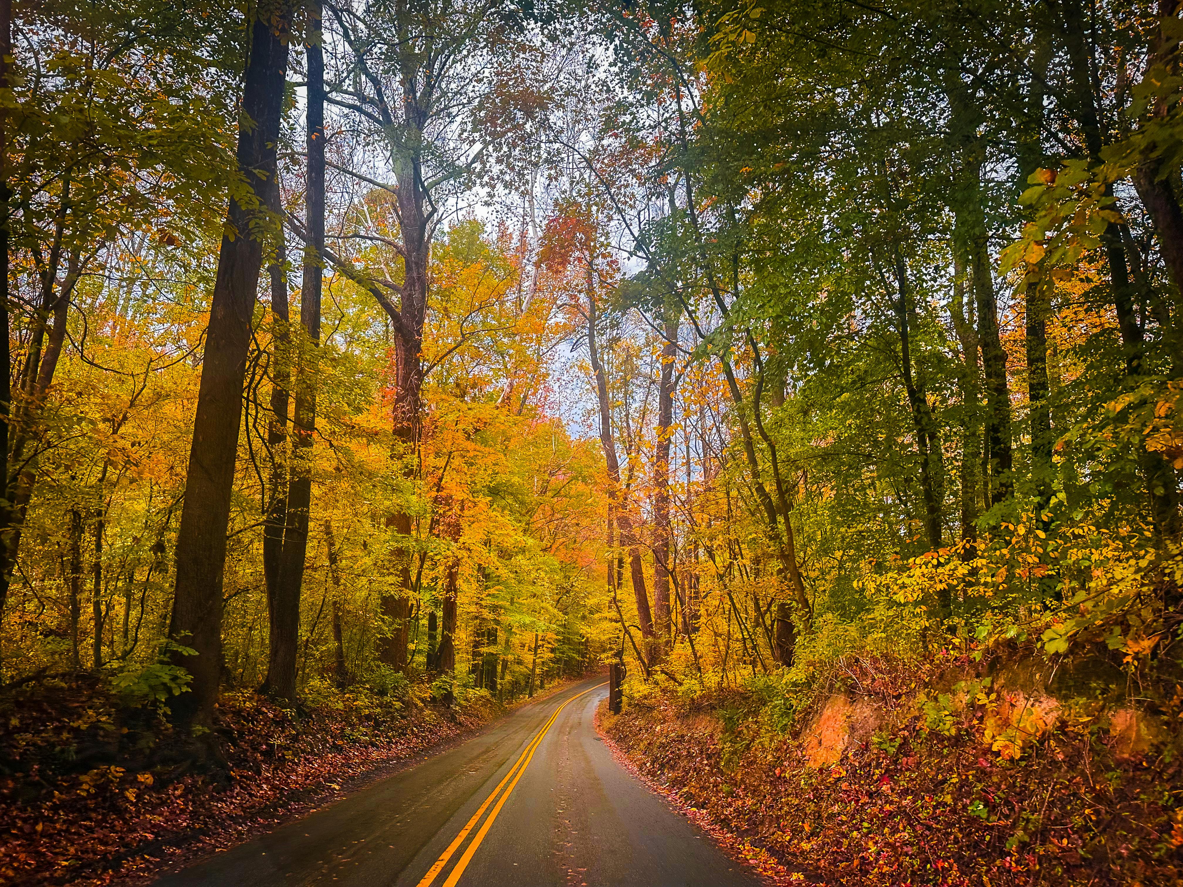
Blue Ridge Parkway, Virginia and North Carolina
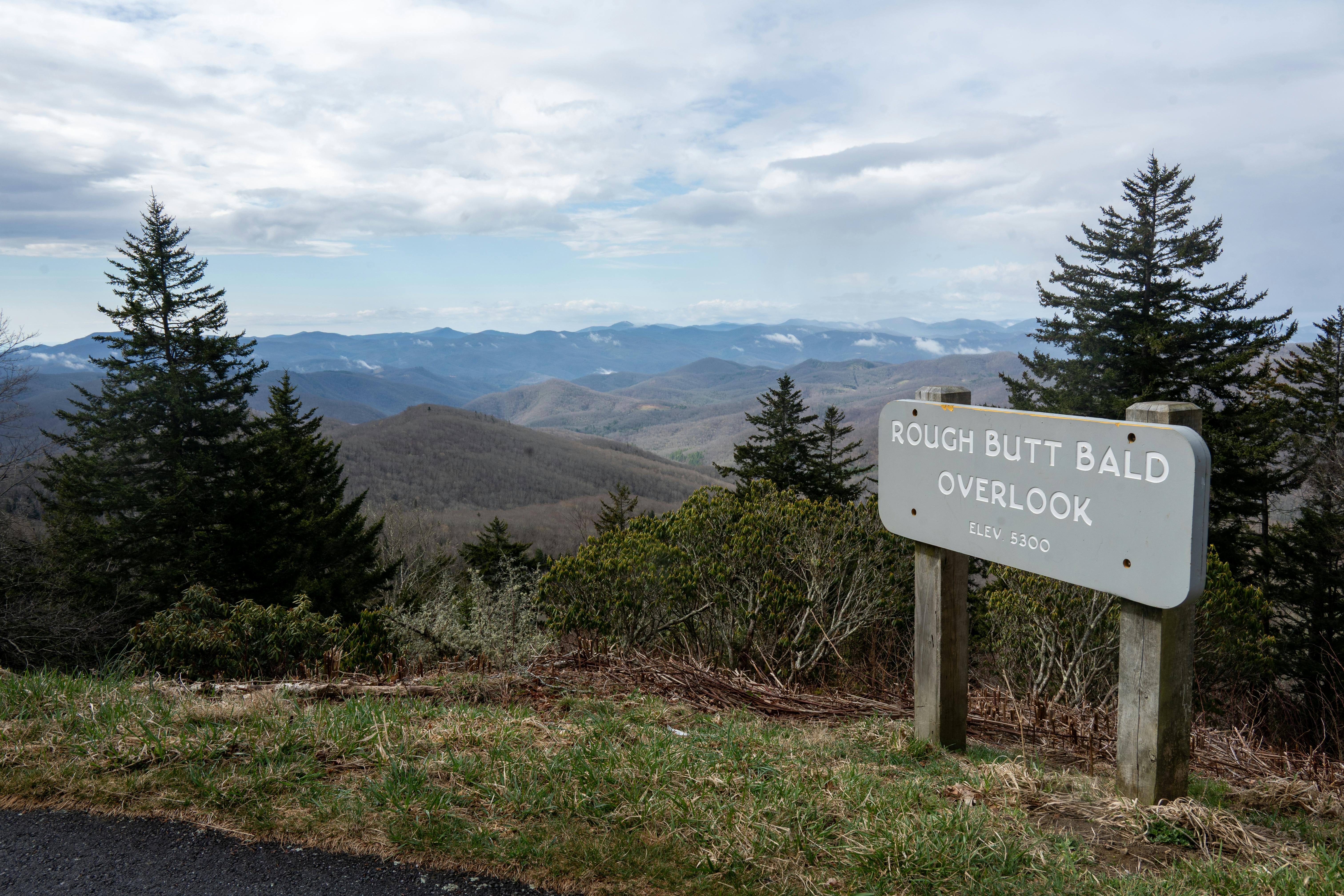
The Blue Ridge Parkway was a favorite for travelers who wanted a slower road trip. Managed by the National Park Service, the 469-mile route linked Shenandoah National Park in Virginia with Great Smoky Mountains National Park in North Carolina.
By 2015, it had long been one of the most visited units in the national park system. Drivers came for mountain overlooks, hiking access, picnic areas and small Appalachian towns near the parkway’s exits. It was especially popular in spring wildflower season and during the fall color peak.
Unlike faster interstate drives, the parkway was built for scenery, not speed. Commercial traffic is largely absent, and that made it feel calm even during busy travel periods. For many families, it was the opposite of a rushed vacation.
The route’s appeal was also tied to affordability. Campgrounds, budget lodges and free overlooks made it a realistic trip for middle-class households looking for a week on the road.
Overseas Highway, Florida Keys
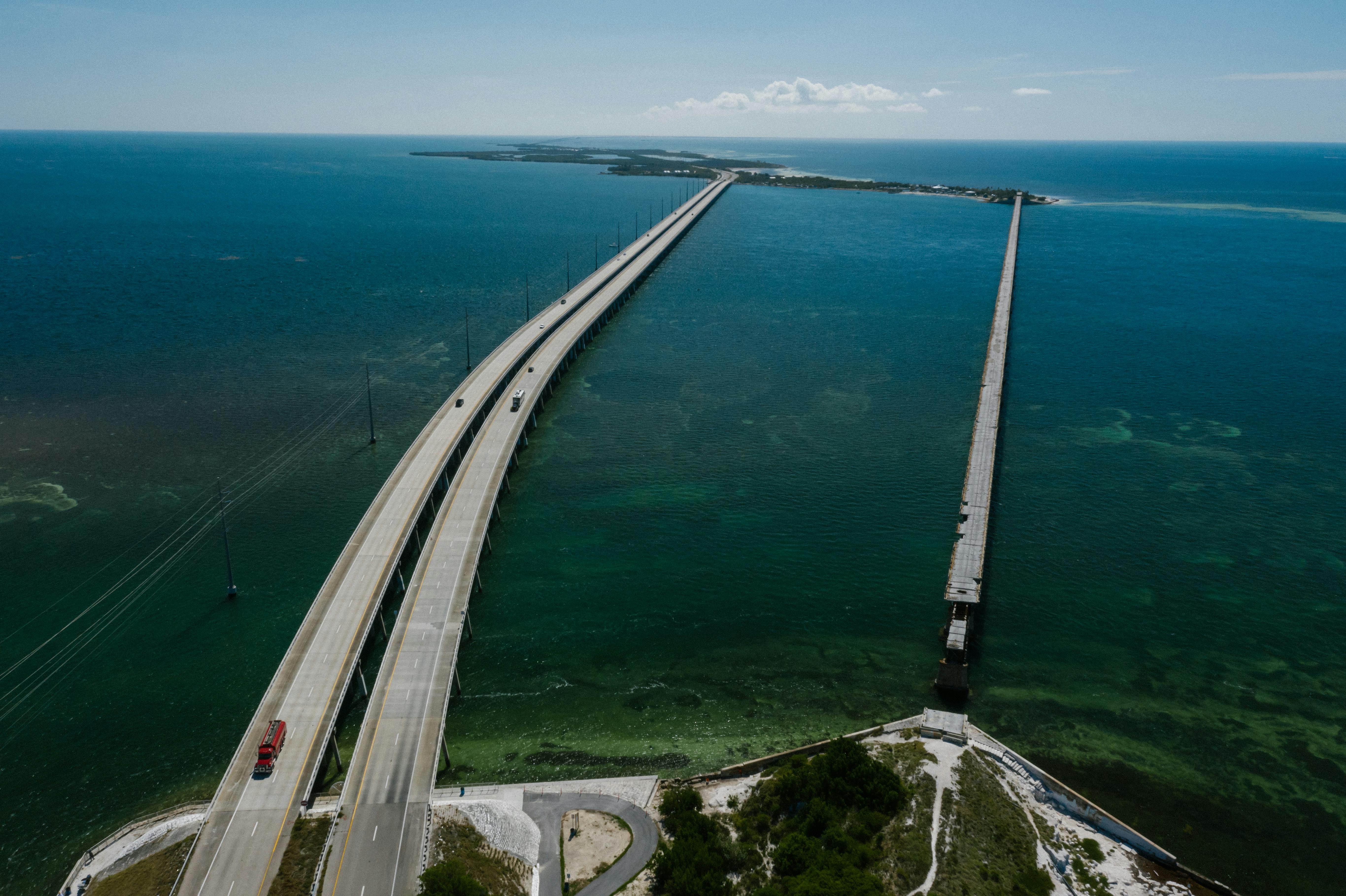
The Overseas Highway from Miami to Key West stood out in 2015 as one of the country’s most recognizable warm-weather drives. The route follows US 1 through the Florida Keys, crossing a chain of islands with long bridges and broad views over turquoise water.
The Seven Mile Bridge remained the most famous segment, often featured in travel advertising and television footage. Monroe County tourism officials had spent years promoting the Keys as a road-accessible tropical getaway, a major advantage for travelers who wanted beach scenery without flying to the Caribbean.
That made the route especially appealing during winter and spring. Visitors could leave South Florida and feel they were entering a very different landscape within a matter of hours. Seafood shacks, fishing charters and sunset stops added to the relaxed mood.
At the same time, the highway’s popularity highlighted its fragility. Hurricanes, heavy traffic and limited evacuation routes were recurring concerns in state and county emergency planning discussions.
Going-to-the-Sun Road, Montana
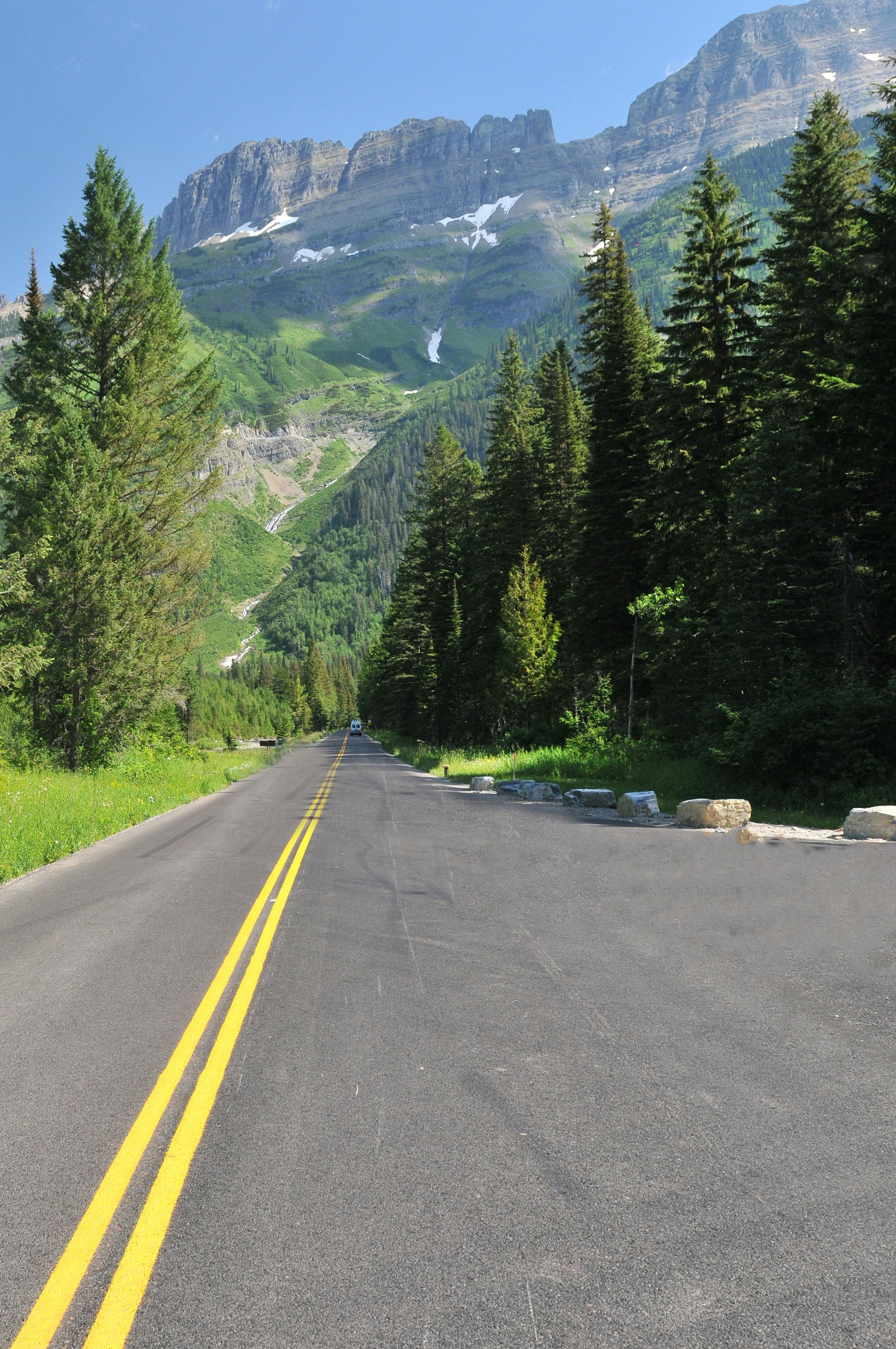
Going-to-the-Sun Road in Glacier National Park was one of the most dramatic drives Americans talked about 10 years ago. The road stretches about 50 miles across the park, connecting West Glacier and St. Mary while climbing through the Rocky Mountains.
Because of snow, the route is usually open only part of the year, and that added to its mystique. National Park Service crews often spent months clearing drifts that could tower above roadside barriers. When the road opened, it quickly became a seasonal must-do.
In 2015, Glacier was seeing strong visitation growth, part of a broader rise in park travel before the National Park Service centennial year in 2016. Visitors came for alpine views, wildlife sightings and the chance to drive a route often described as an engineering landmark.
The road was never a casual high-speed cruise. Tight curves, steep drop-offs and frequent pull-offs demanded patience, but those same features helped make it unforgettable.
Great River Road, Mississippi River corridor
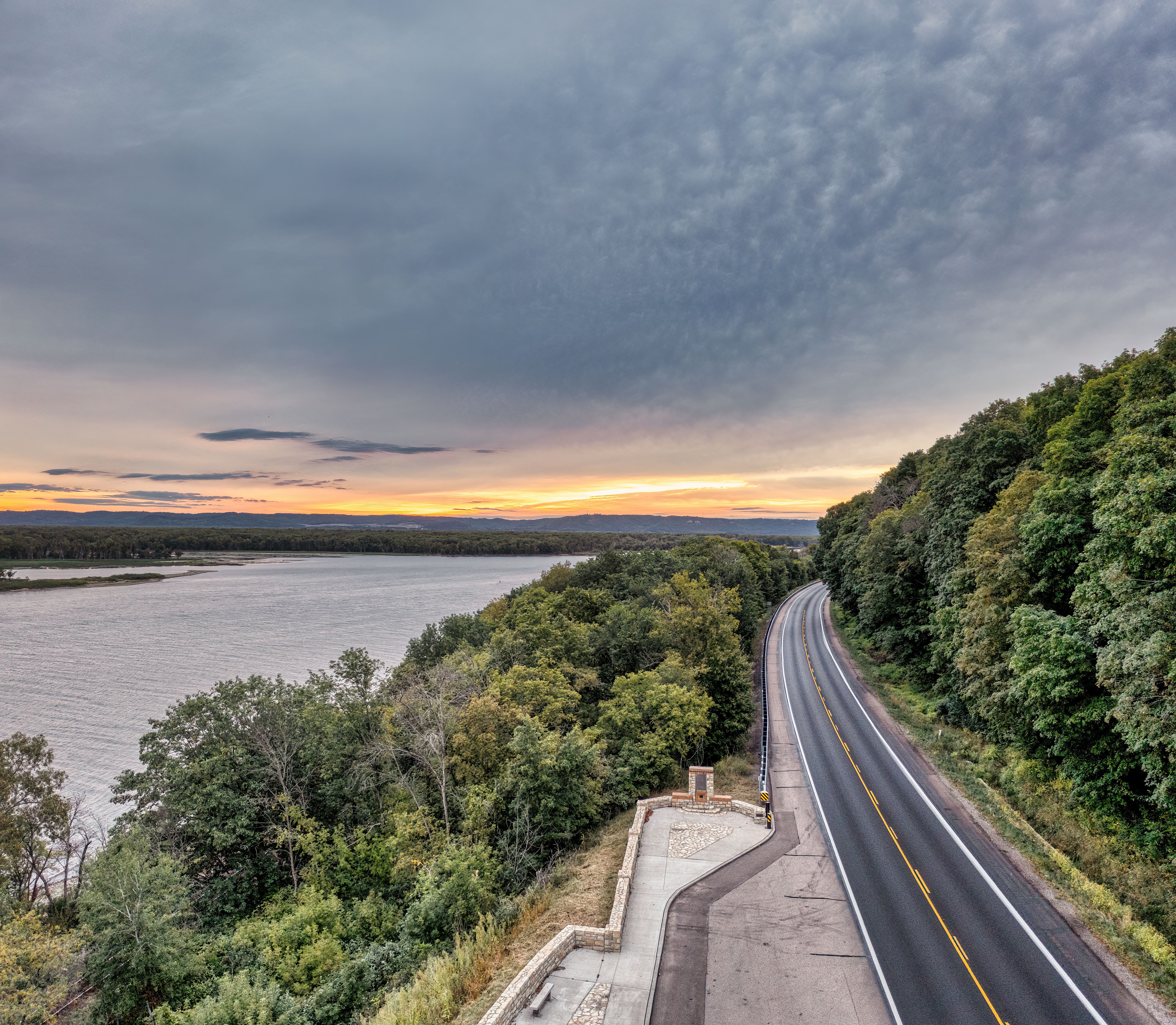
The Great River Road offered a different kind of iconic road trip in 2015. Instead of one uninterrupted highway, it followed the Mississippi River through 10 states, from Minnesota down to Louisiana, tying together river towns, farmland, music history and Civil War sites.
Its scale made it less famous in pop culture than Route 66, but travel experts often praised it as one of the nation’s richest heritage drives. The route passed through places tied to Mark Twain, blues music, steamboat history and regional food traditions, especially in the lower Mississippi Delta.
For many travelers, the appeal was flexibility. Some drove a single state segment, while others built longer trips around Memphis, St. Louis or New Orleans. That made it easier to tailor to budget and schedule than some cross-country routes.
By 2015, heritage tourism was a major selling point, and the Great River Road fit that trend well. It was scenic, but it was also deeply American in story and identity.
The Loneliest Road, Nevada
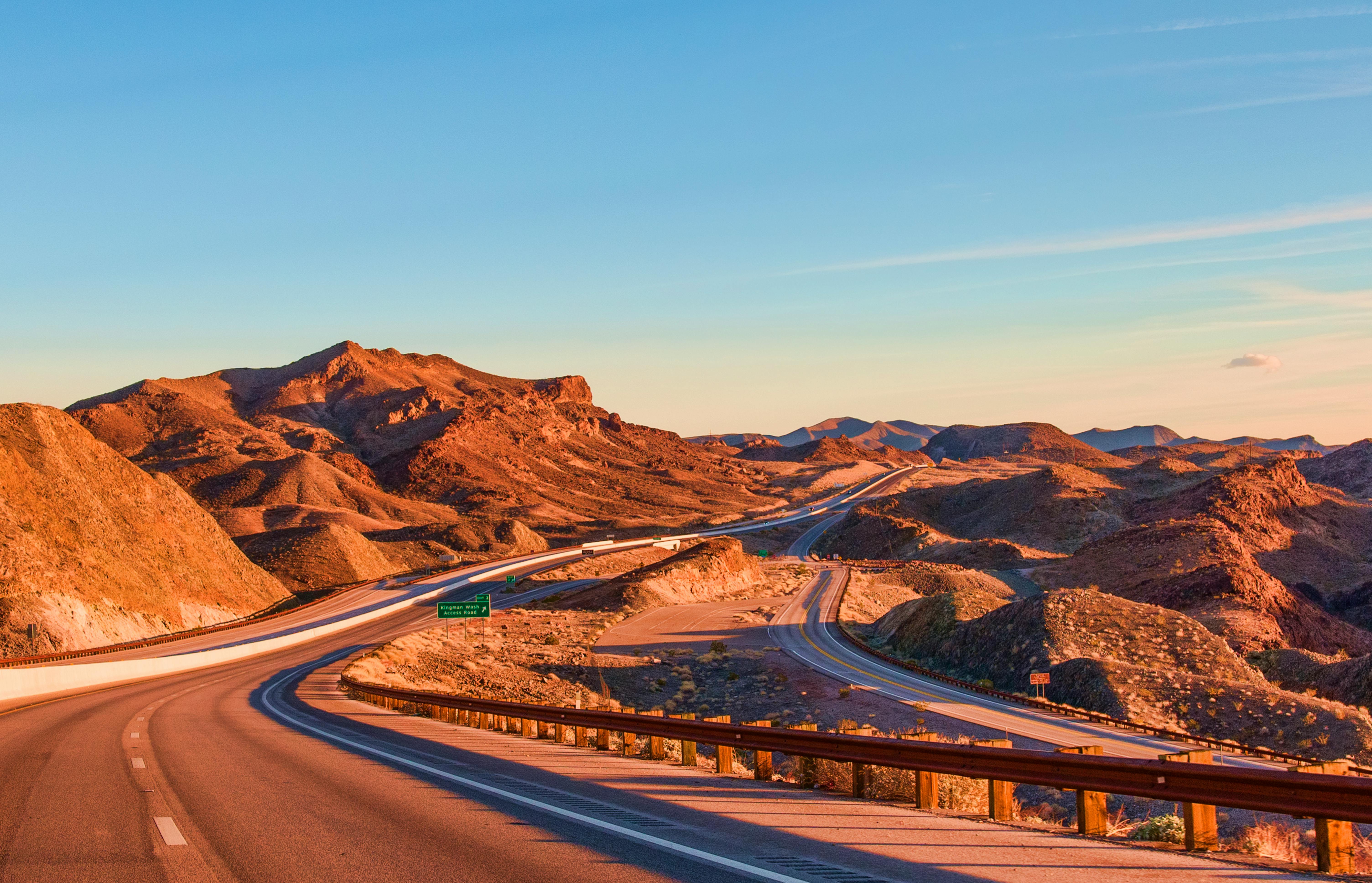
US 50 across Nevada, often marketed as the Loneliest Road in America, had a strong following a decade ago among drivers who wanted open space rather than famous attractions. The route cut across the Great Basin, linking small towns, mountain ranges and vast desert basins.
The nickname came from a 1986 Life magazine description, but it was tourism officials in Nevada who turned it into a badge of honor. By 2015, the branding was well established, attracting travelers who saw emptiness as part of the adventure.
Stops like Ely, Austin and Fallon gave the road just enough structure for a multiday trip. Ghost towns, old mining history and unusually dark night skies added to the experience. It appealed to motorists who wanted quiet and distance.
That same remoteness required planning. Fuel stops could be far apart, cell service was inconsistent, and summer heat posed real risks for unprepared drivers.
Natchez Trace Parkway, Mississippi to Tennessee
The Natchez Trace Parkway was one of the most relaxed scenic drives on the list in 2015. Running roughly 444 miles from Natchez, Mississippi, to near Nashville, Tennessee, the route followed a corridor shaped by Native American travel, frontier movement and early US history.
Administered by the National Park Service, the parkway banned commercial traffic and kept speeds moderate, which helped preserve its peaceful character. Drivers could stop at interpretive sites, forest trails and historic landmarks without the pressure of heavy truck traffic common on nearby highways.
Its popularity 10 years ago reflected a broader interest in road trips that mixed scenery with education. The route felt accessible to retirees, families and history-minded travelers who wanted something quieter than beach traffic or western mountain drives.
It also had a practical advantage. The trace connected several mid-South destinations while still feeling sheltered from the rush of regular interstate travel.
Acadia All-American Road, Maine
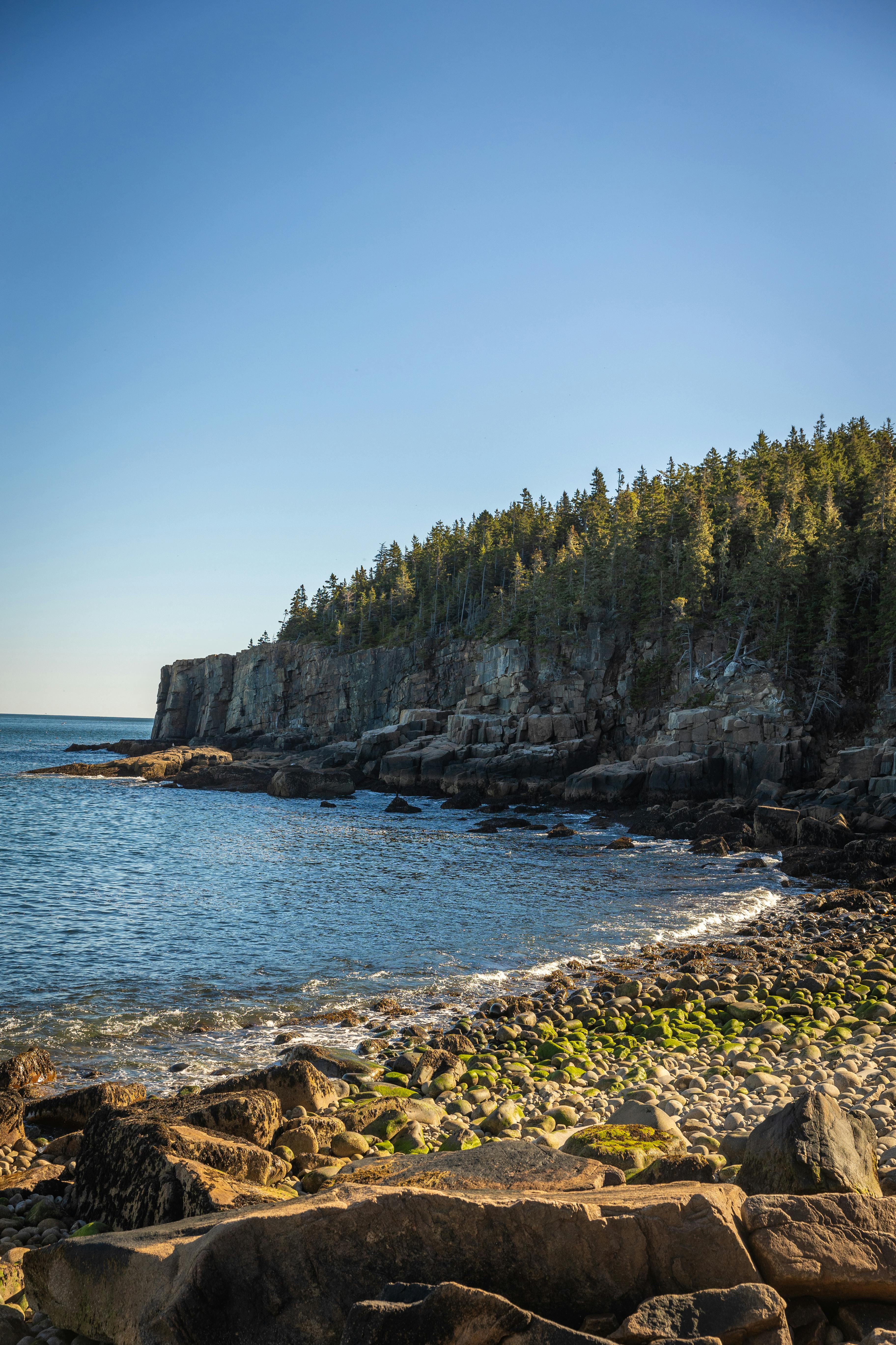
Maine’s Acadia All-American Road was a standout New England drive in 2015, especially in late summer and fall. The route looped through Mount Desert Island and around Acadia National Park, delivering rocky coastlines, forested sections and views of Frenchman Bay.
Tourism officials in Maine routinely promoted Bar Harbor and Acadia as one of the Northeast’s top car-trip destinations. The drive appealed to travelers from Boston, New York and the Mid-Atlantic who wanted a classic coastal vacation without crossing the country.
Part of its iconic status came from variety. In a single day, travelers could climb Cadillac Mountain, stop in town for lobster, and continue along curving park roads with ocean pull-offs and granite shoreline views.
Seasonality mattered here too. Peak foliage and summer demand could crowd roads and lodging, but that pressure also reinforced the route’s reputation as a bucket-list drive.
Lake Shore Drive to Upper Peninsula routes, Michigan
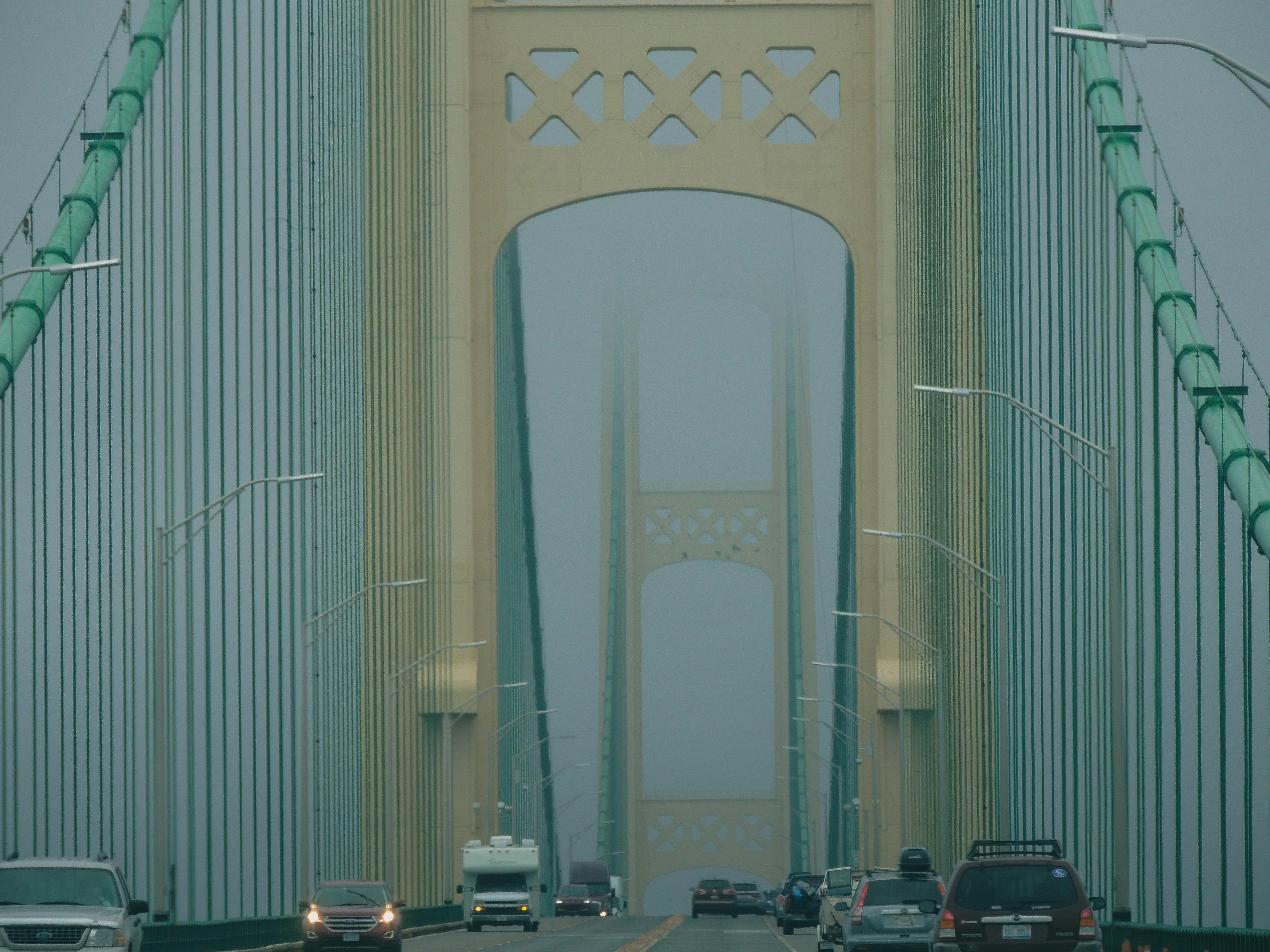
Michigan offered one of the Midwest’s most underrated road trip combinations in 2015, especially routes linking Lake Michigan shoreline towns with longer drives into the Upper Peninsula. Travelers often started around Chicago-bound or western Michigan corridors before heading north toward Sleeping Bear Dunes, Mackinac Bridge and Lake Superior.
State tourism campaigns at the time emphasized freshwater coastlines, dune landscapes and small resort towns. That message resonated with families looking for scenic vacations within driving distance of Detroit, Chicago, Indianapolis and other major population centers.
Crossing the Mackinac Bridge remained a signature moment. Once in the Upper Peninsula, drivers found waterfalls, forest highways and shoreline vistas that felt far removed from urban Midwestern life. The region’s relative coolness also made it attractive in peak summer.
For many travelers, this was a practical alternative to western national park trips. It offered big scenery, lower costs and fewer logistics than flying across the country.
San Juan Skyway, Colorado
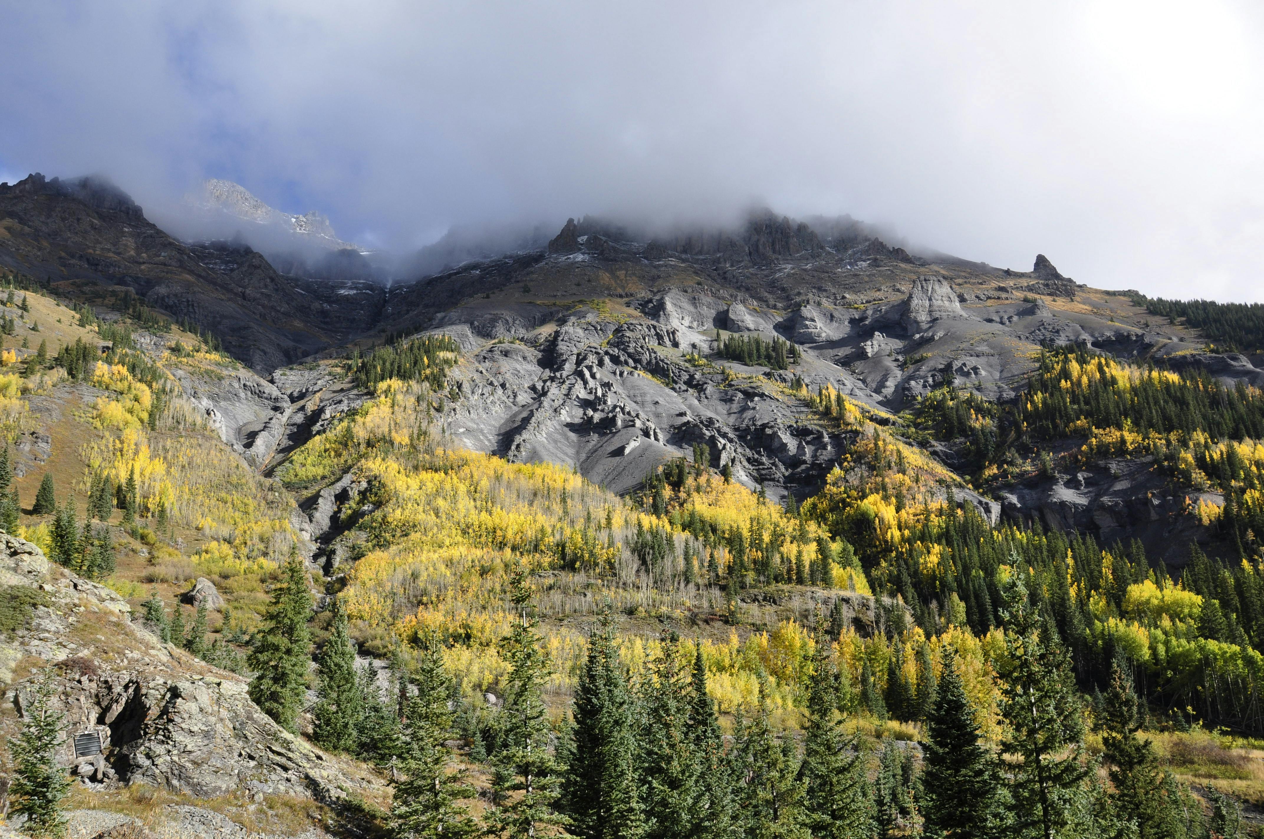
Colorado’s San Juan Skyway was already a legend among mountain drives by 2015. The 236-mile loop in the state’s southwest connected towns such as Durango, Silverton, Ouray, Telluride, Cortez and Ridgway through a mix of high passes and historic communities.
The route’s most famous section, the Million Dollar Highway between Silverton and Ouray, drew drivers for its narrow lanes, steep grades and sweeping alpine views. Colorado tourism materials often highlighted the road as a premier fall-color route, but it also attracted summer visitors heading into the San Juan Mountains.
Unlike routes built mainly around one park, the Skyway combined scenery with old mining history, skiing culture and access to Mesa Verde National Park. That variety gave it broad appeal among couples, families and motorcyclists.
The road also demanded respect. Weather could shift quickly at elevation, and some sections were intimidating even for experienced drivers, which only added to its reputation.
Hana Highway, Hawaii

The Road to Hana on Maui rounded out many 2015 lists of iconic American drives, even though it required getting to Hawaii first. The route covered roughly 64 miles from Kahului to Hana, but distance mattered less than the hundreds of curves and dozens of one-lane bridges along the way.
Travelers went for waterfalls, black-sand beaches, tropical forest and roadside banana bread stands. Hawaii tourism messaging frequently positioned the drive as an essential Maui experience, and rental car itineraries often built a full day around it.
What made it iconic a decade ago was how immersive it felt. Drivers were not just moving between points. They were slowing down, stopping often and experiencing a landscape that changed mile by mile.
By 2015, local officials and residents were also increasingly vocal about congestion and road etiquette. That tension foreshadowed today’s larger debate over balancing visitor demand with community life on scenic routes.