14 Travel Ideas That Expose How Fragile U.S. Infrastructure Really Is
Travel across the United States can feel effortless when roads, transit, and connections line up, yet the experience changes quickly when mobility options narrow. Some destinations depend on ferries, shuttles, seasonal roads, or limited public transit, so timing and planning matter as much as the sights. Parking rules, reservation systems, and last-mile connections often determine how much can fit into a day. Weather and maintenance can also affect access, especially in mountain and coastal areas. A flexible itinerary, clear pickup points, and backup routes help reduce stress. These fourteen places stand out for how transportation choices shape daily pacing and comfort, especially when reservations, road alerts, and transit schedules change at once.
Mackinac Island, Michigan
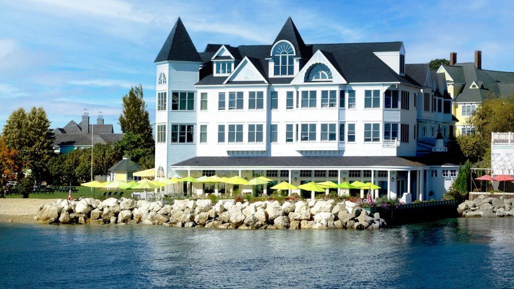
Mackinac Island feels distinct because cars are largely absent, and movement depends on walking, bicycling, and horse-drawn transport. Access begins with seasonal ferry service from Mackinaw City and St. Ignace, so schedules and weather can influence arrival and departure times. Luggage handling often involves porters or carts, and packing light can make transitions easier. Once on the island, distances can feel longer than expected without a vehicle, especially when visiting the perimeter road or Fort Mackinac. Planning meals and sightseeing around foot travel keeps days comfortable, and checking ferry times helps avoid rushed returns, especially when afternoon crossings fill and weather delays last departures.
Fire Island, New York
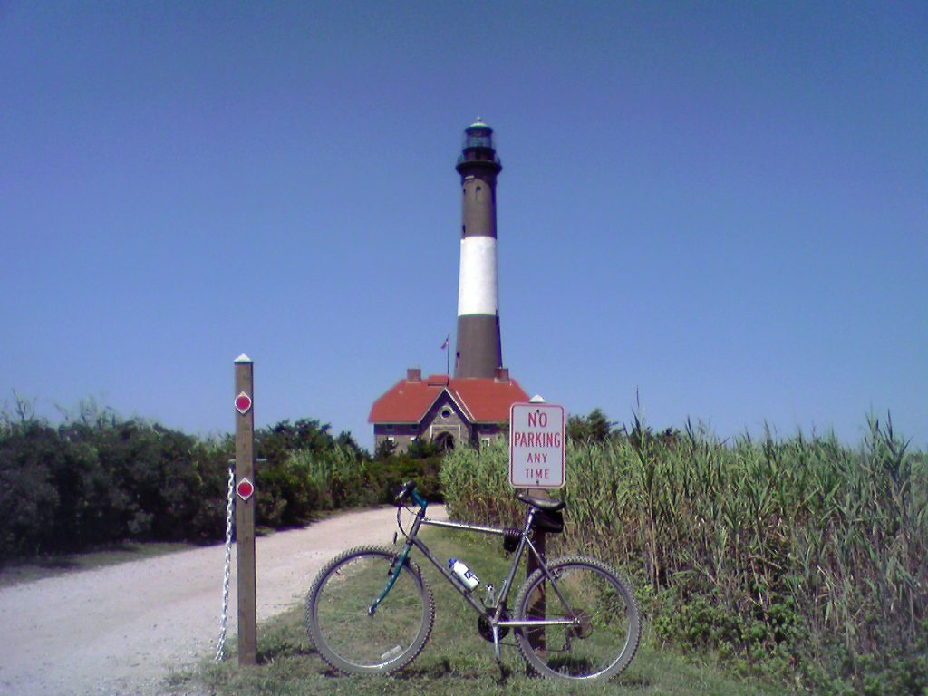
Fire Island shapes travel around ferries and footpaths, and the absence of private cars in many communities changes daily rhythm. Access typically runs through ferry terminals such as Bay Shore or Patchogue, and schedules can vary by season and day of week. Weather and tide conditions can also influence crossings, which makes buffer time useful. On arrival, movement relies on boardwalks, bicycles, and limited service vehicles, so rolling luggage can be awkward on sand and narrow paths. Grocery trips and dining plans often require more coordination than in car-centric towns. Advance planning helps keep beach days simple and unhurried, especially when last ferries depart early and stores close sooner.
Key West, Florida
The Key West sits at the end of the Overseas Highway, and that single roadway can shape everything from arrival timing to dinner reservations. Traffic congestion or crashes along U.S. 1 can cause long delays, especially during peak travel weekends. Once in town, compact streets encourage walking and biking, yet parking remains limited and tightly regulated. Many visitors rely on scooters, taxis, or rideshares, which work best with planned pickup points in busy areas. Nearby islands and water activities also depend on boat schedules and weather. Staying flexible keeps the trip comfortable when transportation slows unexpectedly, especially when bridge backups form and ferry departures shift with wind.
Boston, Massachusetts
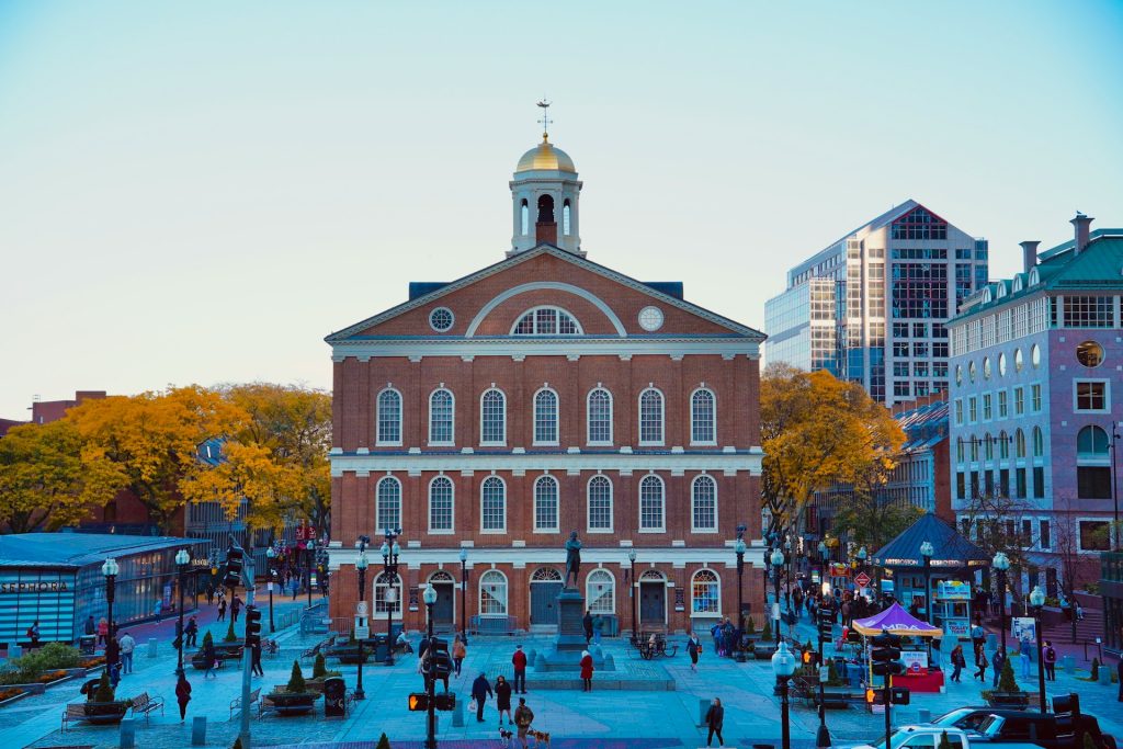
Boston often feels easier without a car, yet that convenience depends on understanding transit lines, walkable routes, and strict parking rules. The Massachusetts Bay Transportation Authority serves many popular areas, but service changes and crowded peak times can affect pacing. Driving in the city can be stressful due to narrow streets, one-way patterns, and limited parking, while garages can be expensive. Walking works well, though hills and weather can change comfort levels. For day trips, commuter rail schedules matter, especially for late returns. Knowing fare options and planning transfers ahead helps keep historic sightseeing and dining plans on track, especially when weekend maintenance alters routes and trains run less frequently.
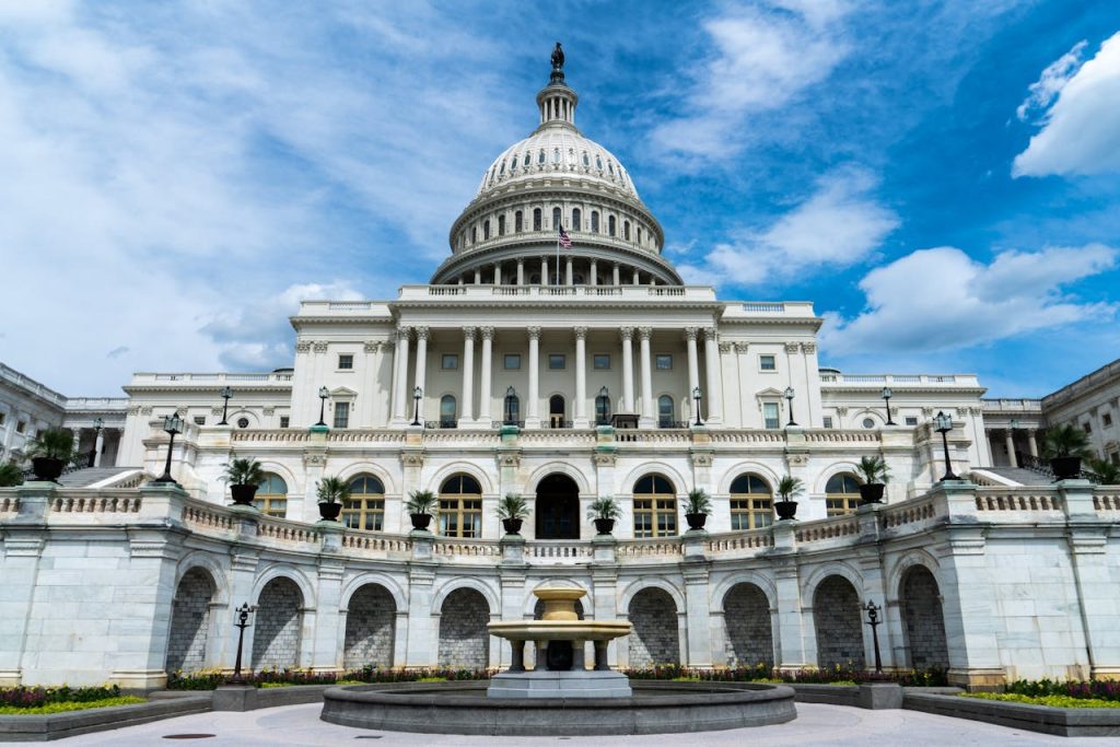
Washington, D.C.
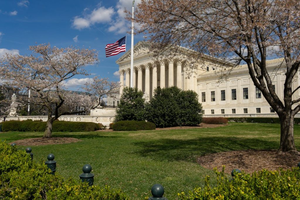
Washington, D.C. rewards transit planning because monuments, museums, and neighborhoods spread out, and traffic can surge during events. The Metro system connects major areas, yet weekend maintenance and station closures sometimes require rerouting. Museums and federal-adjacent sites can draw crowds that slow sidewalks and rideshare pickup zones. Driving adds challenges from limited street parking and timed restrictions near busy corridors. For visitors, mapping walking routes between the National Mall stops can prevent unnecessary backtracking. Checking service alerts, choosing clear meeting points, and using transit-friendly footwear can keep a packed itinerary running smoothly from morning to evening.
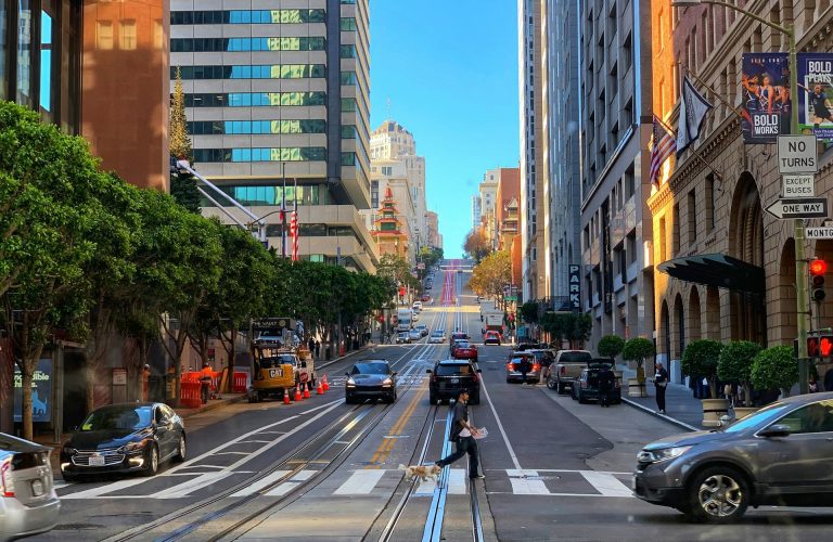
San Francisco, California

San Francisco transportation shapes the experience through steep hills, limited parking, and a mix of transit options that vary by neighborhood. Driving can be slow, and parking restrictions are strict, so many visitors prefer public transit, rideshares, or walking. Cable cars and buses offer access to popular areas, but crowds can lengthen waits during peak seasons. The city’s compact layout helps, yet hills can make short distances feel demanding, especially when carrying bags. For day trips, ferry and regional rail schedules affect timing. Planning routes with elevation in mind and keeping transit payment ready can make days feel easier, especially during rainy weeks when traffic slows and sidewalks get slippery.
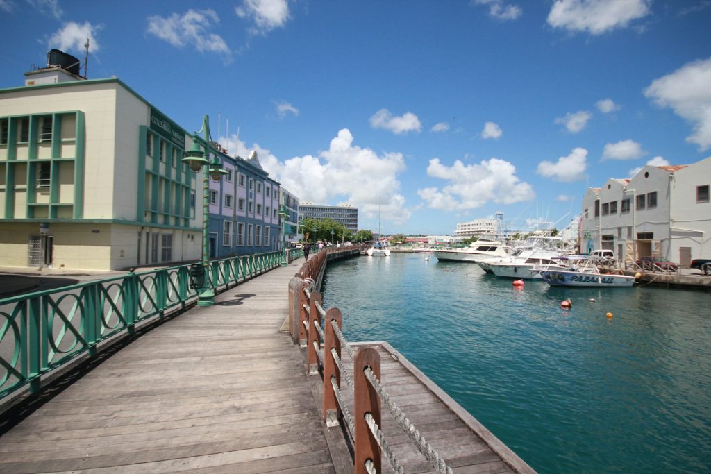
New Orleans, Louisiana
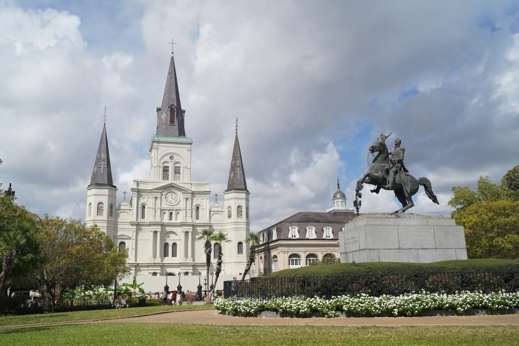
New Orleans, Louisiana travel depends on a blend of walking, streetcars, and rideshares, and each option works differently by neighborhood and time of day. The French Quarter encourages walking, yet narrow streets and heavy foot traffic can slow movement during festivals and weekends. Streetcars connect key corridors, but schedules and crowding vary, especially during major events. Driving can be inconvenient due to limited parking and one-way patterns, and some areas use strict enforcement. Rideshare pickup zones can shift during road closures. Checking parade routes, planning meeting points, and choosing routes with steady lighting and activity helps keep evenings and early mornings manageable.
Yellowstone National Park, Wyoming
Yellowstone experience depends heavily on driving because the park covers a vast area and public transit is limited. Seasonal road openings and closures shape which entrances, loops, and attractions are reachable, with some routes unavailable in winter. Wildlife jams can slow traffic unexpectedly, and those delays can ripple into lodge check-ins and tour times. Fuel, food, and cell coverage are not uniform, so planning stops matters. Distances between geyser basins and viewpoints can be longer than they appear on maps, making early starts useful. A reliable vehicle, extra time, and awareness of official road status can keep the trip smoother, especially when dawn traffic and bison crossings slow key junctions.
Denali National Park, Alaska
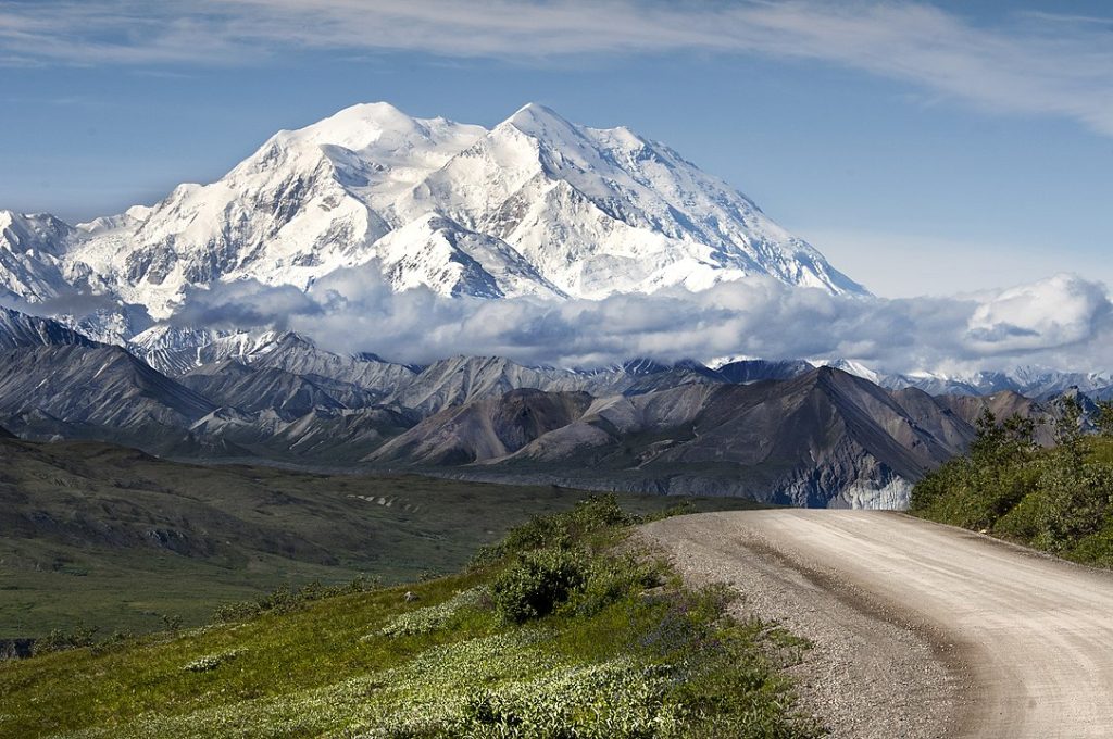
Denali travel logistics center on its limited road access and a system that often relies on buses rather than private vehicles. The park road extends deep into the wilderness, but access has long depended on conditions, maintenance, and operational decisions that can change available endpoints. Many visitors use shuttle or tour buses to reach interior areas, which means schedules and seat availability shape daily plans. Weather can also affect visibility and comfort, making flexible timing valuable. Lodging locations influence commuting time to the entrance area. Planning reservations early and building buffer time helps the experience feel calm rather than rushed, especially when tours sell out and weather delays change return times.
Yosemite Valley, California
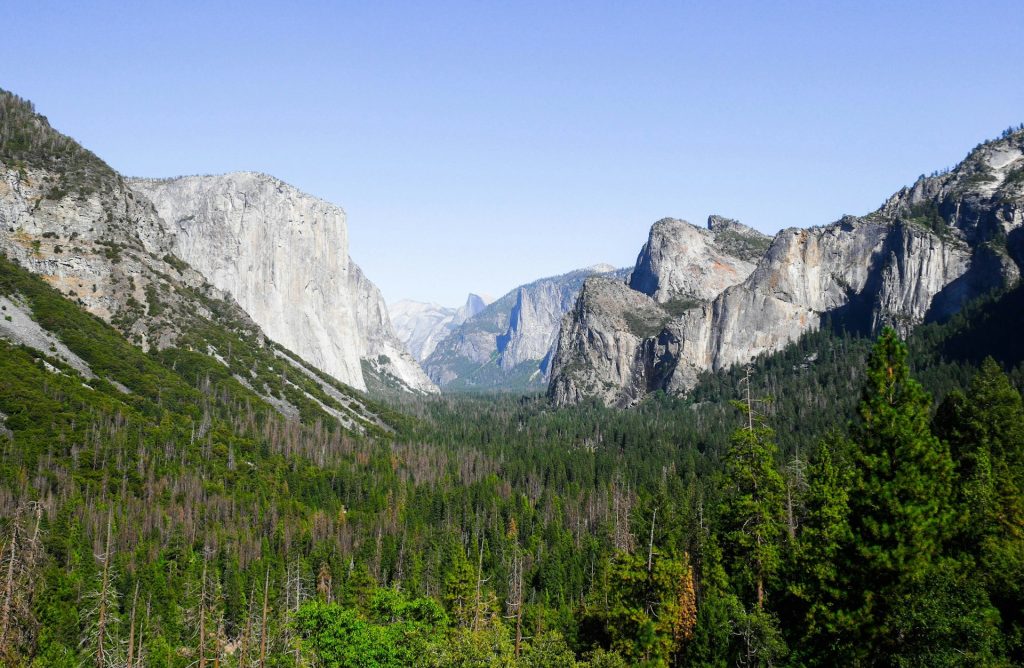
Yosemite Valley can feel tightly managed because roads funnel visitors into limited parking areas, and congestion peaks during popular seasons. The park’s shuttle system helps reduce driving inside the valley, yet lines can form during mid-day and around major trailheads. Entry rules, reservations, and temporary restrictions can change by season, so checking official updates matters. Once parking fills, late arrivals may circle for long periods, which can sap energy before a hike. Some viewpoints require additional driving outside the valley, adding time. Early starts, clear shuttle plans, and patience with traffic patterns often make the visit far more enjoyable, especially when weekend crowds surge and shuttle stops reach capacity.
Zion National Park, Utah
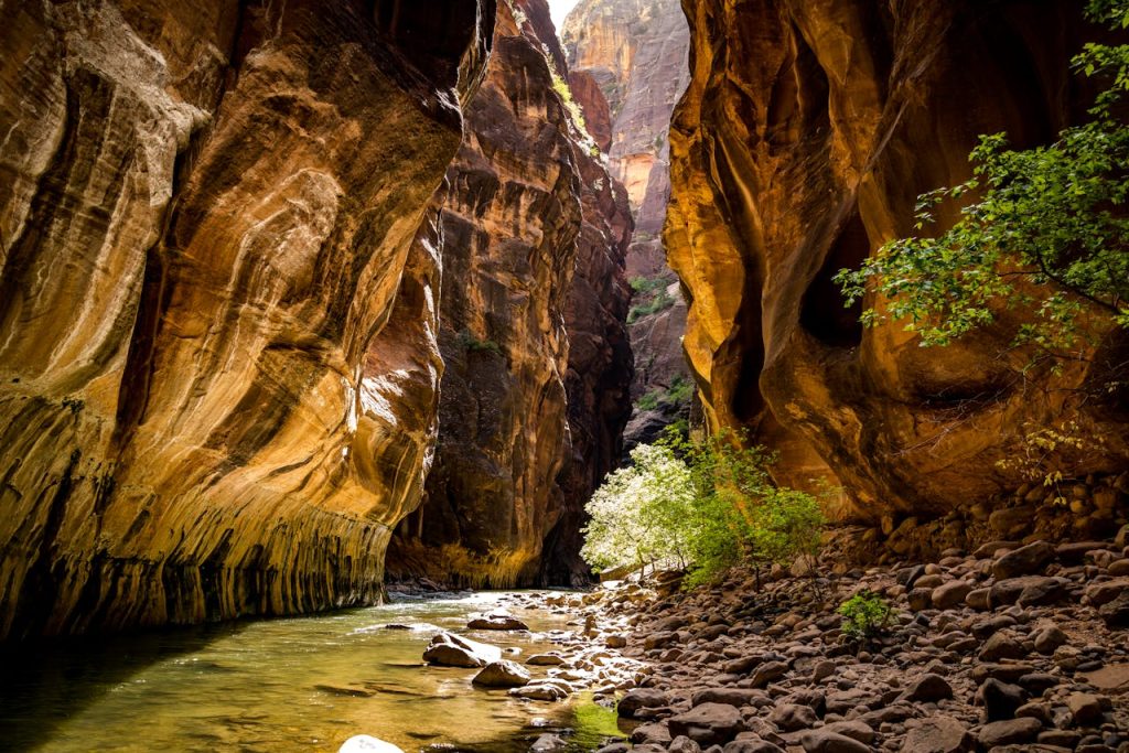
Zion’s transportation plan shapes daily choices because the main canyon often relies on shuttle buses during busy seasons. Private vehicles may face restrictions in Zion Canyon, and parking in Springdale and the visitor center area can fill early. Shuttle waits can grow at peak hours, which affects hike timing, especially for popular trails. Heat in summer and short daylight in winter change when buses feel comfortable and how long lines last. Nearby road construction or weather can also influence access. Planning trail priorities, arriving early, and tracking shuttle schedules helps keep the experience smooth from the first stop to the final return, especially when shuttle frequency drops and trailhead lines build quickly.
Nantucket, Massachusetts
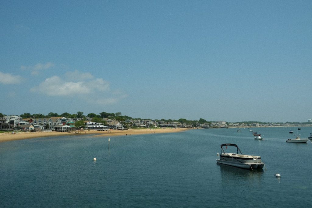
The Nantucket, Massachusetts access depends on ferries and flights, and that limited entry system shapes everything from weekend pacing to grocery runs. Ferry reservations can sell out during peak season, and weather can delay crossings, so arrival buffers help. Bringing a car requires advance planning and added cost, and many visitors prefer bicycles or walking once on island roads. Rental availability can tighten in summer, making early booking useful. Once settled, distances can feel manageable, yet beach access and evening plans still depend on timing and transport. Knowing the ferry schedule and choosing lodging near town can reduce daily hassle, especially when return sailings fill up after sunset dinners.
Catalina Island, California
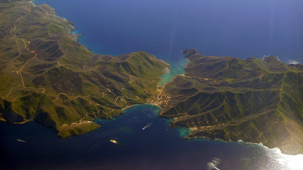
Catalina Island relies on ferry schedules from the mainland, and that timetable influences day trips, dinner plans, and lodging check-ins. Seas can be rough at times, so weather affects comfort and occasional delays. On the island, cars are limited and much of Avalon is walkable, but steep streets can make short trips feel strenuous. Golf carts and local shuttles fill gaps, yet rentals can book up during busy weekends. Activities like interior tours depend on set departure times, which can compress a day. Booking ferries early and coordinating transportation on arrival keeps the experience more relaxed, especially when selecting earlier crossings and reserving carts ahead for scenic overlooks. Hotel staff can also suggest easier routes.
Glacier National Park, Montana
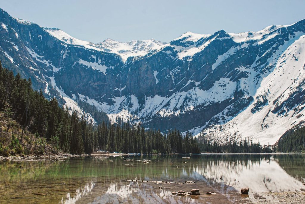
Glacier National Park travel often hinges on seasonal access, road conditions, and planning around the Going-to-the-Sun Road. That scenic route typically opens only after plowing and safety checks, and construction or weather can trigger delays. Parking at popular trailheads can fill early, and shuttle options vary by year and season. Distances between areas like Many Glacier and Logan Pass require significant drive time, so a packed itinerary can feel rushed. Wildlife crossings and narrow roads also slow traffic. Checking official road status, leaving early, and building extra time between stops helps the park feel more approachable, especially when timed-entry rules and roadwork compress travel windows.