17 American Cities Facing Planning Mistakes

American cities often carry the long shadow of decisions made by planners, developers, and policymakers who worked under assumptions that no longer fit present conditions. Across the country, patterns of highway expansion, low density zoning, flood-prone development, and uneven neighborhood investment have produced challenges that shape daily life for residents. These issues do not come from sudden crises but from accumulated choices about transportation priorities, land use rules, and the economic value placed on certain communities over others. The result is a landscape in which some cities must retrofit sprawling layouts that strain public services, while others confront aging infrastructure or regulatory barriers that slow needed adaptation. Understanding these planning mistakes is not about criticizing growth or past leaders but about identifying the structural causes behind today’s congestion, housing shortages, climate risks, and regional inequities. By examining how different cities arrived at their current challenges, it becomes easier to see which reforms could improve livability and resilience for decades to come.
Los Angeles

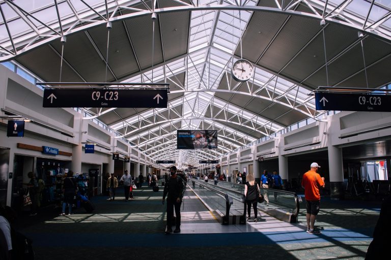
Los Angeles illustrates how a metropolitan vision centered on car travel can shape nearly every aspect of urban life generations later. Early and mid-century investments in freeways, paired with zoning that separated housing from jobs, created patterns of long commuting that limit walkability and make transit expansion more difficult. Neighborhoods were divided by highway construction that removed homes and disrupted community networks, leaving scars that still influence social and economic outcomes. Efforts to increase density remain uneven, often facing local resistance that slows projects near transit corridors where they would be most effective. As the population grows, the mismatch between available housing and demand pushes prices upward, reinforcing long travel times for workers priced out of central areas. These conditions reflect the challenge of retrofitting a region designed for a different era, where shifting away from car dependence requires sustained investment and cooperation that has historically been hard to achieve.
Phoenix

Phoenix continues to confront the consequences of rapid outward expansion across fragile desert terrain, a pattern shaped by decades of low density zoning that encouraged long drives between homes, jobs, and services. This approach increased infrastructure costs as each new subdivision required additional roads, utilities, and emergency coverage stretched across wide distances. The region’s high heat amplifies the need for careful planning, yet sprawling development often removes natural desert surfaces that help regulate temperatures. As growth pushes farther into environmentally sensitive areas, managing water becomes more complex, especially with long term Colorado River shortages affecting supply. Transit systems struggle to match the pace of outward growth, leaving many residents dependent on cars for daily tasks. Redeveloping central areas at higher density could relieve some pressures, but current zoning and market patterns make these transitions gradual. Phoenix’s challenge lies in balancing continued population growth with sustainable land use that respects its environmental limits.
Houston
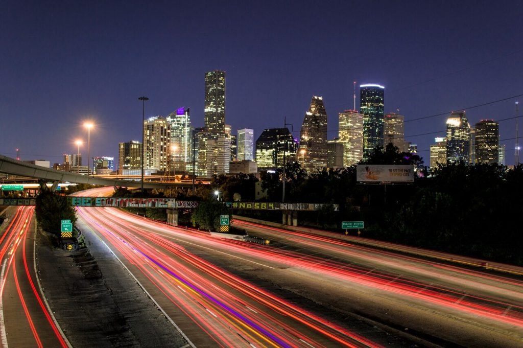
Houston demonstrates how flexible zoning and a long history of expansion across low lying land can create vulnerabilities that become more visible with each severe storm. Decades of development in floodplains, alongside extensive paving over natural drainage areas, intensified runoff during heavy rainfall events. As new subdivisions replaced wetlands and open spaces that once absorbed water, flood risks in surrounding neighborhoods increased. The region’s pattern of expanding road networks also encouraged low density growth that stretched municipal services and emergency response needs across a vast area. While Houston’s open zoning approach allows development to move quickly, it also makes it difficult to establish cohesive standards for resilience, stormwater management, and transportation planning. Rebuilding after storms highlights inequities in how recovery resources reach different communities, with some areas repeatedly affected while others see stronger protective investment. Solutions require long term coordination across agencies, developers, and residents to guide growth into safer, more sustainable patterns.
Atlanta

Atlanta’s planning challenges stem from decades of development that prioritized road networks and low density residential patterns, creating a city where long commutes and limited transit options shape everyday life. The region grew outward faster than its transportation infrastructure could adapt, which left many communities without frequent or reliable alternatives to driving. Efforts to build rail and bus networks have struggled to keep pace with suburban expansion, resulting in fragmented coverage that makes it difficult to move efficiently between employment centers. Zoning rules that separate commercial and residential uses limit opportunities for more compact neighborhoods where people can walk or bike to essential services. As population increases, road congestion intensifies and the cost of maintaining widely distributed infrastructure rises. Redevelopment projects near existing transit corridors could help address these issues, but progress is gradual and often complicated by local opposition or funding gaps. Atlanta’s long term challenge is to realign growth patterns with transportation strategies that support accessibility and reduce reliance on cars.
Miami
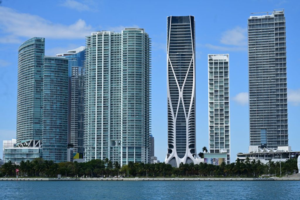
Miami faces a combination of planning issues shaped by coastal development, rising seas, and land use patterns that place intensive growth along vulnerable shorelines. For decades, waterfront construction replaced natural buffers and wetlands that once protected interior neighborhoods from storm surge and flooding. As sea levels rise, the pressure on these developed areas increases, creating costly maintenance and resilience needs. Inland communities also feel the effects as higher ground becomes more desirable, leading to concerns about displacement and uneven investment. The city’s transportation network remains heavily oriented toward car travel, which contributes to congestion and complicates evacuation planning during severe weather. Transit oriented development has potential but competes with limited land availability and longstanding zoning practices that favor single use districts. Miami’s situation highlights how environmental risk, rapid population growth, and historical planning decisions intersect, requiring coordinated solutions that balance safety, equity, and economic needs.
New Orleans
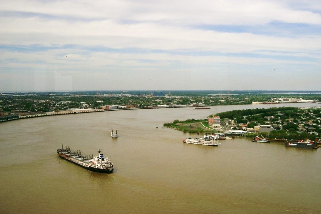
New Orleans carries a unique set of planning challenges rooted in its geography and the legacy of development across areas that sit below sea level. Neighborhoods built on former wetlands are particularly vulnerable to flooding when major storms hit or when drainage systems become overwhelmed. Years of uneven investment in protective infrastructure left some areas with strong defenses while others remain exposed. As the city rebuilds after repeated disasters, differing rates of recovery widen gaps between communities that receive timely improvements and those that wait longer for resources. The street and canal systems, while historic, require continuous upgrades to function effectively in a changing climate. Housing patterns shaped by past displacement and economic shifts complicate efforts to create resilient neighborhoods that can withstand future storms. New Orleans must balance heritage preservation, ecological restoration, and modern engineering to correct planning patterns that no longer align with current environmental realities.
Chicago

Chicago’s planning concerns emerge from decades of uneven economic development that created sharp contrasts between thriving downtown districts and corridors that experienced long term disinvestment. As job growth concentrated in the central area, transit networks continued to serve commuters but struggled to maintain strong connections within neighborhoods where population declined. Vacant land in certain districts places pressure on the city to attract redevelopment without pushing out longtime residents. Aging infrastructure, including transit lines and road systems, requires significant reinvestment to meet modern needs. Meanwhile, zoning rules that restrict mixed use or higher density development in some areas limit the city’s ability to bring housing and services closer to major employment hubs. These challenges contribute to disparities in access to transportation, job opportunities, and public amenities. Chicago’s path forward depends on targeted reinvestment that strengthens neighborhood stability while modernizing infrastructure to support a more balanced and resilient urban pattern.
Detroit
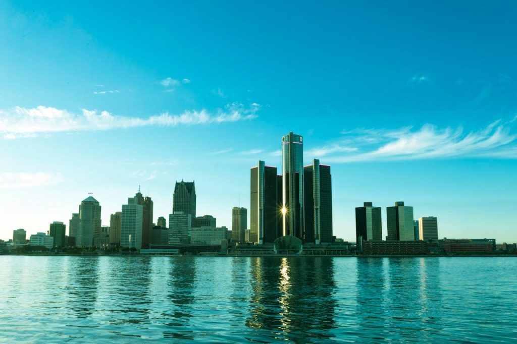
Detroit’s planning challenges stem from a dramatic population decline that left the city with far more land, roads, and utilities than its current residents can reasonably support. Neighborhoods that once held dense housing now contain scattered homes separated by vacant lots, making it costly to provide essential services such as street maintenance, lighting, and water infrastructure. Wide roadways built for a much larger population encourage fast traffic and limit walkability, which complicates revitalization efforts focused on creating vibrant mixed use districts. Economic shifts reduced employment opportunities near residential areas, contributing to long travel times for many workers. Redevelopment initiatives aim to transform surplus land into productive uses such as parks, community farms, and new housing, but progress varies widely between districts. Detroit continues working toward a balance between preserving historic character and adapting infrastructure to match current needs while ensuring that long standing communities benefit from new investment.
Austin

Austin’s rapid growth has outpaced its planning framework, creating a mismatch between soaring housing demand and zoning policies that restrict multifamily development near employment centers. As the city attracts new residents and major employers, rising prices push many people farther from downtown, leading to longer commutes and heavier road congestion. The region’s primarily car oriented layout adds pressure to highways and arterial roads, which struggle to handle the combined effects of population growth and limited transit alternatives. Attempts to revise zoning have faced strong debate, slowing efforts to add housing in walkable, transit supportive areas. At the same time, expanding suburbs strain infrastructure and require costly extensions of utilities and public services. Austin’s challenge involves steering growth toward more compact patterns that support mobility, affordability, and environmental sustainability while navigating differing community priorities about neighborhood character and density.
Seattle
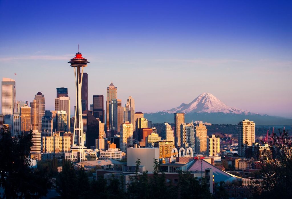
Seattle’s planning issues are shaped by geographic constraints that limit outward expansion, making land use decisions particularly important as population continues to increase. Hills, waterways, and protected natural areas restrict development options, yet zoning in many neighborhoods still limits the construction of multifamily housing. This contributes to high housing costs and pushes development pressure onto the few areas where higher density is allowed. The city’s transportation network experiences strain as more residents travel between job centers in a region where highways and transit lines must navigate difficult terrain. Efforts to expand light rail and improve bus corridors are underway but take years to implement, creating a lag between demand and capacity. Balancing growth with neighborhood concerns around scale and livability remains a central challenge. Seattle must continue adapting its planning approach to provide adequate housing and efficient mobility options within its physical and regulatory constraints.
San Francisco
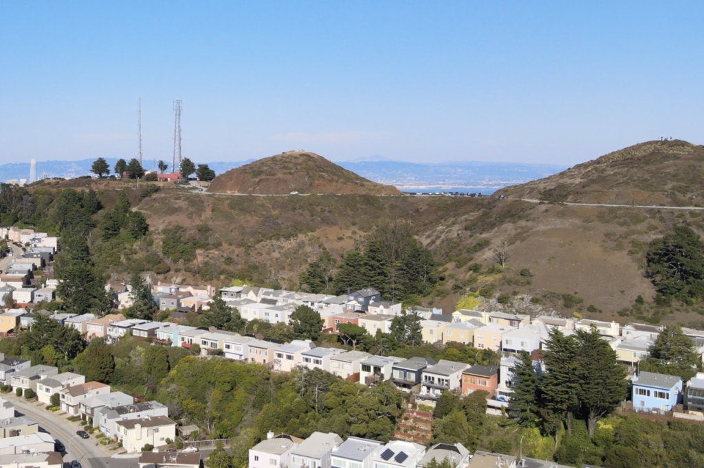
San Francisco deals with planning constraints created by scarce buildable land, stringent zoning rules, and high demand for housing near major employment centers. Limited room for expansion means most growth must occur through infill development, yet large portions of the city maintain low rise zoning that restricts new housing supply. This mismatch drives prices upward and forces many workers to seek affordable options in distant suburbs, increasing regional commute times and pushing more cars onto congested bridges and freeways. Efforts to streamline permitting or allow greater density encounter complex regulatory processes and local opposition, slowing progress. Transit systems serve key corridors but struggle to adapt to shifting commuting patterns and aging infrastructure. San Francisco’s planning challenge is to expand housing opportunities and modernize systems while respecting its historic fabric and managing environmental risks such as earthquakes and sea level rise. Addressing these issues requires coordinated regional strategies, not just city level adjustments.
Denver

Denver’s planning challenges come from balancing rapid population growth with development patterns that continue to spread outward into suburban and exurban areas. As housing demand rises, many new projects appear on the city’s edges where land is more available but where transit access is limited. This pushes residents toward car dependent lifestyles and increases congestion on major corridors connecting the metro region. The city has invested in transit expansions, yet these lines sometimes struggle to attract ridership when surrounding land uses remain low density. Redevelopment opportunities exist in older industrial zones and commercial corridors, but transitioning these areas into mixed use neighborhoods involves long timelines and substantial infrastructure upgrades. Denver also faces environmental considerations related to air quality and water availability, both of which are affected by sprawled land use. The challenge for planners is encouraging compact growth near transit while managing pressures that naturally push development farther from the urban core.
Salt Lake City
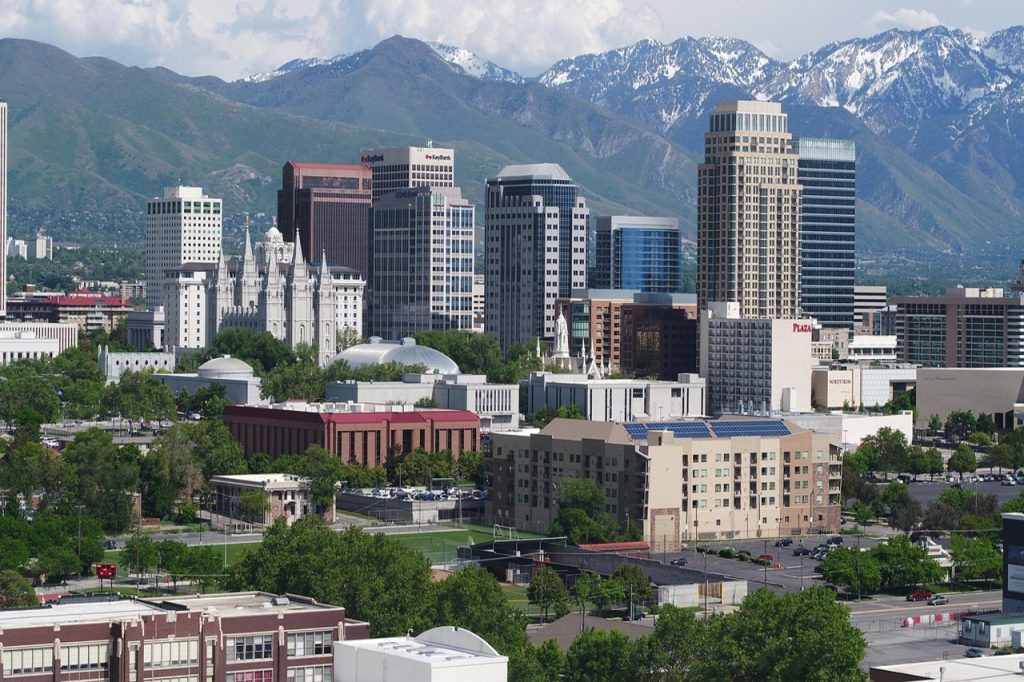
Salt Lake City continues to experience significant population increases across its metropolitan area, placing pressure on transportation networks, housing availability, and natural resources. The region’s geography, framed by mountains and the Great Salt Lake, restricts expansion and funnels growth into limited corridors that quickly become congested. While the city has invested in light rail and commuter rail, sprawling development in surrounding communities reduces the efficiency of these systems by spreading destinations too far apart. Housing demand outpaces supply, particularly in areas close to employment centers, leading many residents to move to distant suburbs that lengthen commute times. Water constraints add another layer of complexity, as ongoing drought and reduced snowpack influence long term planning decisions. Salt Lake City must continue adapting zoning, transportation, and conservation strategies simultaneously in order to support sustainable growth without overwhelming its environmental and infrastructural limits.
Charlotte
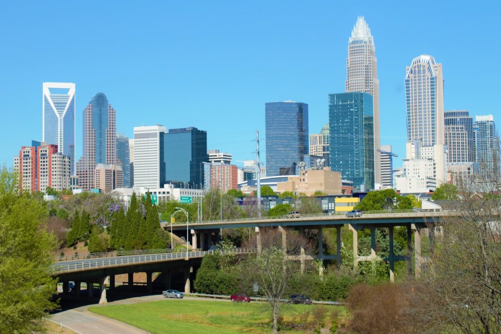
Charlotte’s planning issues emerge from its transformation into a rapidly growing economic hub without a corresponding shift toward compact urban development. Much of the city’s growth has occurred in low density residential areas connected by wide arterial roads that encourage car use and limit walkability. As employment clusters expand, congestion worsens in corridors where transit options are limited and where land use patterns make efficient service difficult. Attempts to build light rail have been successful in certain areas, yet large portions of the metropolitan region remain beyond the reach of reliable alternatives to driving. Housing affordability is also affected, as demand rises faster than the city can produce diverse housing types near job centers. Redevelopment near transit stations offers opportunities for creating mixed use districts, but these projects compete with market pressures that favor larger, car oriented developments. Charlotte’s challenge is rebalancing growth so that transportation and land use work together rather than pulling in opposite directions.
Nashville
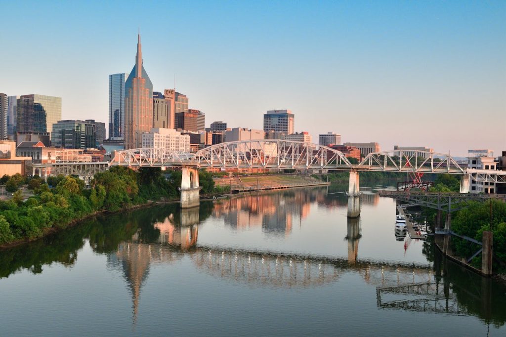
Nashville faces planning challenges tied to its rapid population and tourism growth, both of which place heavy demands on infrastructure that was not designed for such fast change. The city expanded primarily through low density residential neighborhoods that require car travel for most daily needs. As more people move in, major roads experience significant congestion and the lack of an extensive transit system limits options for reducing traffic. Efforts to introduce broader transit improvements have encountered funding hurdles and mixed public support, slowing progress. Housing demand has surged around the city center, leading to rising costs and displacement pressures in nearby neighborhoods. At the same time, suburban growth pushes outward, requiring costly new services and road expansions. Balancing affordability, mobility, and neighborhood character is an ongoing challenge for Nashville as it adapts to its new economic and demographic realities.
Las Vegas

Las Vegas faces planning challenges shaped by rapid outward expansion in a region with limited water resources and extreme environmental conditions. Development has historically stretched across the valley in low density patterns that require long car trips and continued extensions of roads, utilities, and emergency services. As new housing spreads outward, the city must balance growth with conservation strategies that protect its fragile water supply, which is affected by long term reductions in the Colorado River. The built environment’s reliance on wide streets, large parking areas, and heat absorbing surfaces intensifies the urban heat island effect, especially during long summer periods. Transit coverage struggles to keep up with development that moves farther from the urban core, reducing mobility options for residents who do not drive. While infill and mixed use projects are increasing, they remain a smaller share of overall growth. Las Vegas must navigate these pressures while adapting its planning framework to support more compact, resource efficient development.
Portland
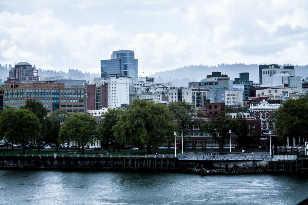
Portland’s planning challenges reflect the tension between its long standing commitment to compact urban form and the realities of increasing population, rising housing costs, and shifting economic trends. The urban growth boundary successfully limited outward expansion for decades, but it also concentrated development pressures inside the boundary, leading to debates over neighborhood density and building height. As demand for housing rises faster than supply, affordability becomes a critical concern, especially for residents priced out of central areas with strong transit access. Transportation patterns are shifting as more people commute across a region not originally designed for such complex flows, placing strain on both transit lines and major roadways. Climate resilience efforts require upgrades to stormwater systems, green infrastructure, and public spaces, yet funding must compete with housing and mobility priorities. Portland’s future planning efforts hinge on balancing environmental goals with the need for inclusive, flexible growth that supports a diverse and expanding population.