8 Cities Where Tourist Maps Leave Out Key Details
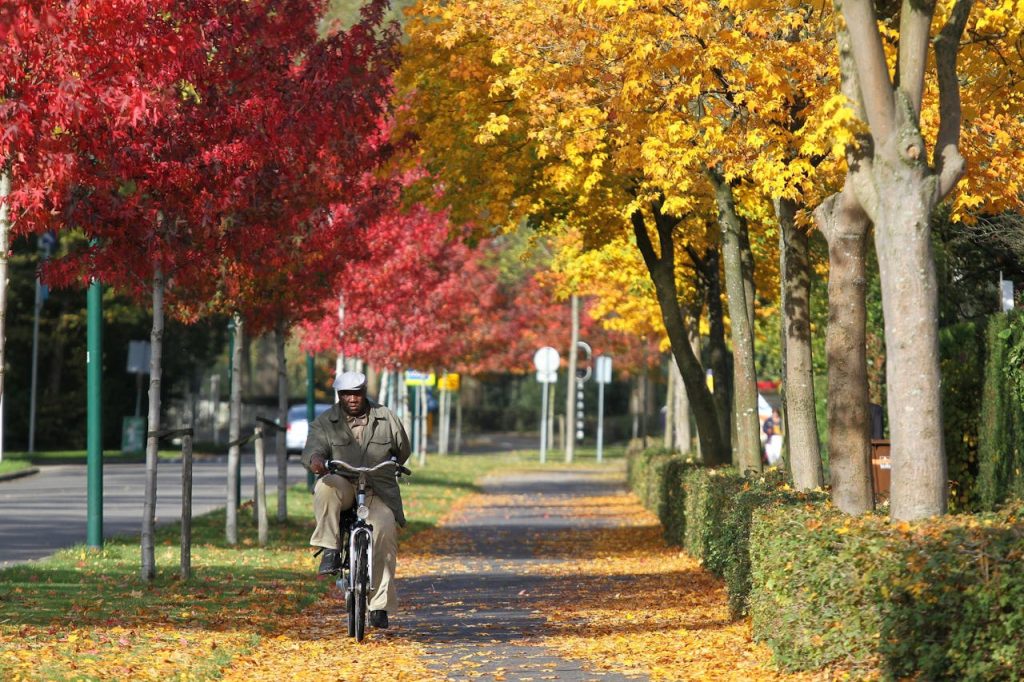
Tourist maps are built for highlights. They plot museums, viewpoints, and the cleanest routes between them, but they rarely explain the quiet rules that decide whether a day feels smooth or tangled. A line on paper can hide ticket validation, zone boundaries, or weekend detours. A charming lane might also be a fast bike corridor. In some historic centers, cameras enforce car limits that never appear on a brochure map. In these eight cities, the real operating manual lives in signs, habits, and a few details worth knowing early.
Venice’s Vaporetto Validations
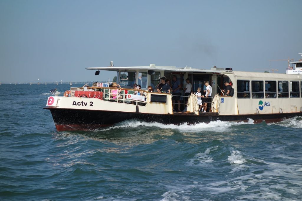
Venice maps make the vaporetto look like a simple hop between docks, but tickets and time passes need a quick validation at the reader before boarding, because that beep starts the clock and is what inspectors look for during spot checks on packed routes near Rialto and St. Mark’s. In the crush, it is easy to drift past the machine with the crowd, yet one skipped tap can turn a smooth ride into an awkward conversation, so locals validate first, keep the pass reachable, and let the city’s pace return to water, stone, and quiet reflections. A small pause at the dock saves time later and keeps the day from feeling like paperwork. It helps. days.
Paris’ Metro And RER Gate Logic
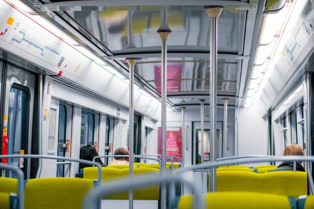
Paris rail diagrams show tidy lines, yet the system runs on gates, validations, and fare zones that most tourist maps never explain, especially where the Metro and RER overlap. A trip that looks simple can cross a zone boundary, require a different ticket type, or place a reader at an unexpected point during a transfer, which matters most on airport and outer-city routes. When the wrong fare is used, the journey can stall at an exit gate, so regular riders keep tickets until fully outside, watch the zone notes on machines, and treat validation as part of the route, not an afterthought during a rush when crowds surge at peak hours. It matters.
Rome’s ZTL Boundaries
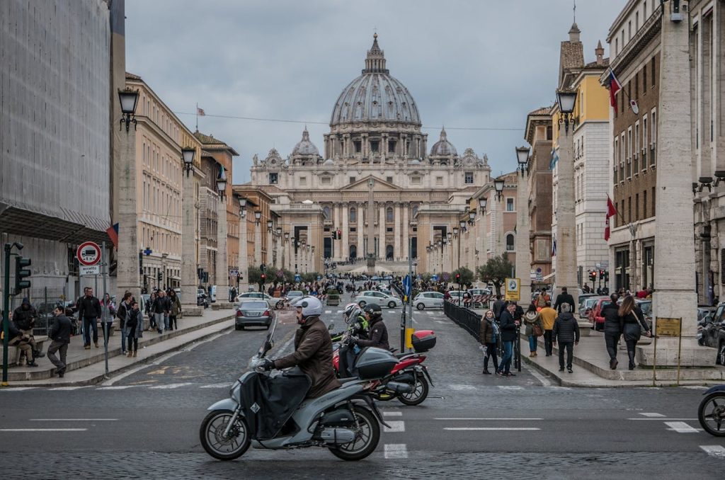
Rome tourist maps celebrate the historic center, but many skip the practical edges of ZTL areas, where car access is limited by cameras and timed rules that change by street. A driver following a hotel pin can cross an unseen boundary during a quick drop-off and later discover that a controlled lane was entered even though traffic looked normal. The city uses ZTL to protect narrow streets and daily life, so seasoned visitors park outside the restricted area, confirm access windows with their hotel when driving is essential, and switch to walking or transit for the final stretch, which keeps the day focused on piazzas, not road signs. as well.
London’s Fare Caps And Touch Rules
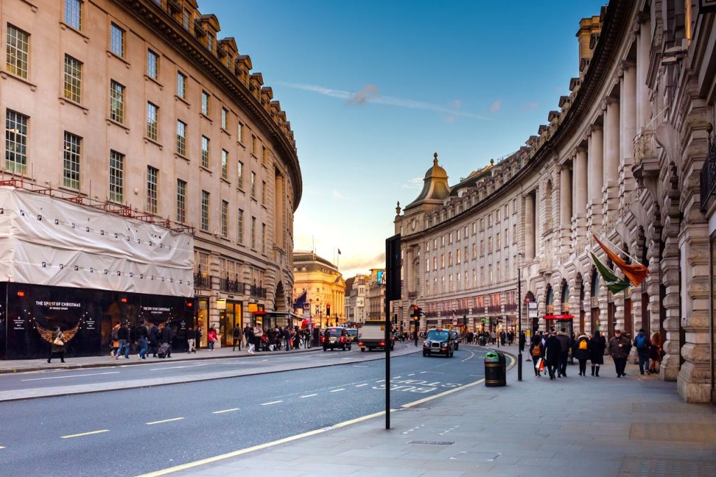
London’s Tube map looks like pure geometry, but the day’s cost is shaped by touch rules, zones, and fare caps more than the line colors. Pay-as-you-go can cap daily and weekly spending, yet only when the same card or device is used and every touch in and touch out is recorded, including on National Rail segments and some outlying stations where gates are not obvious. A missed touch can trigger a maximum fare, peak timing can change the price, and an unplanned zone jump can raise the cap level, so locals tap with discipline, check the reader’s response, and choose routes that match their budgets and schedule and relax once the cap is hit soon.
New York City’s Weekend Reroutes

New York’s subway map suggests permanence, but weekend work can redraw reality with reroutes, skipped stops, and temporary transfers that change where trains actually go. A straightforward trip may suddenly need a shuttle, a different platform, or a longer walk, and the change is usually posted on station signs and alerts long before any printed diagram catches up. The mismatch can make a familiar route feel oddly indirect, so locals check service notices, read platform posters, and keep a backup line in mind, building in extra minutes the way they build in coffee, because a single closed track can reroute an entire evening and keep it easy.
Tokyo’s Early Shutdown
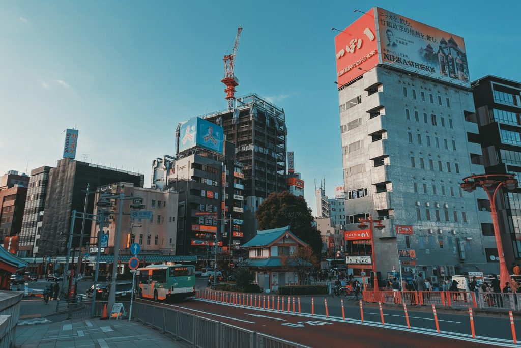
Tokyo rail maps feel endless, yet most trains stop around midnight and restart near 5 a.m., leaving a quiet gap while streets stay bright with late dinners and convenience stores. That timing is easy to miss when transfers stack up, because one delayed connection can shrink options fast and turn a simple return into extra planning, especially after events that end close to midnight. Locals track the last train, favor routes with fewer transfers late at night, and keep a buffer that protects the evening’s mood, checking station screens before heading out and choosing neighborhoods where a final walk home feels safe and straightforward. always.
Amsterdam’s Bike Lanes And Tram Priority
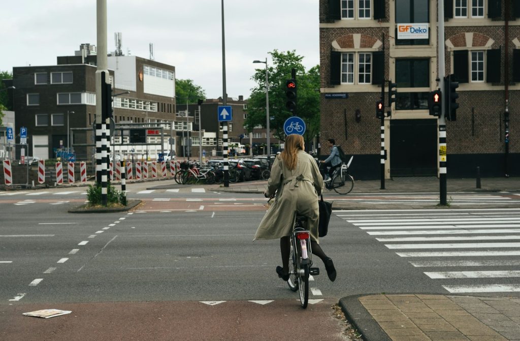
Amsterdam maps highlight canals and museums, but they rarely teach the street choreography locals follow as bikes, trams, and pedestrians share narrow corridors, bridges, and corners with little spare space. Bike lanes are working lanes and trams often have priority, so a casual step, a suitcase drag, or a photo pause in the wrong strip can block fast commuters and trigger bells, sudden braking, and sharp looks. The cues are consistent, from red pavement and bike symbols to track angles and dedicated signals, and reading them turns crossings from tense to natural so sightseeing stays relaxed and everyone keeps moving with the same confidence.
Istanbul’s Istanbulkart Reality
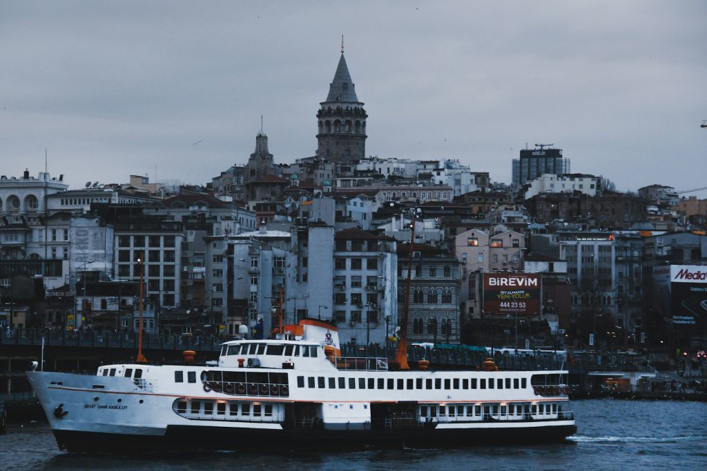
Istanbul transit maps show ferries and rail lines clearly, but many leave out the practical key that makes the network feel easy: Istanbulkart, used across much of daily travel. The card works on metro, trams, buses, and many ferries, and a smooth day depends on topping up credit early, finding the right reader, and tapping quickly at gates while crowds flow behind. Without it, even a short Bosphorus hop can mean extra lines and slow choices at machines, while with it connections click into place, piers feel less confusing, transfers stay faster, and the city’s best moments arrive between stops, not at ticket counters and the day feels calm.