9 Regions Where Weather Extremes Are Disrupting Travel Plans
Travel disruptions used to feel like bad luck, a delayed flight or a missed transfer. Now weather can reshape an entire route. Heat can shorten touring hours, smoke can mute the views that inspired the trip, and heavy rain can close roads that looked reliable the night before. In many regions, the biggest change is uncertainty, with airlines, ferries, and guides adjusting plans to fast moving forecasts. These places are still worth visiting, but the best trips now leave room for reroutes, rest, and smart timing.
Mediterranean Coasts of Southern Europe
Heat waves across Spain, Italy, Greece, and nearby coasts can flip a relaxed itinerary into a timing exercise, with midday sightseeing shrinking, shade hunting becoming constant, and outdoor ruins feeling like ovens by 11 a.m. When temperatures surge, attractions adjust hours, guided walks move to dawn, and wildfire smoke can haze island horizons while ferries, flights, and road closures respond to wind shifts and visibility rules. Trips land better when plans favor early waterfront walks, indoor museums, late dinners, and a spare day that can absorb a sudden trail closure or canceled sailing without turning the week into a scramble.
Canadian Prairies and Boreal Belt
In the Canadian Prairies and the boreal belt, wildfire smoke can drift hundreds of miles, turning a clear forecast into a muted sky that limits outdoor time, changes photography, and makes long drives feel oddly heavy. Air quality advisories can cancel lake cruises and hikes, and reduced visibility sometimes leads to flight delays, diversions, or cancellations that ripple through smaller airports where options are limited. Flexible itineraries keep a city day in reserve, track smoke and wind maps alongside weather, pack basic masks for comfort, and stay ready to pivot to a clearer region when the plume shifts overnight.
U.S. Desert Southwest Corridor

Across the U.S. Desert Southwest, extreme heat reshapes travel logistics, from slower airport ground operations to shorter safe hours for outdoor stops in places like Phoenix, Las Vegas, and desert parks. Rental car lines feel longer, vehicles run hotter, and many hikes work best at sunrise, while mid day plans move indoors as rangers post advisories and some trails effectively empty out. Monsoon bursts can add sudden flooding and washed crossings, so strong plans lean on early starts, shaded breaks, cooling ready lodging, and routes with backup roads when canyon tours pause, and keep water and cooling time built into every stop.
Caribbean Hurricane Belt
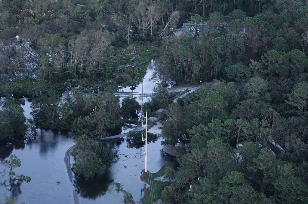
In the Caribbean, hurricane season can turn island hopping into rapid rescheduling, even when the ocean looks calm and the disruptive weather stays far out on the forecast cone. Airlines cancel flights, cruise lines swap ports, ferries pause when seas build, and hotels reshuffle rooms as forecast confidence changes, leaving travelers juggling new times across multiple islands. Trips hold up best with refundable bookings, buffer nights, fewer tight connections, offline copies of confirmations, and a mindset that treats a quiet indoor day and a delayed beach as normal, not ruined, just rearranged for the safer window.
Japan’s Pacific Typhoon Track
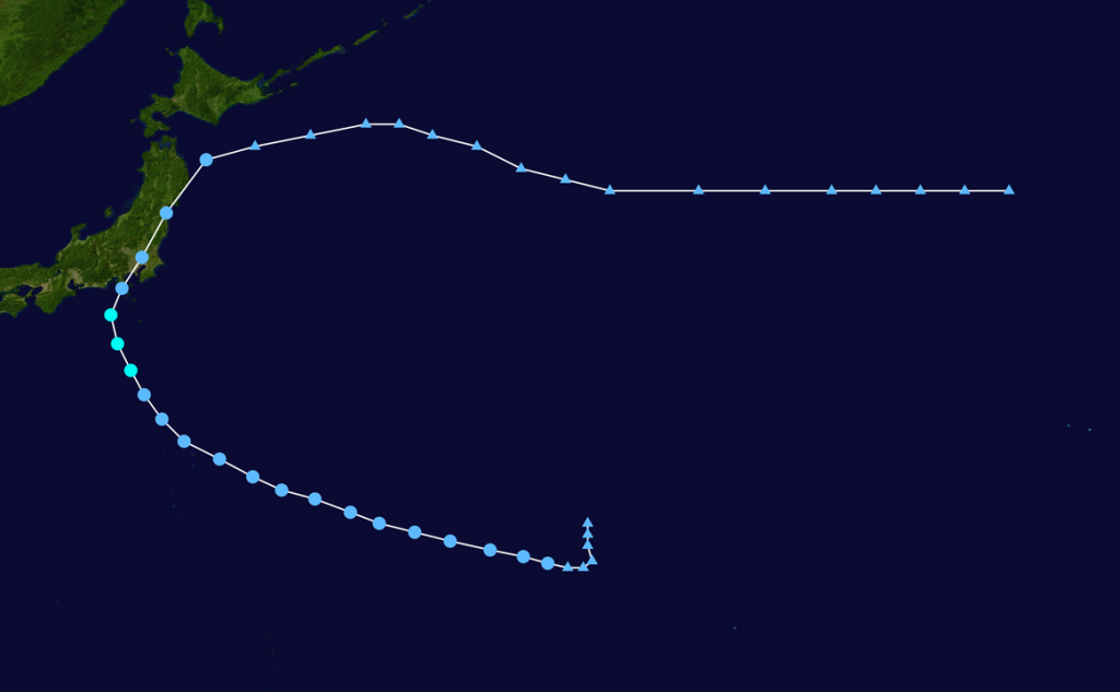
Along Japan’s Pacific typhoon track, disruptions can be orderly and still wide, with flights canceled, shinkansen service slowed, and local rail lines paused when wind and rain cross safety thresholds. A multi city plan can compress into one station day, then restart suddenly, creating crowded platforms, scarce taxis, and hotels that fill fast as everyone rebooks at once. Itineraries survive best with slack travel days, lodging that can extend by a night, flexible meal plans near the hotel, and an indoor backup of museums, markets, and cafés that keeps the day rewarding even when the forecast keeps shifting.
Southeast Asia’s Monsoon Zone
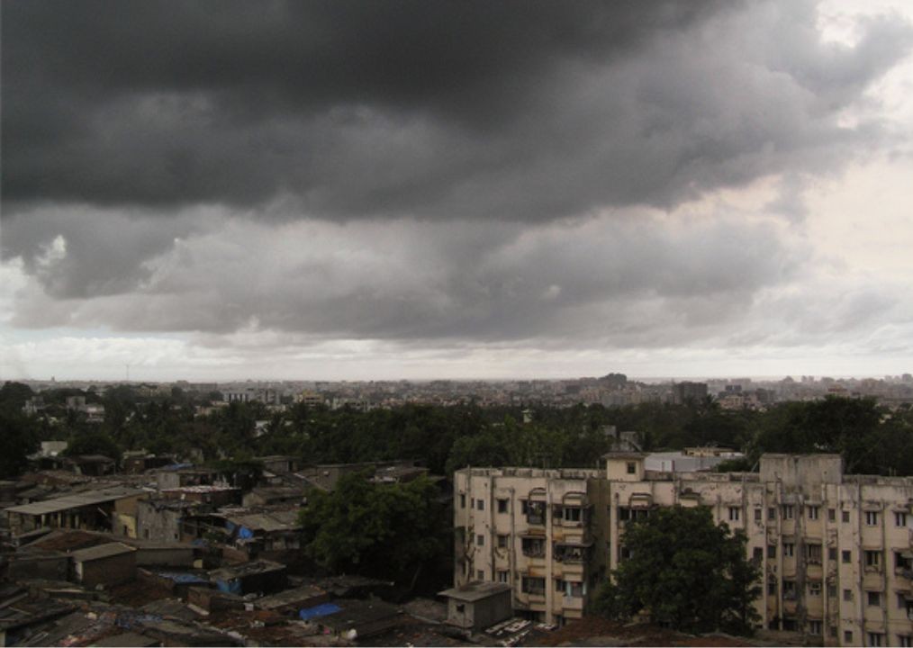
Across Southeast Asia’s monsoon zone, repeated downpours can flood streets and trigger slope slips that slow buses, trains, and airport transfers far more than the distance suggests on a map. Ferries pause when seas rise, regional flights stack delays as storms move along the route, and a tightly packed multi city schedule can unravel through missed connections and crowded rebooked departures. Plans stay stable when they linger longer in each place, avoid back to back transfer days, choose lodging near food and transit, and keep one open day for weather so the trip bends instead of breaking in a way that still feels local.
Pacific Northwest Atmospheric River Region
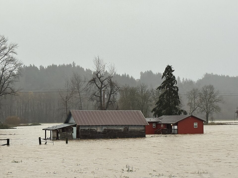
In the Pacific Northwest, atmospheric rivers can deliver days of intense rain that swells rivers, closes mountain passes, and triggers slides that cut highways linking Seattle, Vancouver, the coast, and interior valleys. Driving plans can flip to long reroutes, ferries may run on altered schedules, and rail service can slow for track and slope checks during the heaviest periods. Travel works best with one strong base, flexible day trips, extra fuel and snacks, waterproof layers that actually hold up, and a willingness to swap a planned hike for a waterfront museum when conditions turn rough and decisions need to be made fast.
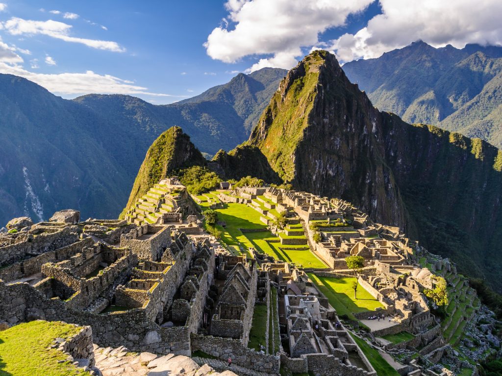
Peruvian Andes Gateway to Machu Picchu
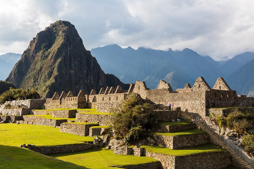
In the Peruvian Andes, heavy rain can disrupt the narrow transport chain to Machu Picchu, where rail and road choices are limited and many itineraries hinge on one timed connection. Landslides and debris can pause trains and slow Sacred Valley roads, which cascades into shifted guide times, crowded rebooked departures, and hotel check ins that slide later into the night. Itineraries hold up with a buffer day in Cusco, flexible tickets when possible, and a calm backup plan in Aguas Calientes, so a weather delay feels like part of the mountains, not lost time, and the altitude day still feels well used.
Alpine Europe Ski Regions
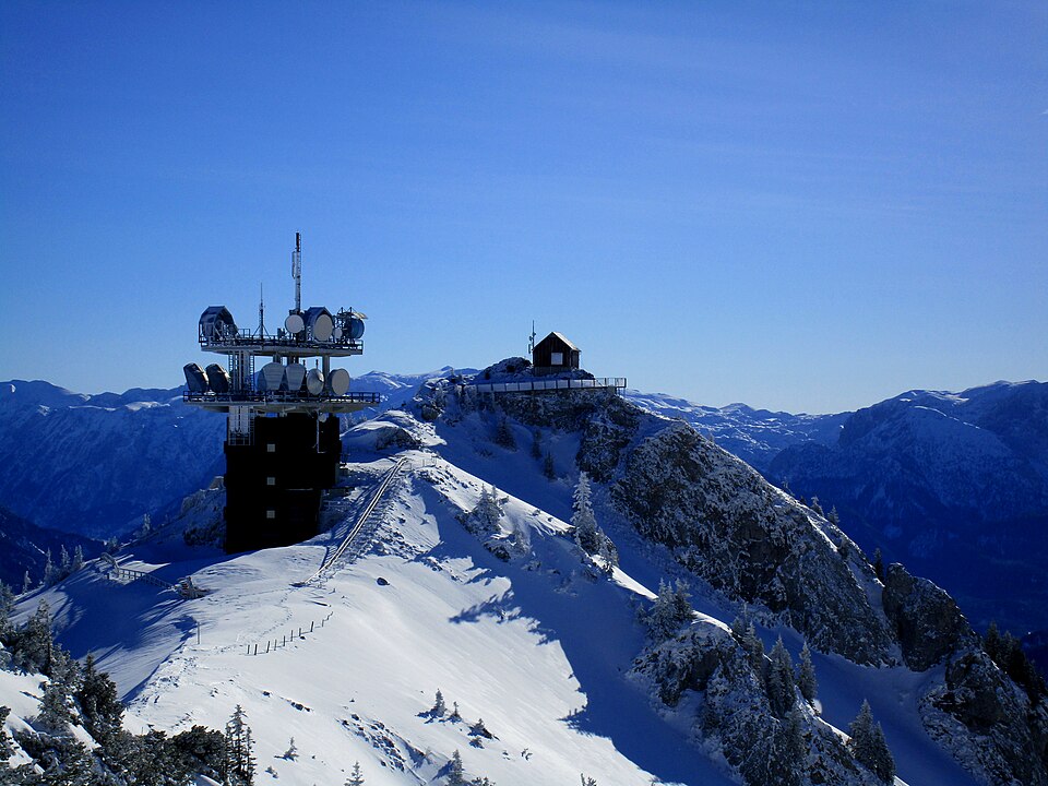
Across the Alps, weather swings can change both conditions and access, with warm rain thinning lower slopes, freeze lines rising, and sudden storms closing lifts, roads, and mountain rail links. When terrain concentrates on a few open runs, lift lines grow and day plans shift from exploring to managing timing, visibility, avalanche control holds, and transit updates between valleys. Trips stay satisfying with flexible dates, cancellation options, and alternate days for spas, valley towns, and winter walks, so a warm spell or storm cycle does not steal the whole holiday, and the week still feels balanced.