The 7 Most Dangerous Hiking Trails in America Ranked by Fatality Rate
America’s iconic hikes can look like clean lines on a map until wind, ice, heat, and exposure change the rules. A dry slab turns slick after a brief storm, a narrow ridge becomes a balance test, and a hot descent can drain judgment faster than legs. Crowds add pressure, too, because delays stack and daylight shrinks.
Because the United States does not publish one consistent trail-by-trail fatality system, true fatality rates are hard to standardize nationwide.
The ranking below uses time-bounded public death counts for each route and converts them into a simple comparison, estimated deaths per year for that window in practice.
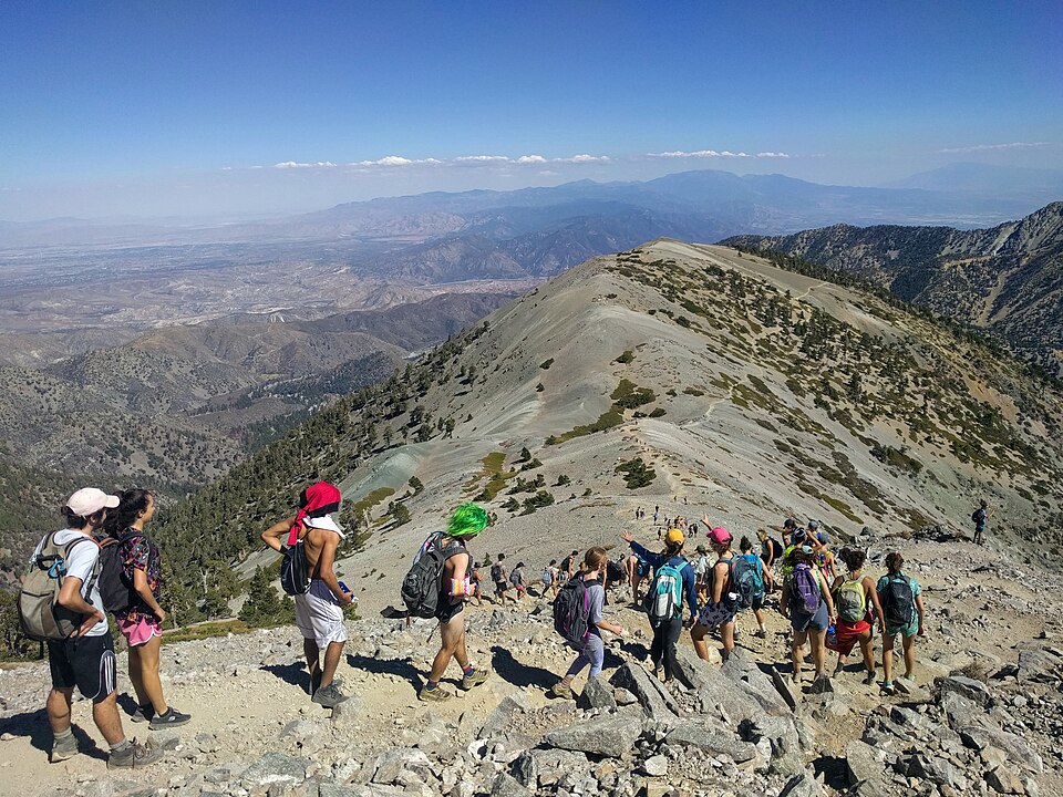
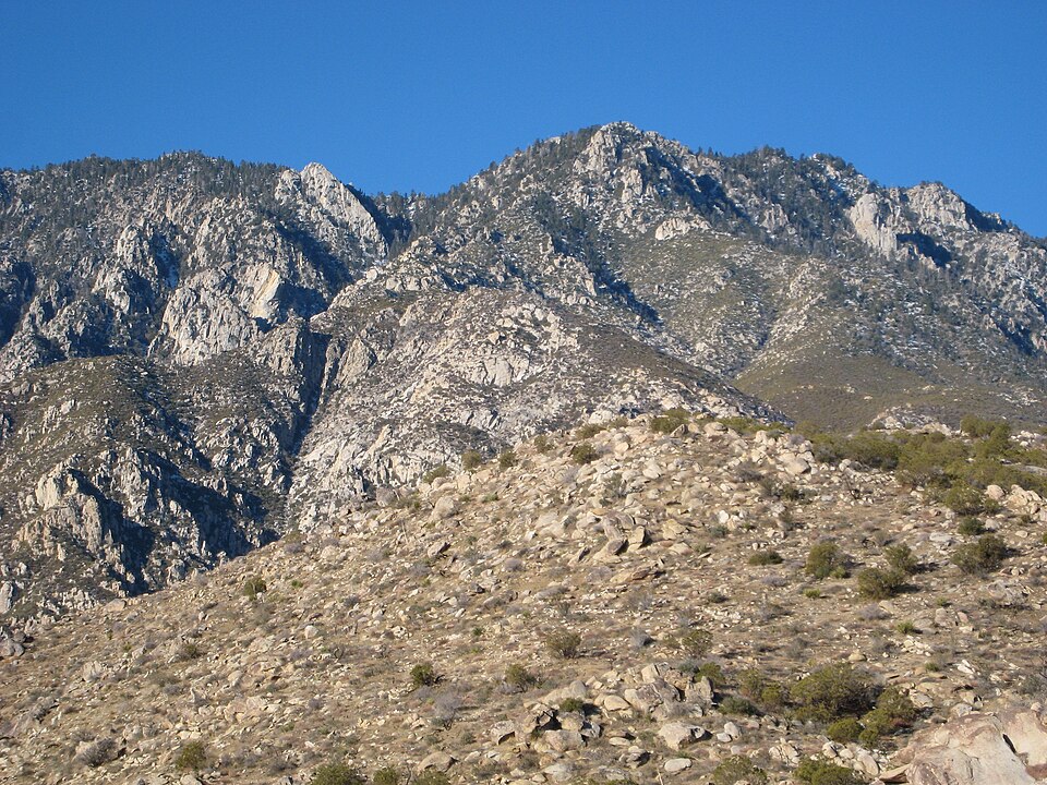
1. Mount Baldy Devil’s Backbone, California
Mount Baldy sits close to Los Angeles, which can make it feel like a casual day out until winter reshapes the mountain. The Devil’s Backbone traverse narrows, stays exposed, and ice can appear even when the lower trail looks dry. Weather flips at 10,000 feet, and the ridge offers few easy exits once conditions turn. Many incidents start with light traction on hard ice, or with a layer that is not enough.
Officials reported 23 deaths on Mount Baldy from 2016 to 2025, about 2.3 per year across that window.
Long evacuations and patchy signal mean timing matters. A late turnaround can turn a manageable problem into a hard night on the mountain.
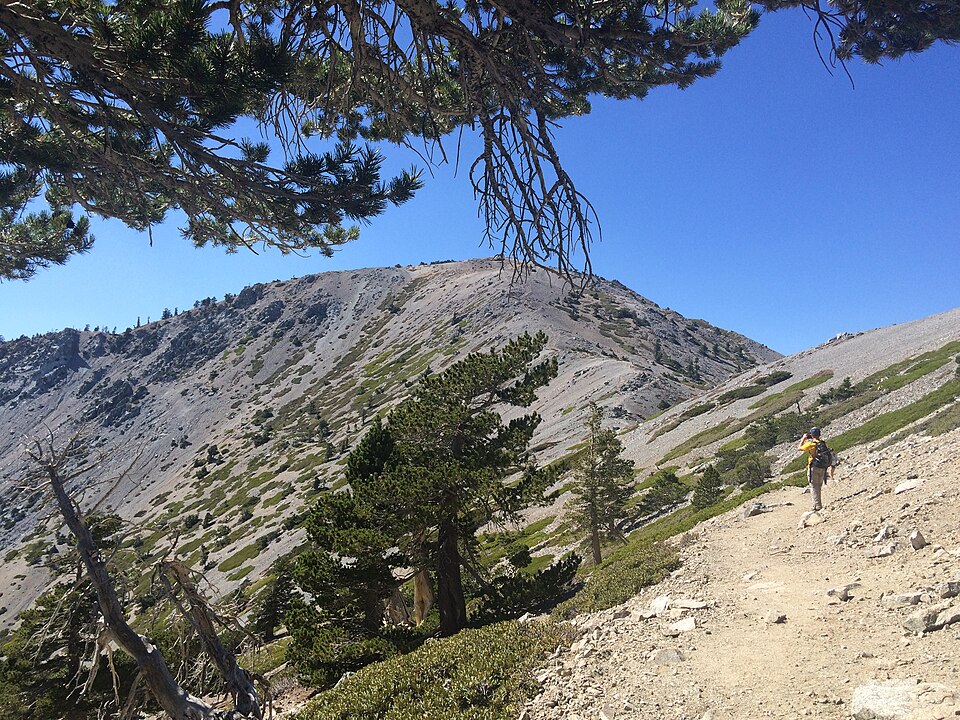
2. Mount Whitney Main Trail, California
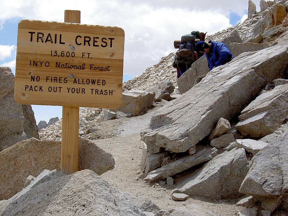
Mount Whitney’s Main Trail can look orderly in summer photos, which nudges people to treat it like a long walk. The trouble shows up when snow and ice linger on steep traverses and the runout below stays unforgiving. Altitude slows decision-making, storms can build early, and the return demands hours of focus when legs are tired. It is also a long summit day, and darkness arrives quickly.
Sheriff’s officials have said deaths on Whitney average 1 to 2 per year, about 1.5 using the midpoint.
Many fatal incidents they highlighted involved falls on snow and ice, where crampons, an ice axe, and practiced self-arrest mattered more than grit.
3. Half Dome Cables Route, Yosemite National Park
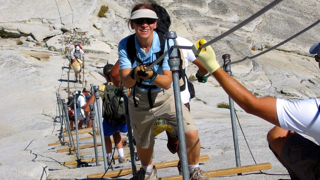
Half Dome’s cables are famous because the finish is dramatic: a steep granite face where everyone funnels into one line. When rain or morning moisture reduces friction, the slab stops forgiving hesitation. Crowding can stretch the final climb into a long wait on slanted rock, and afternoon storms raise pressure to be off the cables early, not halfway up.
A study of incidents above Little Yosemite Valley reported 8 fatalities (2005 to 2009) and 4 (2011 to 2015), about 1.2 per year across those windows.
The same research argues crowding is not the only driver. Weather, timing, and fatigue still set the margin out there on smooth granite.
4. Angels Landing, Zion National Park
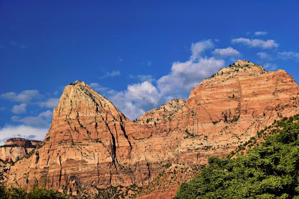
Angels Landing earns its reputation on the final ridge, where the trail narrows and chains become part of the route. The last stretch is short but focused, with steep drop-offs and little room to reset once nerves spike. Wind, bottlenecks, and footing can turn a pace into stop-and-go movement, and that jittery rhythm raises the chance of a bad step.
Reporting has cited five deaths on the hike in the prior five years at the time, roughly 1 per year for that window.
Zion’s permit system helps meter traffic beyond Scout Lookout, but it cannot change the exposure on the ridge itself. Passing is limited, so patience becomes a safety tool.
5. Cactus To Clouds (Skyline), California
Cactus to Clouds compresses two climates into one push, starting near Palm Springs and climbing toward Mount San Jacinto. The Skyline section is steep, exposed, and shade-poor, and heat can arrive early and linger even in spring. With more than 10,000 feet of gain, fatigue builds quietly, and late starts often lock hikers into the hottest hours. When water and salts slip behind, the descent stops feeling like an exit.
A rescue volunteer has described the route as seeing about one fatality per year.
Rising temperatures are also shrinking the safer seasonal window, which makes timing harder to get right and mistakes harder to undo.
6. Grand Canyon Inner-Canyon Corridor Trails, Arizona
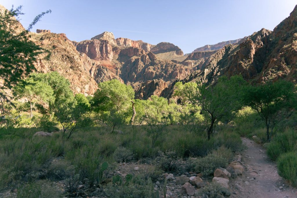
Grand Canyon corridor trails can make a day hike sound simple: descend, touch a landmark, then climb back out. The trap is the return, which arrives when heat is strongest and legs are tired. Below the rim, shade is limited, and dehydration can stack with low sodium and poor pacing, especially when a schedule leaves no margin for rest or cooling.
A CDC study of 2004 to 2009 EMS data identified 6 fatal exertional heat-related illness cases, roughly 1 per year in that warm-season window.
Most hikers do fine, but the canyon punishes optimism. The safest plans are usually the ones that turn around early and keep energy in reserve.
7. Precipice Trail, Acadia National Park
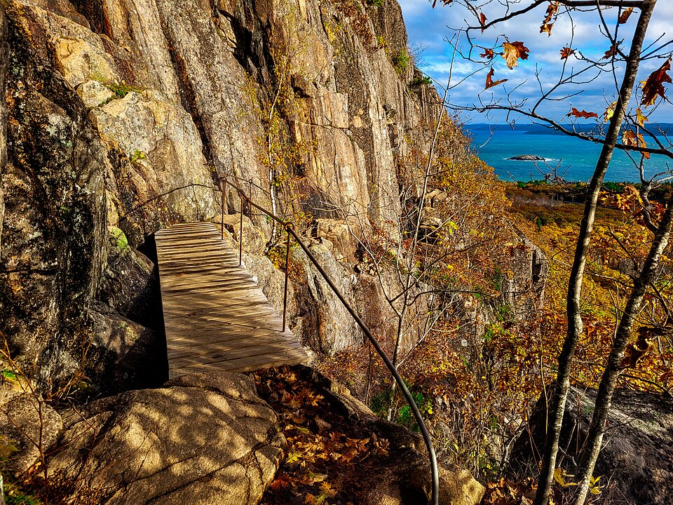
Precipice is short, steep, and thrilling, with iron rungs and ladders fixed into Champlain Mountain above the Atlantic. It can feel controlled, but exposure is real, and wet rock, wind, or a loose hold can shift the day in seconds. The route is narrow, so slower climbers can create stop-and-go movement on the rungs, and that rhythm makes footing feel less certain. Rescues can take hours because access is limited.
One report notes two recorded fatalities on the trail in the past 35 years, about 0.06 per year for that span.
Acadia also documented a fall of 60 feet after a rock gave way during a climb, a reminder that conditions still decide.