The Uniquely American Road That Passes Through More History Than Any Other Route on Earth
Across the U.S., scenic highways often double as history lessons, especially on routes managed by the National Park Service. One of the clearest examples is the Natchez Trace Parkway, a 444-mile road from Natchez, Mississippi, to Nashville, Tennessee, that follows a travel corridor used long before the first cars arrived.
The road and the scale of its history
The Natchez Trace Parkway is operated by the National Park Service, which states that the modern road runs 444 miles through Mississippi, Alabama, and Tennessee. Congress authorized the parkway on May 18, 1938, according to the National Park Service, turning an older trail into a federally managed scenic route.
Long before that 1938 action, the Natchez Trace had already carried centuries of movement. The National Park Service says Native Americans, including the Chickasaw and Choctaw, used the trail for trade, travel, and communication, and early American settlers later followed the same corridor in the late 1700s and early 1800s.
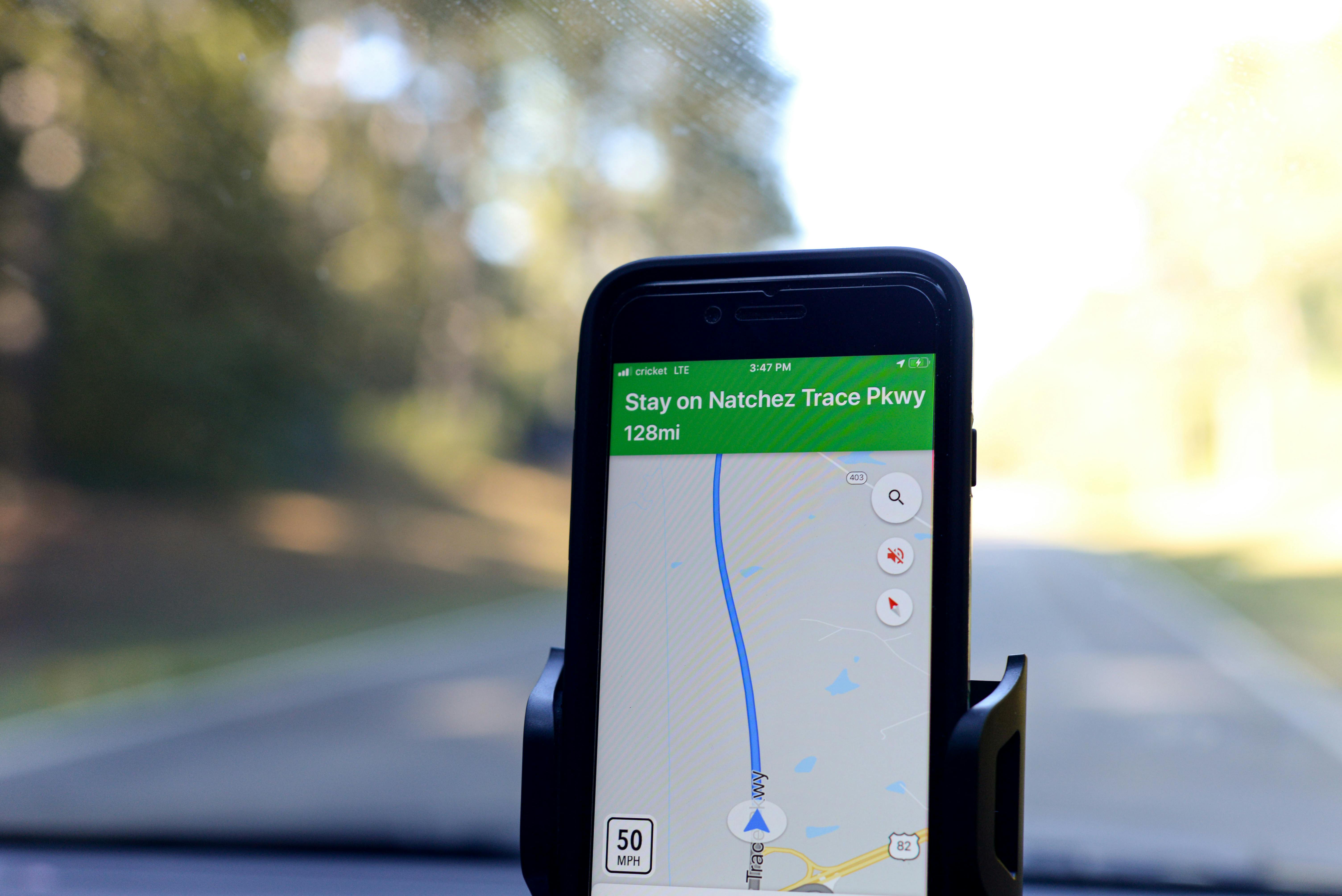
The route now includes dozens of marked stops, from Emerald Mound near Natchez to Meriwether Lewis’s grave near Hohenwald, Tennessee. The parkway’s posted speed limit is generally 50 mph, according to the National Park Service, which helps preserve its role as a scenic and historic drive rather than a commercial highway.
What it means in Mississippi, Alabama, and Tennessee
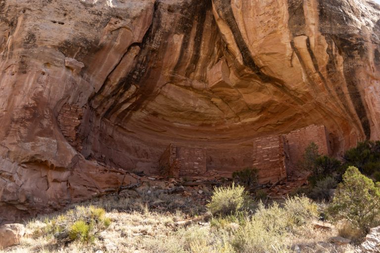
For travelers in Mississippi, the road begins near Natchez and passes communities and sites tied to some of the oldest documented history on the route. The National Park Service identifies stops such as Mount Locust, one of the few remaining stands used by early Kaintucks, and Emerald Mound, a major Mississippian ceremonial site built between 1200 and 1730.
In Alabama, the parkway covers only a short segment, about 33 miles, but that section still carries recognized historic weight. The National Park Service notes that the Alabama stretch includes the Colbert Ferry area, where George Colbert operated a key crossing on the Tennessee River in the early 1800s.
In Tennessee, the road continues to Nashville and includes well-known stops such as the Double Arch Bridge near Franklin and the Meriwether Lewis site. A full ranking of every historic road on Earth is not issued by the National Park Service, so any broader claim beyond the Trace’s unusually dense concentration of historic sites is not publicly confirmed by the agency.
Why the Natchez Trace still stands out now

The reason this route gets continued attention is partly historical depth and partly federal protection. The National Park Service says the parkway preserves the old Trace’s path, while limiting commercial traffic, billboards, and modern roadside development across much of its 444-mile length.
That protection gives drivers access to a corridor that reflects several eras at once, from Indigenous trade networks to frontier migration to New Deal-era road building. The parkway was largely completed in the 20th century, with the Double Arch Bridge opening in 1994, according to the Federal Highway Administration and National Park Service records.
For residents and visitors, that means the Natchez Trace functions less like an interstate and more like a linear historic park across three states. The National Park Service continues to present it as a recreational and preservation corridor, with hiking trails, interpretive stops, and no commercial traffic allowed, a policy that still shapes the drive today.