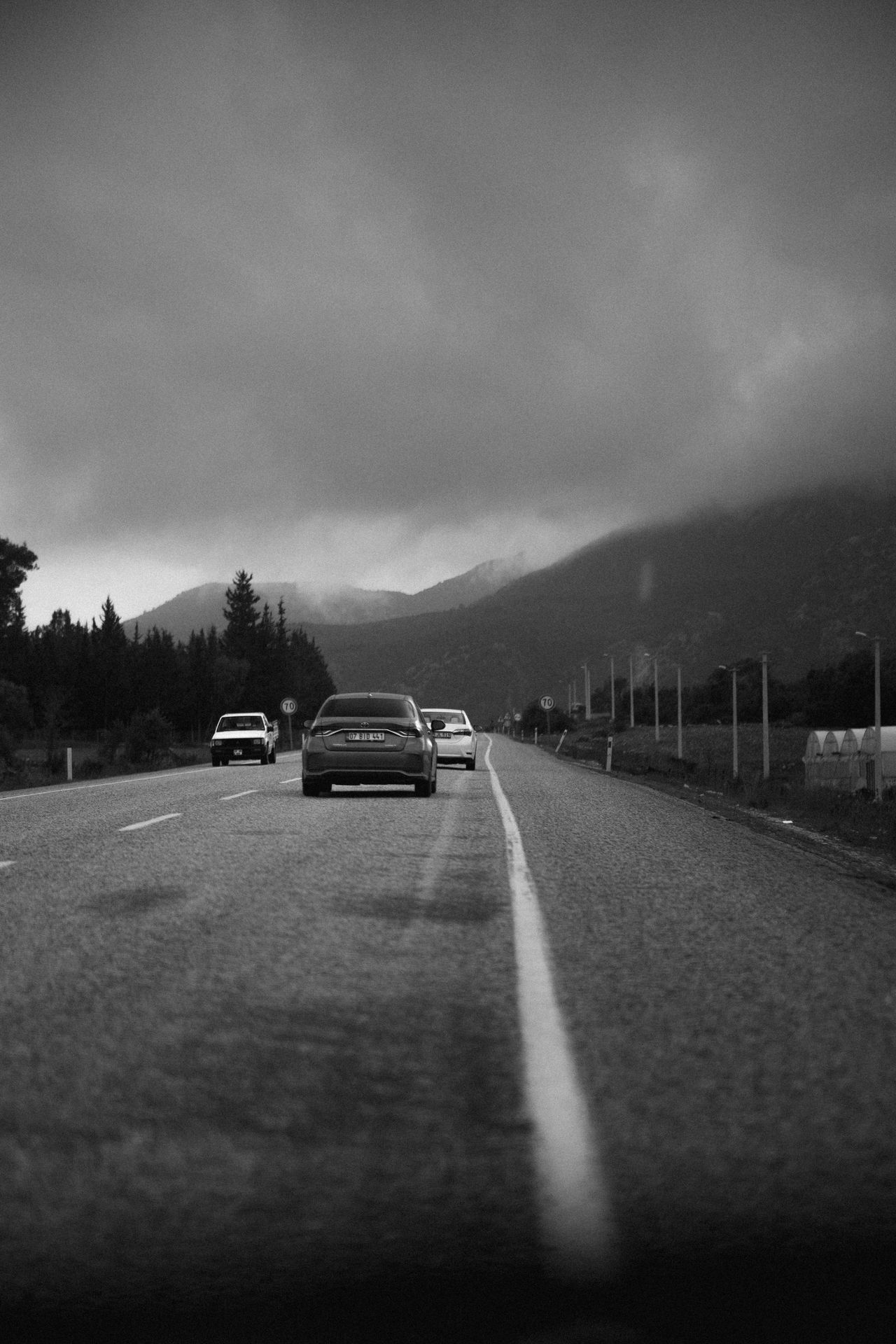
12 Road Trips in North America That Travel Influencers Have Completely Ruined
Some of North America’s best-known road trips are not exactly secret anymore. What changed is how quickly one photo, one reel or one viral stop can turn a scenic drive into a traffic jam.
Across the US, Canada and Mexico, park managers, local residents and tourism offices have spent recent years dealing with overcrowding at pullouts, trailheads, beaches and small towns that sit along iconic driving routes. The roads are still beautiful, but the experience on many of them has shifted in ways regular travelers now notice right away.
Pacific Coast Highway, California
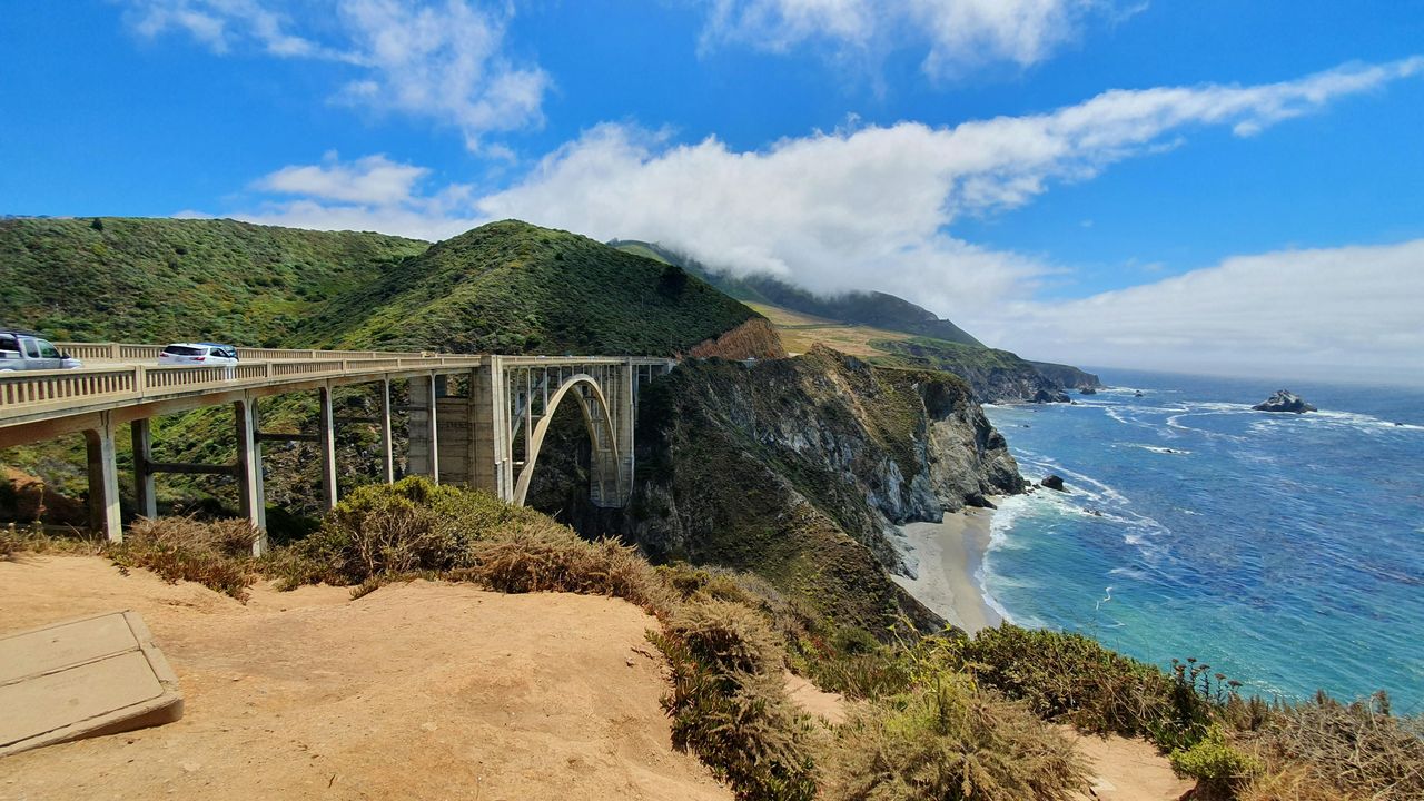
California’s Highway 1 has long been one of the most photographed drives in the country, but the social media era intensified pressure on every dramatic turnout between Malibu and Big Sur. Tourism officials in coastal counties have repeatedly warned about illegal parking, shoulder stops and unsafe pedestrian behavior around cliffside viewpoints.
The route has also faced practical strain. Storm damage and landslides have caused repeated closures in recent years, especially in the Big Sur region, which forces traffic onto limited detours and concentrates visitors in open sections. Local businesses still depend on tourism, but many communities say the stop-and-shoot pattern pushed by influencers often overwhelms small parking areas and rural services.
Residents and rangers have regularly asked travelers to stay on trails, avoid geotagging fragile spots and respect private property. The drive remains spectacular, but travelers expecting a quiet cinematic cruise often find congestion, long waits and crowded overlooks instead.
Going-to-the-Sun Road, Montana
Glacier National Park’s signature road has become one of the clearest examples of scenic fame colliding with limited capacity. The 50-mile alpine route, which is typically open only seasonally because of snow, now regularly draws heavy summer demand far beyond what roadside pullouts and visitor infrastructure can easily absorb.
The National Park Service introduced timed vehicle reservation systems in peak seasons to control traffic and reduce gridlock near popular areas. Officials said the goal was to improve safety and visitor flow, not to discourage tourism. Still, travelers used to spontaneous road trips often found that viral images of Logan Pass did not mention the planning now required.
Wildlife jams add another layer. A single bighorn sheep sighting can back up cars for long stretches, and roadside stopping creates safety risks on narrow mountain curves. What was once sold online as a carefree park drive is now, in many cases, a heavily managed trip with reservation rules and early starts.
Blue Ridge Parkway, Virginia and North Carolina
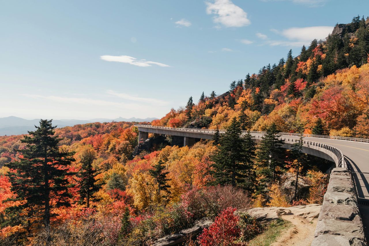
The Blue Ridge Parkway remains one of the most visited National Park Service units in the country, connecting Shenandoah National Park to Great Smoky Mountains National Park across 469 miles. Its appeal has widened online thanks to fall foliage clips, mountain cabin content and scenic overlook photography that exploded on short-form video platforms.
That attention has translated into major seasonal crowding, especially in October. Parkway officials and nearby tourism bureaus have repeatedly told visitors to expect packed overlooks, full trailhead lots and slow-moving traffic during peak leaf weeks. In some mountain towns, locals say weekends now feel more like festival traffic than a quiet scenic drive.
The issue is not that the parkway lost its views. It is that the internet often sells a peaceful autumn escape that only exists at off-hours or in shoulder season. Travelers who arrive midday during peak color often find long lines at stops that used to feel tucked away.
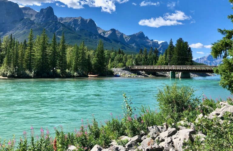
Icefields Parkway, Alberta
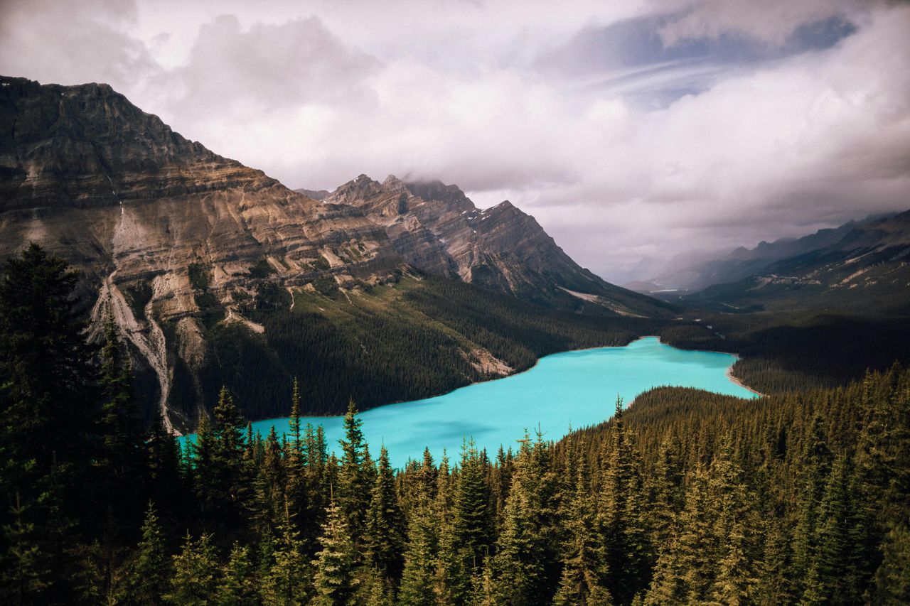
The 144-mile route between Banff and Jasper is still one of the most dramatic drives in North America, with glaciers, turquoise lakes and wildlife visible from the road. But Alberta tourism officials and Parks Canada have spent years balancing global demand with ecological limits in one of the continent’s most heavily photographed mountain corridors.
At major stops like Peyto Lake, Athabasca Glacier and Bow Lake, parking pressure has become routine in peak summer months. Visitors chasing viral images often cluster at the same few lookouts, even though the parkway has many quieter places nearby. Officials have also warned repeatedly about roadside wildlife etiquette after visitors stopped too closely for bears, elk and mountain goats.
The route’s fame grew faster than its infrastructure. Fuel stops are limited, weather shifts quickly and cell service can be unreliable, yet online content often presents the drive as simple and effortless. For many travelers, the reality is more crowded and much more tightly regulated.
Route 66, Southwest and Midwest

Route 66 has always traded on nostalgia, but social media gave the old highway a second visual life. Neon signs, retro motels, giant roadside statues and desert diners became ideal content, helping revive business in some towns while also creating a more staged experience in others.
State tourism campaigns along the route still celebrate that attention, especially as the highway approaches its 2026 centennial. At the same time, some local operators say the modern Route 66 road trip can feel less like discovery and more like moving from one over-photographed backdrop to the next. Certain stops now see long lines for the exact same angle made famous online.
That shift matters because the route’s appeal was once its unpredictability. Travelers could wander, talk to locals and linger. In many well-known sections today, the road is still rich with history, but the rhythm is increasingly shaped by viral checklists.
Cabot Trail, Nova Scotia
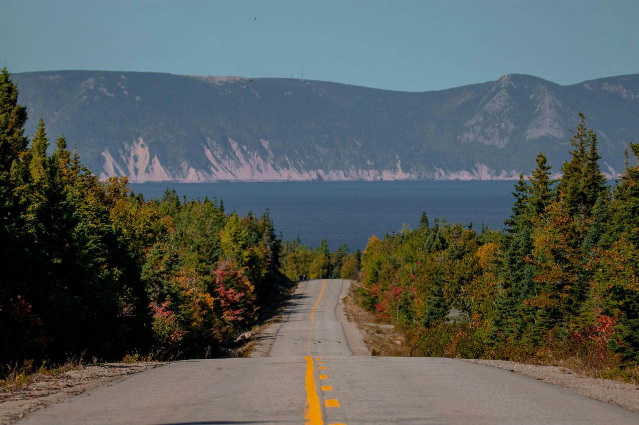
Nova Scotia’s Cabot Trail has become a magnet for drone footage, coastal cliff photos and autumn road trip content. The 185-mile loop through Cape Breton Highlands National Park has always been scenic, but tourism officials in Nova Scotia have acknowledged major seasonal concentration tied to cruise traffic, foliage travel and online visibility.
The road itself remains manageable for most of the year, yet certain lookoffs, hiking access points and village stops now feel compressed during peak periods. Restaurants and inns benefit from demand, but staffing and housing pressure in seasonal tourism communities have become real concerns in Atlantic Canada.
Locals often say the issue is not visitors themselves, but visitor behavior. Stopping abruptly for photos, crowding private viewpoints and treating small fishing communities like content sets can erode the relaxed atmosphere that made the drive famous in the first place.
Hana Highway, Maui
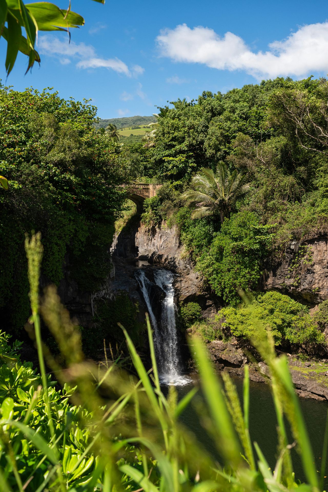
Maui’s Road to Hana has become one of the most discussed examples of overtourism tied to social media. The narrow, winding route includes roughly 620 curves and 59 bridges, many of them one lane, and local officials have repeatedly urged visitors not to stop illegally, trespass or block access for residents and emergency vehicles.
Hawaii tourism agencies and Maui County have spent years telling travelers to treat the road as a living community corridor, not just a sightseeing challenge. Influencer-style stop lists encouraged people to pull over at waterfalls, roadside fruit stands and unofficial swimming spots without understanding local rules or safety conditions.
The backlash has been public and sustained. Residents in East Maui have spoken out about traffic, litter and disrespect for private land. The drive is still open and popular, but the gap between the curated online fantasy and the on-the-ground reality is now hard to miss.
Overseas Highway, Florida Keys
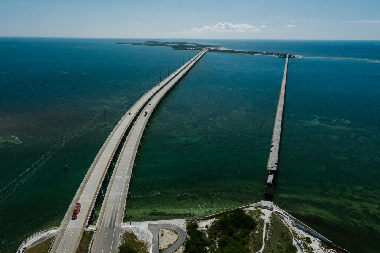
The drive from Miami to Key West still delivers turquoise water views, bridge crossings and laid-back island stops, but its image online has become almost too polished. Viral clips often show empty roads and sunset-perfect pullovers, even though US 1 through the Keys can back up heavily on weekends, holidays and storm evacuation days.
Monroe County officials and local business groups continue to promote tourism, yet they also face recurring strain from traffic volume, limited land and high service costs. Parking in Key West, in particular, can be difficult and expensive, and many roadside photo spots do not have the room social posts seem to imply.
The experience is not ruined so much as reshaped. For travelers expecting a free-flowing tropical cruise, the reality often includes stop-and-go traffic, reservation-heavy lodging and crowds at many of the same sunset spots featured online.
Great Smoky Mountains Loop, Tennessee and North Carolina
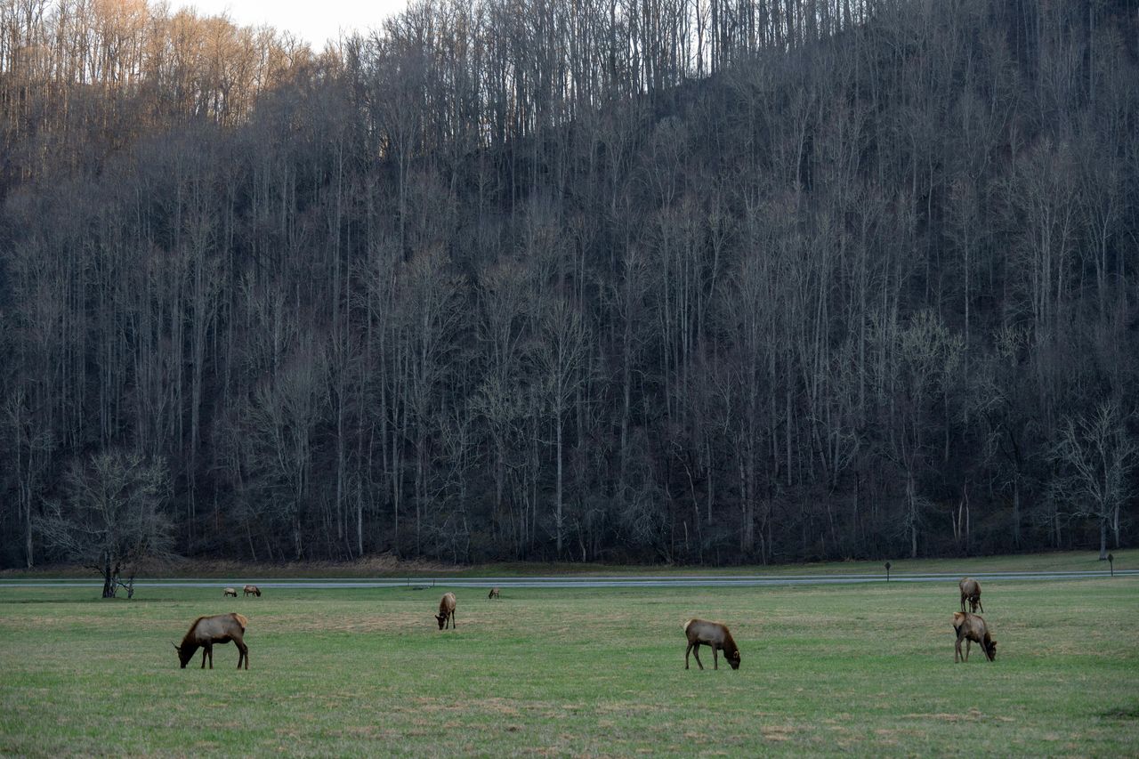
Road trips built around Great Smoky Mountains National Park have surged as the park has remained the most visited national park in the US. Social media helped popularize drives through Cades Cove, Newfound Gap Road and nearby gateway towns, turning what used to be a broad regional vacation into a tightly focused set of must-film locations.
The park does not charge an entrance fee, which keeps demand high, but officials have added parking tag requirements and expanded traffic management efforts in response to pressure on roads and facilities. Cades Cove is a regular bottleneck, especially during wildlife viewing periods and fall weekends.
Tourism remains central to the region’s economy, but local frustration rises when visitors block lanes for bear sightings or crowd scenic pullouts. The mountains are still there. The feeling of stumbling onto a quiet overlook, however, is getting harder to find in peak season.
Monument Valley to Page, Arizona and Utah
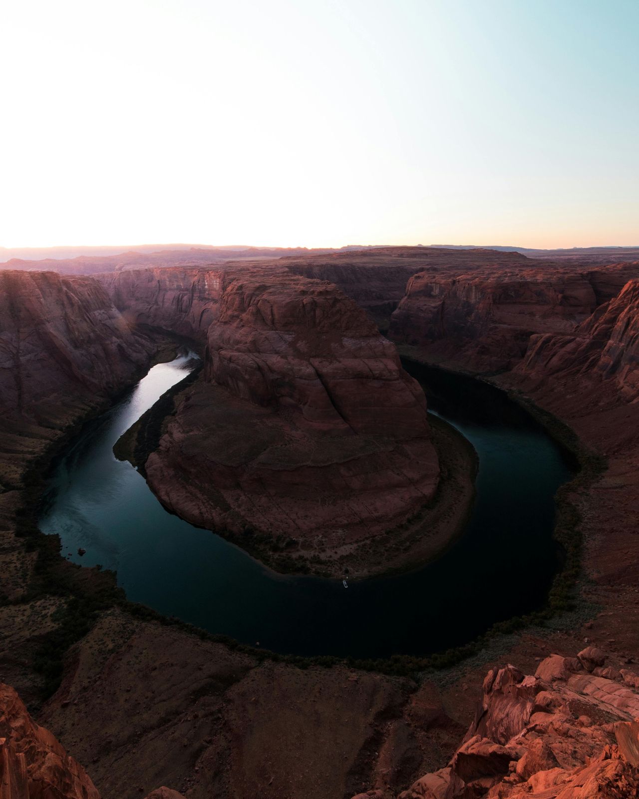
The desert drive linking Monument Valley, Horseshoe Bend, Antelope Canyon and nearby Page has become one of the most packaged influencer routes in the Southwest. A handful of cinematic stops now dominate online coverage, even though the region is vast, culturally complex and spread across tribal, federal and local jurisdictions.
At Horseshoe Bend, the city of Page and federal land managers invested in formal parking, fees and trail infrastructure after visitor growth accelerated sharply. Antelope Canyon access is controlled through guided tours on Navajo land, a system that reflects both safety needs and tribal management of an intensely photographed site.
Travel content often strips out those details and sells the route as spontaneous. It is not. Reservations, fees, heat exposure and respect for Navajo Nation rules are basic parts of the trip, and travelers who ignore them quickly find the online version was incomplete.
Sea-to-Sky Highway, British Columbia
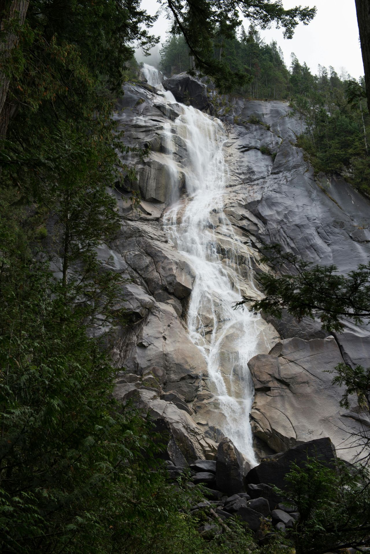
The highway from Vancouver to Whistler has become an all-seasons visual staple, with Shannon Falls, the Stawamus Chief and mountain viewpoints filling travel feeds year-round. British Columbia authorities have repeatedly had to manage congestion and illegal roadside parking at major stops, especially on sunny weekends and during ski season.
In response, some areas saw parking controls, enforcement or redesigns meant to reduce dangerous shoulder stopping. Search and rescue groups in the province have also spent years warning that heavily shared viewpoints can attract people who are unprepared for terrain, weather or cliff exposure.
The problem is not the road itself. It is the mismatch between highly edited content and real mountain travel. What looks like a quick scenic stop online can involve full lots, permit rules nearby, steep hikes or risky roadside conditions.
Baja California’s Transpeninsular Highway, Mexico
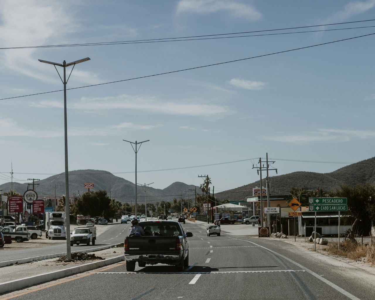
Mexico’s Highway 1 through Baja California still offers one of the continent’s great long-distance drives, linking border cities, desert stretches, Pacific surf towns and the Sea of Cortez. But as van-life content and remote-work travel spread online, parts of the route gained a reputation as a carefree off-grid paradise that local realities do not fully support.
Tourism remains important in Baja California and Baja California Sur, especially in places like Ensenada, Loreto, Todos Santos and La Paz. Yet residents and longtime travelers say social media has concentrated visitors into a narrow set of beaches, taco stops and camp spots, increasing waste, price pressure and crowding in places once known for breathing room.
The road is still a classic. What has changed is expectation. Travelers arriving with a curated influencer map often miss the distance, fuel planning, safety judgment and local respect that have always been essential to doing Baja well.