14 Peruvian Inca Trails Eroded by Landslide Threats
Geologists and archaeologists from the Peruvian Ministry of Culture have issued increasingly urgent warnings regarding the structural integrity of the Great Inca Road, known locally as the Qhapaq Ñan. These experts highlight that climate change has accelerated glacial melt and intensified seasonal rainfall patterns throughout the Andes, creating a perfect storm for geological instability. The steep topography that defines these ancient engineering marvels is now their greatest vulnerability, as water saturation weakens the soil binding the stone foundations to the mountainsides.
Civil defense officials and risk management specialists at Peru’s Geological, Mining, and Metallurgical Institute (INGEMMET) actively monitor these trekking corridors for signs of mass movement. They note that the combination of seismic activity and deforestation for agriculture has removed critical ground cover, leaving the historic pathways exposed to gravity-driven erosion. Understanding which specific routes face the highest risk allows hikers and preservationists to grasp the fragility of this UNESCO World Heritage network.
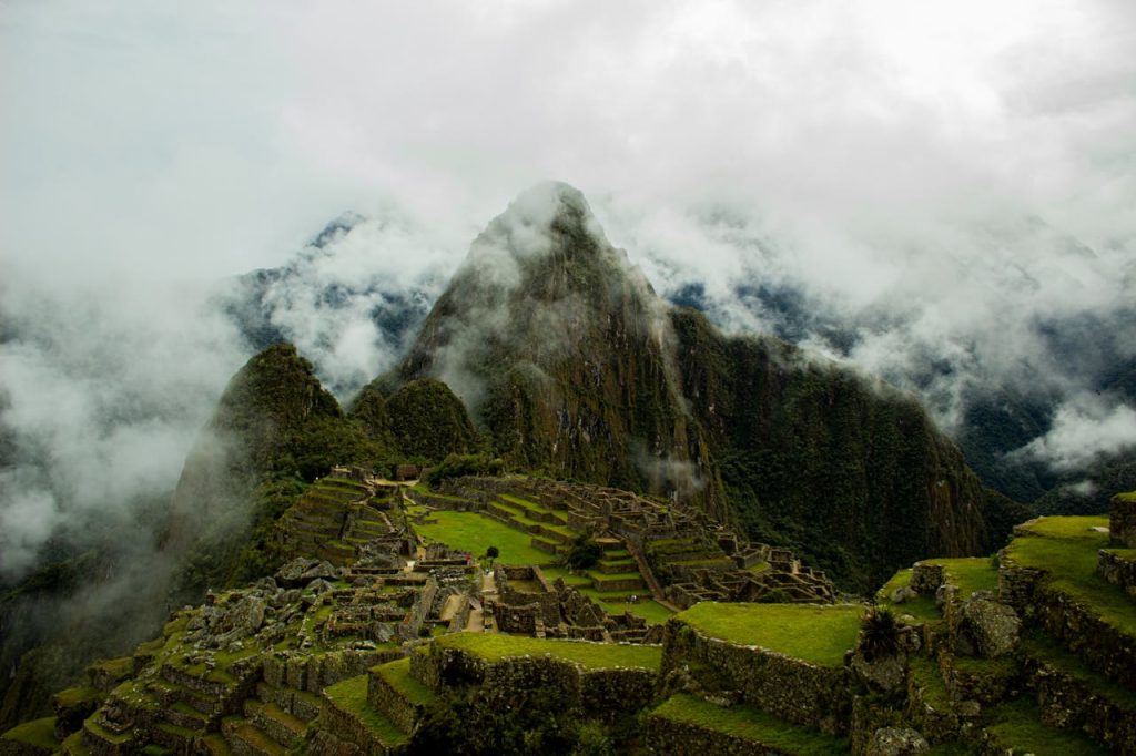
The Classic Inca Trail To Machu Picchu
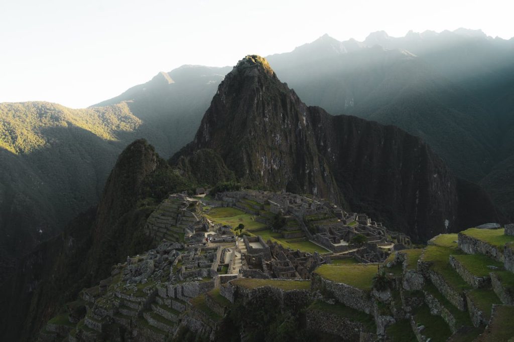
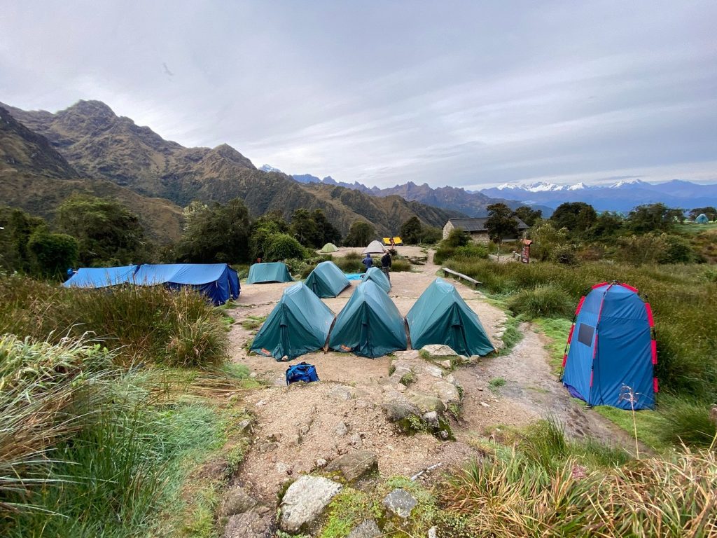
Heritage conservationists and geological engineers closely examine the famous forty-three kilometer route for signs of subsidence, particularly near the Wiñay Wayna archaeological complex. This sector sits on a steep slope where heavy rainfall frequently saturates the soil, leading to micro-landslides that undermine the stone paving. Park rangers strictly limit the number of daily hikers to five hundred partly to reduce the vibrational stress on these unstable sections, although weather remains the primary threat.
Hydrologists warn that the Urubamba River valley below the trail acts as a dynamic erosion engine. When the river swells during the wet season, it scours the base of the mountains, destabilizing the slopes above where the trail traverses. Maintenance crews work tirelessly to reinforce retaining walls, but the sheer volume of water cascading down from the high passes continues to wash away topsoil and loosen the ancient masonry.
The Salkantay Trek
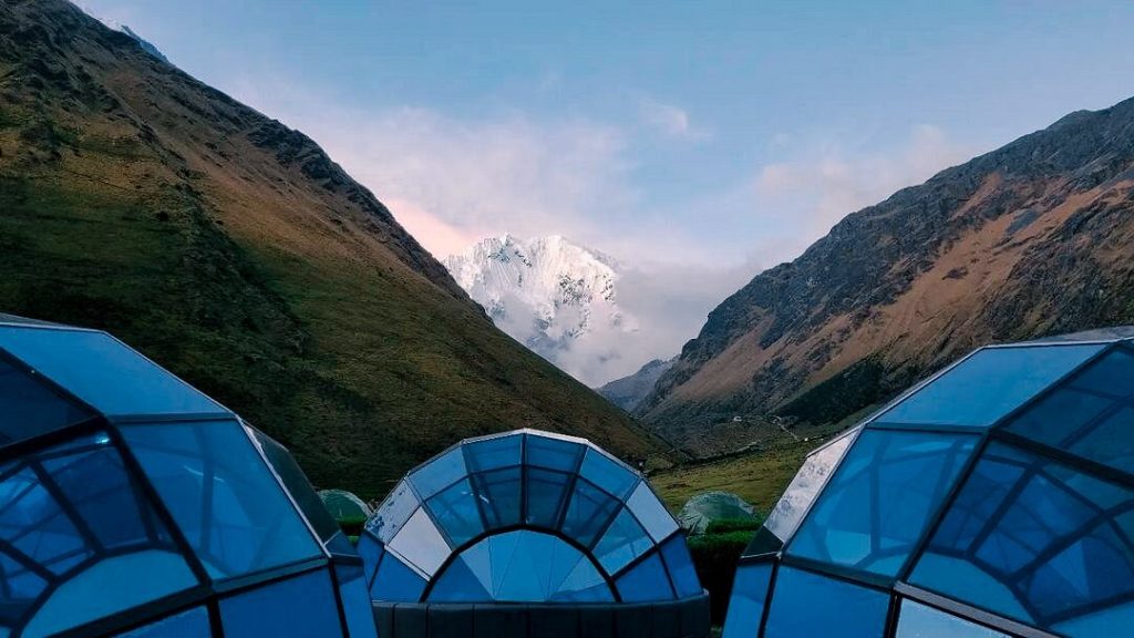
Glaciologists monitoring the Cordillera Vilcabamba identify the Salkantay route as a high-risk zone for glacial lake outburst floods and debris flows. As the Salkantay glacier retreats, it leaves behind loose moraine rock that can easily mobilize during heavy rain events, sending torrents of mud and stone across the trekking paths. Adventure tourism guides report that the landscape here changes rapidly, with sections of the trail frequently washed out or buried by fresh landslides.
The descent into the cloud forest near Santa Teresa is particularly prone to slope failure due to the transition from rocky alpine terrain to soil-heavy jungle. Geologists note that the humid environment accelerates the weathering of the rock, while the steep gradient of the Santa Teresa River valley creates a natural chute for gravity slides. Hikers in this area often face detours where the original path has slid entirely into the river below.
The Choquequirao Trek
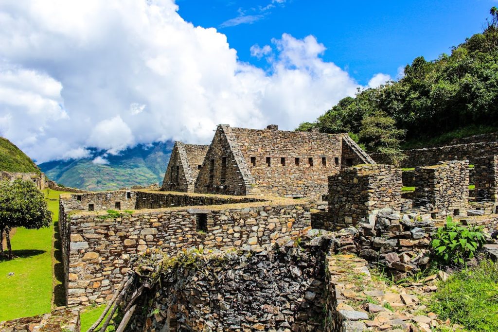
Archaeologists working at the “Sister of Machu Picchu” describe the access route across the Apurimac Canyon as one of the most geologically volatile treks in the region. The trail plunges deeply into the canyon before climbing the opposite side, traversing sheer cliff faces that are subject to constant rockfall. Structural engineers emphasize that the geological fault lines running through the canyon make the soil inherently unstable and prone to shifting without warning.
Recent assessments by regional government officials indicate that the deforested slopes along the path offer little resistance to erosion. When seasonal rains hit the arid canyon walls, the water travels fast and carries massive amounts of sediment, cutting deep gullies into the trail surface. The isolation of this route means that landslide repairs often take weeks or months, leaving the ancient stones suspended precariously over thousand-foot drops.
The Lares Trek
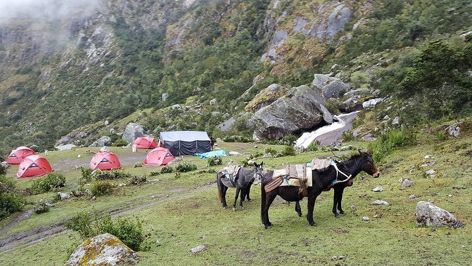
Agricultural experts and soil scientists observe that the Lares Valley faces significant erosion due to a combination of traditional farming practices and natural geology. The trek passes through active agricultural communities where centuries of tillage have loosened the soil on steep gradients. During the rainy season, this loose earth becomes saturated and heavy, leading to rotational slides that can sever the trekking routes connecting the high-altitude villages.
The trail system here relies on unpaved earthen paths rather than the stone-paved infrastructure of the classic Inca Trail, making it far more susceptible to washing away. Hydrologists point out that the lack of modern drainage systems in the remote passes exacerbates the problem, as water pools on the trail and softens the ground. Trekkers often encounter sections of deep mud that signal active soil movement underneath the surface.
The Huchuy Qosqo Trek
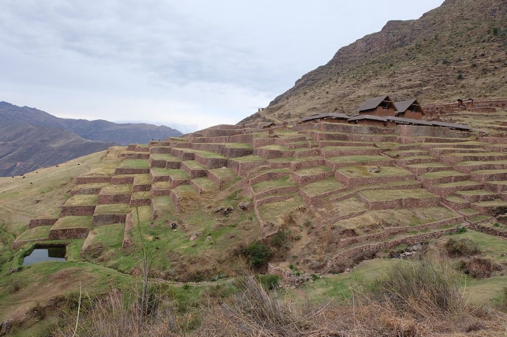
Preservationists focus on the section of trail leading from the Lamay district up to the Huchuy Qosqo archaeological site as a critical erosion hotspot. The path ascends a precipitous canyon wall composed of red clay and loose shale that dissolves rapidly under heavy precipitation. Civil defense teams in the Sacred Valley frequently monitor this area for rockslides that threaten both the hikers and the communities living below.
The site itself sits on a plateau overlooking the Vilcanota River, a position that commands spectacular views but exposes the access routes to severe wind and water weathering. Geologists note that the lack of vegetation on the canyon walls allows water to gain velocity as it runs off the high puna, scouring the trail and triggering debris flows. The constant maintenance required to keep the path open serves as a testament to the relentless geological forces at work.
The Vilcabamba To Espiritu Pampa Route
Expedition leaders and jungle ecologists categorize this remote trek as extremely vulnerable due to the heavy rainfall characteristic of the high Amazon basin. The trail leads into the final refuge of the Incas, traversing dense cloud forests where the soil is perpetually moist. Botanists explain that while the vegetation holds the topsoil, the sheer weight of the water-logged biomass can trigger massive landslides on the steep Andean slopes.
The historical significance of the route attracts serious trekkers, but the infrastructure is minimal and often overgrown. River specialists warn that the numerous water crossings along the way are prone to flash flooding that eats away at the riverbanks where the trail approaches. The dynamic nature of the jungle environment means that the path is in a constant state of being reclaimed by both the forest and the shifting earth.
The Inca Quarry Trail To Cachicata
Geological surveyors studying the Ollantaytambo region point to the Cachicata quarries as a site of active rockfall and slope instability. This trail was used by the Incas to transport massive pink granite stones, and the slide marks from ancient times are still visible. Today, experts warn that the same gravity ramps used to move the megaliths are prone to releasing loose scree and boulders onto the hiking path.
The trail sits on the exposed flank of the mountain, facing the full brunt of the wind and rain without the protection of a valley. Erosion specialists note that the dry, dusty soil creates a slip layer over the bedrock, making the footing treacherous even without a major landslide event. The sheer verticality of the terrain means that any rock dislodged from above gathers dangerous momentum before reaching the trail level.
The Ausangate Circuit
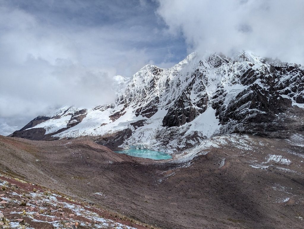
Climate change researchers monitoring the Vilcanota mountain range highlight the Ausangate circuit as a frontline for permafrost degradation. As the high-altitude permafrost melts, it destabilizes the moraines and ridges that the trail crosses. Mountaineering guides report that slopes that were once frozen solid are now becoming fluid, leading to solifluction where the soil slowly flows downhill like a viscous liquid.
The route passes numerous glacial lakes that are swelling with meltwater, increasing the pressure on natural dams. Hydrologists caution that a breach in these dams could trigger catastrophic floods that would obliterate the trail infrastructure in the valleys below. The stunning multicolored geology of the region is beautiful to photograph but indicates a mix of mineral deposits that weather and erode at different rates, causing uneven settling of the path.
The Santa Teresa Hydroelectric Route
Civil engineers and transport officials view the backdoor route to Machu Picchu along the Urubamba River as a perpetual landslide zone. The trail follows the railway tracks and the riverbank, sitting at the bottom of a massive canyon with steep, unstable walls. During the rainy season, it is common for mudslides to block the railway and the hiking path, stranding visitors and cutting off supply lines.
The hydroelectric plant nearby alters the water flow, but the primary threat comes from the natural geology of the canyon. Risk management experts note that the vibrations from the trains combined with water saturation create a high potential for slope failure. Hikers walking along the tracks are frequently warned to watch the cliffs above for falling rocks, a danger that persists year-round but spikes during the wet months.
The Qhapaq Ñan Central Segment
Peruvian archaeologists working in the central Andes near Junín and Huánuco emphasize that this section of the Great Inca Road suffers from neglect and agricultural encroachment. The ancient paving stones are often removed or destabilized by local farming activities, which disrupts the original drainage engineering. Without the proper water channels, heavy rains pool on the roadbed and cause the foundation to slump and slide downhill.
The sheer scale of this segment makes continuous monitoring difficult for the Ministry of Culture. Preservationists report that entire sections of the monumental road have been lost to landslides in remote ravines. The loss of the retaining walls allows the hillside to reclaim the engineering work, erasing the physical evidence of the Inca Empire’s connectivity in these high-altitude corridors.
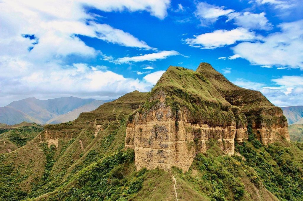
The Aypate Trail In Piura
Meteorologists tracking El Niño phenomena identify the Aypate archaeological complex and its access trails as highly vulnerable to extreme weather events. Located in the northern Piura region, this area experiences torrential rains during El Niño years that far exceed the historical norms the road was built to withstand. Conservationists note that the rapid accumulation of water turns the dry tropical forest soil into a slurry that washes away ancient foundations.
The remoteness of Aypate means that damage assessments often lag behind the actual weather events. Geologists warn that the granite blocks used in the construction are sliding out of position as the mud beneath them liquefies. The trail, which winds through a unique ecological zone, faces the dual threat of rapid erosion from water and the overgrowth of aggressive vegetation that pries the stones apart.
The Huánuco Pampa Segment
Heritage experts maintain that the trail leading to and from the massive administrative center of Huánuco Pampa is threatened by gully erosion. The vast plateau is exposed to strong winds and heavy seasonal rains that channel water into deep ruts along the ancient road. Hydrologists explain that once the stone surface is breached, the water eats away at the soft subsoil, creating caverns that eventually collapse under their own weight.
Local community patrols work to preserve what remains, but the geological forces are immense. The site sits in a high-altitude plain where the freeze-thaw cycle heaves the ground, loosening the stonework. Experts in Inca architecture point out that the precise drainage canals designed by the original builders have largely clogged over centuries, forcing water to find destructive new paths through the trail structure.
The Colca Canyon Trekking Routes
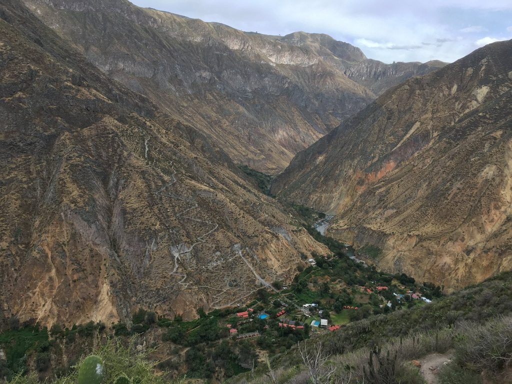
Seismologists and geologists in the Arequipa region constantly monitor the Colca Canyon for instability caused by the active Sabancaya volcano nearby. The trekking routes descending into the canyon to reach the oasis of Sangalle traverse steep walls composed of volcanic ash and loose scree. Frequent earth tremors unsettle this material, leading to rockfalls that can block the narrow paths without warning.
The depth of the canyon, one of the deepest in the world, magnifies the impact of gravity on the trail system. Risk assessment teams note that the dry climate prevents the growth of deep-rooted vegetation that might otherwise anchor the soil. Consequently, the trails are in a constant state of motion, sliding incrementally toward the Colca River at the canyon floor with every minor seismic event.
The Maras And Moray Connecting Trails
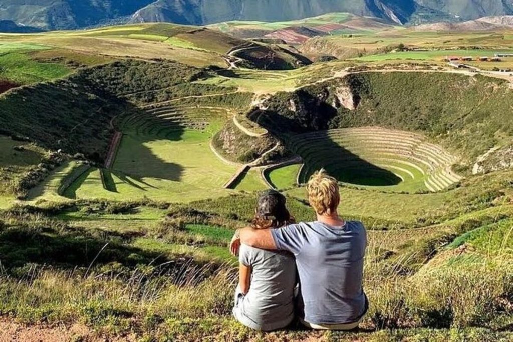
Soil scientists and agricultural historians observe that the trails connecting the salt mines of Maras and the agricultural terraces of Moray traverse highly soluble limestone and saline rich soils. The geological composition of the Sacred Valley here creates a landscape prone to sinkholes and subsidence. During the wet season, the water dissolves the minerals in the ground, creating voids that can cause the surface trails to buckle and collapse.
The popularity of this route for biking and hiking has increased the physical wear on the path, accelerating the erosion process. Conservationists warn that the dust generated by traffic loosens the surface, which then washes away in the rain. The resulting gullies threaten not only the recreational trails but also the integrity of the ancient agricultural terraces that define the landscape.