8 Cities Where Navigation Apps Lead Visitors Astray

Digital navigation tools promise clarity, but in certain cities they routinely create confusion. Historic layouts, dense construction, evolving traffic rules, and layered infrastructure challenge algorithmic logic. Visitors often trust apps blindly, unaware that local geography developed long before modern mapping standards. Shortcuts lead to dead ends, and pedestrian routes differ from vehicle logic. In some places, locals rely on instinct. Understanding where apps struggle helps travelers move more confidently. These cities demonstrate how technology sometimes misreads reality, turning simple journeys into unexpected detours. Local knowledge often outperforms digital guidance during unexpected disruptions or route changes.
Venice, Italy

Venice presents constant challenges for navigation apps due to its car-free design and layered walkways. GPS signals struggle among narrow canals and stone corridors. Apps frequently suggest routes that include nonexistent bridges or private passages. Water taxis, ferries, and walking paths follow different logic than streets. Visitors often circle the same blocks repeatedly. Even locals rely on landmarks instead of directions. Travelers trusting turn-by-turn instructions frequently overshoot destinations, ending up far from intended routes despite short distances within the historic center’s compact but complex geography. Human orientation remains essential within Venice’s unique urban fabric and historic pathways.
Boston, Massachusetts
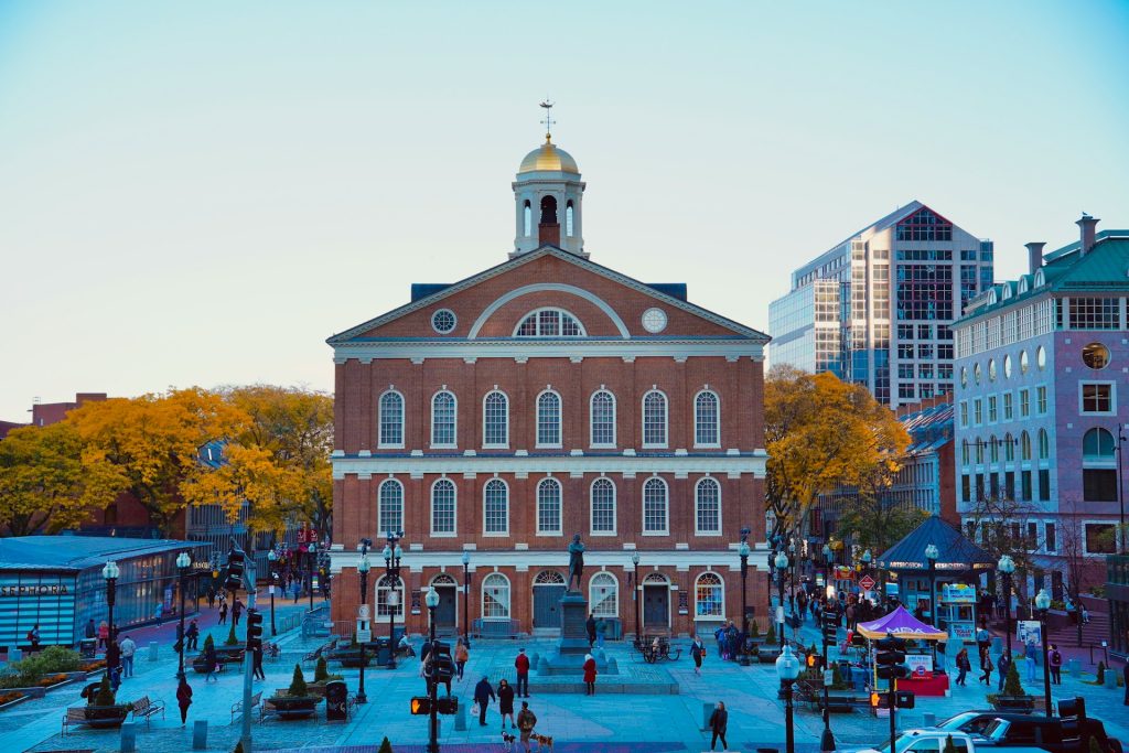
Boston’s navigation problems stem from its colonial-era street design. Roads curve unpredictably, overlap, and change names without warning. GPS systems assume grid logic that does not apply. Apps regularly reroute drivers through narrow residential streets or prohibited turns. Underground tunnels disrupt signals. Pedestrian routes differ sharply from vehicle paths. Construction projects frequently alter traffic flow. Locals navigate by memory rather than maps. Visitors relying on apps often miss entrances, overshoot exits, or loop unnecessarily. Boston’s layered history and constant infrastructure changes routinely outpace digital mapping updates. Longtime residents still debate directions using landmarks rather than street names.
Rome, Italy

Rome confuses navigation apps through its dense layering of ancient streets, modern roads, and restricted traffic zones. GPS signals weaken near stone structures and underground ruins. Apps often guide drivers into limited traffic areas carrying fines. One-way streets change frequently. Pedestrian shortcuts differ from vehicle logic. Construction and events block routes without warning. Visitors following apps may circle neighborhoods repeatedly. Locals rely on familiarity rather than directions. Rome’s living history resists algorithmic precision, making navigation tools unreliable without contextual awareness of zones, time restrictions, and evolving urban patterns. Local intuition remains a valuable tool for moving efficiently.
San Francisco, California
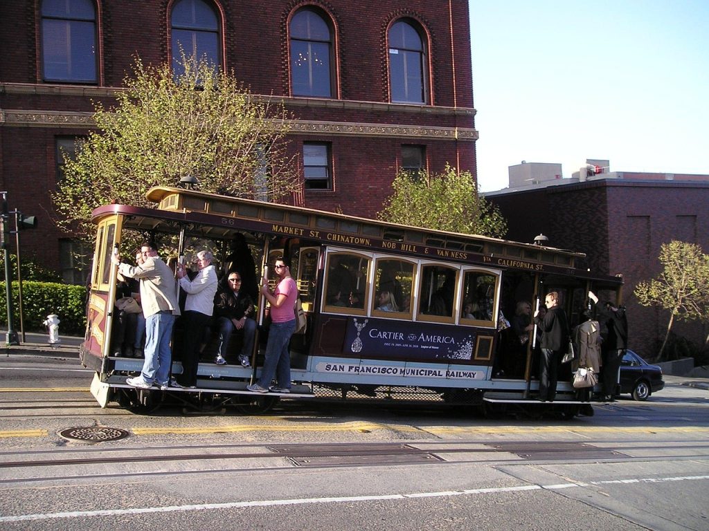
San Francisco challenges navigation apps through steep hills, microstreets, and signal interference. GPS often misjudges elevation, suggesting impossible turns or stair-only routes. One-way streets change direction by block. Construction disrupts accuracy. Fog interferes with signals. Pedestrian routes differ significantly from driving paths. Apps sometimes guide users into unsafe neighborhoods or closed roads. Locals navigate using landmarks and slope awareness. Visitors trusting apps frequently overshoot destinations or face unexpected climbs. San Francisco’s topography and density reveal how digital maps struggle with three-dimensional urban environments. Terrain awareness often matters more than distance calculations here.
Tokyo, Japan
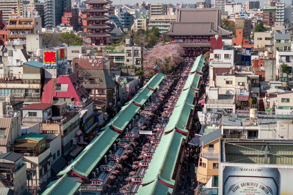
Tokyo’s navigation difficulties arise from its address system rather than street names. Many roads lack names entirely. GPS locations reference block numbers unfamiliar to visitors. Underground stations span multiple exits. Apps often direct users to wrong sides of buildings. Elevated walkways confuse positioning. Dense construction interferes with signals. Pedestrian routes differ from vehicle directions. Locals rely on landmarks and station maps. Visitors following apps may stand near destinations without recognizing them. Tokyo’s organized complexity challenges digital navigation assumptions rooted in Western addressing conventions. Cultural familiarity greatly improves wayfinding accuracy across the city.
Marrakech, Morocco

Marrakech frequently misleads navigation apps due to its historic medina layout. Narrow alleys block GPS signals. Routes shift with market activity. Apps suggest paths inaccessible to outsiders. Dead ends appear without warning. Pedestrian-only zones confuse vehicle mapping. Temporary stalls alter walkways daily. Locals navigate through memory and sound cues. Visitors following apps often get lost deeper within the medina. Marrakech’s organic urban design resists fixed mapping, making human guidance more reliable than digital instructions within its centuries-old labyrinthine neighborhoods. Asking locals often shortens travel time significantly and reduces stress during busy market hours.
Paris, France

Paris confounds navigation apps through layered streets, underground passages, and complex intersections. GPS struggles near historic stone buildings. One-way streets change unexpectedly. Pedestrian tunnels and bridges confuse route logic. Construction frequently alters access. Apps often prioritize shortest distance over practicality. Cyclists and walkers receive inaccurate suggestions. Locals navigate by arrondissement awareness rather than directions. Visitors relying solely on apps may miss entrances or overshoot landmarks. Paris’s blend of medieval pathways and modern infrastructure challenges digital precision in dense central districts. Experience helps distinguish practical routes from theoretical ones.
New Orleans, Louisiana
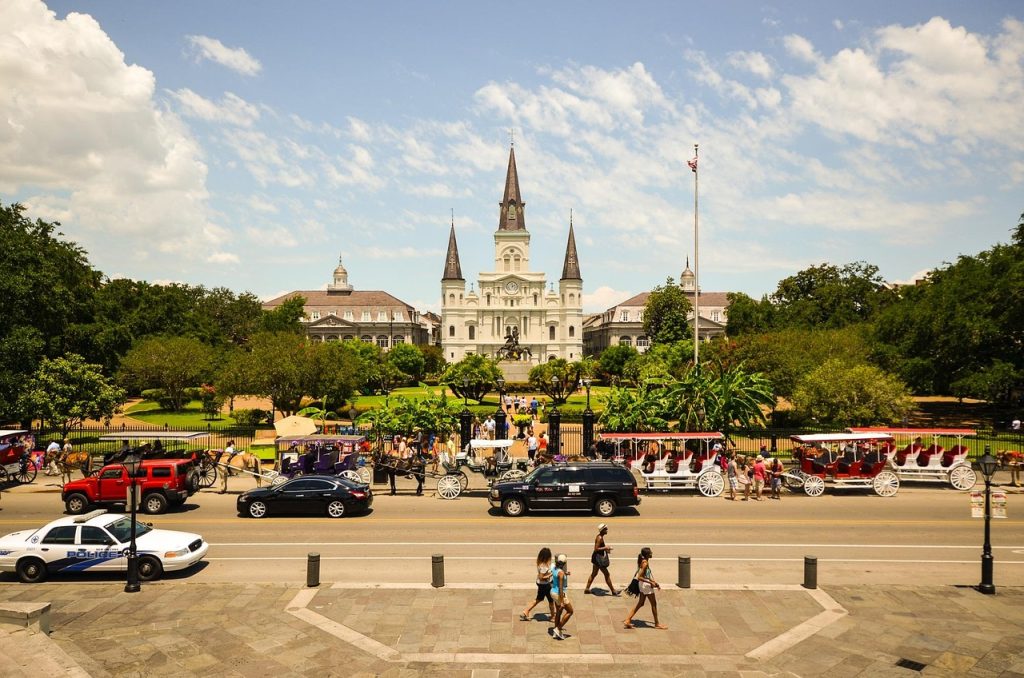
New Orleans misleads navigation apps through irregular streets, one-way zones, and festival disruptions. GPS struggles in the French Quarter’s narrow corridors. Temporary closures occur frequently. Street names change direction without warning. Elevated roadways interfere with signals. Pedestrian routes differ from driving paths. Apps reroute users into congested or restricted areas. Locals navigate by neighborhood familiarity. Visitors trusting apps often encounter dead ends or delays. New Orleans’ fluid urban rhythm and frequent events outpace real-time digital updates. Local advice often prevents unnecessary detours during busy periods and saves time, especially during major parades, concerts, and weekend festivals.