8 Coastal Drives in America Drivers Call a Traffic Hellscape
Transportation analysts and urban planners have long observed a frustrating paradox regarding the most beautiful coastal routes in the United States. While marketing brochures promise windswept freedom and open horizons, the reality on the asphalt is often a grinding procession of brake lights. Traffic engineers note that the very geography that makes these drives stunning, such as narrow spits of land and cliffside edges, also restricts infrastructure. This creates natural bottlenecks that cannot handle modern vehicular volume.
According to travel logistics experts, the rise of road trip tourism has transformed once-quiet seaside arteries into some of the nation’s most congested corridors. Local authorities in these regions frequently report that travel times can triple during peak seasons. This turns a relaxing scenic drive into an endurance test for engines and patience alike. Veteran drivers and data analysts identify these eight coastal roads as the most notorious congestion zones in the country.
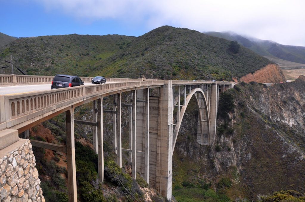
Pacific Coast Highway In Malibu
Traffic data from the Los Angeles metropolitan area consistently flags the stretch of California State Route 1 through Malibu as a premier site of congestion. Known globally as the PCH, this iconic roadway serves as both a major commuter artery and a magnet for millions of tourists. The result is a volatile mix of distracted sightseers and frustrated locals. Safety officials emphasize that the lack of alternative routes means a single fender bender can paralyze traffic for miles. Drivers are often left trapped between the Santa Monica Mountains and the Pacific Ocean with nowhere to turn.
Highway patrol officers frequently cite the dangerous combination of erratic parking and high speeds as a primary cause for the daily slowdowns. Visitors attempting to pull off onto narrow gravel shoulders to capture sunset photos often disrupt the flow of traffic. This forces approaching vehicles to slam on their brakes. Urban planners argue that the road was simply not designed to accommodate the density of modern Los Angeles traffic. It turns one of the world’s most beautiful drives into a linear parking lot on summer weekends.
The Overseas Highway In The Florida Keys
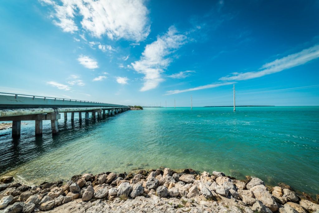
The engineering marvel known as U.S. Route 1 connects the Florida Keys to the mainland, but emergency management officials regard it as a fragile lifeline prone to catastrophic delays. Because the highway is largely a two-lane road traversing a series of bridges and islands, there are almost no detours available. A crash investigation on a bridge or a vehicle breakdown can shut down movement entirely in both directions. This strands motorists above the water for hours at a time.
Local residents and freight drivers describe the slow pace as an unavoidable fact of life, particularly during weekends and lobster season. Traffic studies indicate that the volume of vehicles far exceeds the capacity of the road during peak tourist months. State troopers strictly enforce passing zones, but the sheer density of RVs and boat trailers creates a sluggish caravan. The line of vehicles often moves at a fraction of the posted speed limit for over a hundred miles.
Montauk Highway In The Hamptons
New York transportation officials have long struggled with the seasonal gridlock that overtakes Route 27 on the eastern end of Long Island. Known locally as the Trade Parade, the morning congestion is driven by a massive influx of contractors and service workers commuting east to maintain high-end properties. A reverse exodus follows in the afternoon. During summer Fridays, the traffic volume swells even further with vacationers. This creates delays that can turn a short drive into a multi-hour ordeal.
Regional planners point out that the geography of the South Fork limits the possibility of expanding the roadway. With historic villages and preserved farmland pressing in on both sides, the single-lane highway becomes a chokepoint that cannot be widened. Police departments in Southampton and East Hampton deploy traffic control officers to manually direct intersections. Yet the volume of vehicles remains overwhelming. Many seasoned drivers rely on back roads or simply avoid driving during peak windows.
U.S. Route 6 On Cape Cod
The infrastructure leading onto Cape Cod is famously strained by the summer population explosion. The Sagamore and Bourne Bridges act as critical bottlenecks. Massachusetts Department of Transportation data shows that traffic backups at these entry points can stretch for miles. This often affects connecting highways long before drivers even reach the canal. Once on the Cape, Route 6 serves as the primary spine. Congestion analysts note that it frequently grinds to a halt as it narrows from two lanes to one further down the peninsula.
Tourism boards acknowledge that the changeover days for rental properties create predictable surges in traffic that overwhelm local capacity. On Saturdays, thousands of visitors attempt to enter and exit simultaneously. This completely saturates the roadway. Civil engineers have debated solutions for decades, but the constraints of the existing bridges and the environmental sensitivity of the surrounding marshlands make significant expansion difficult. Drivers are left to endure the crawl.
The Road To Hana In Maui
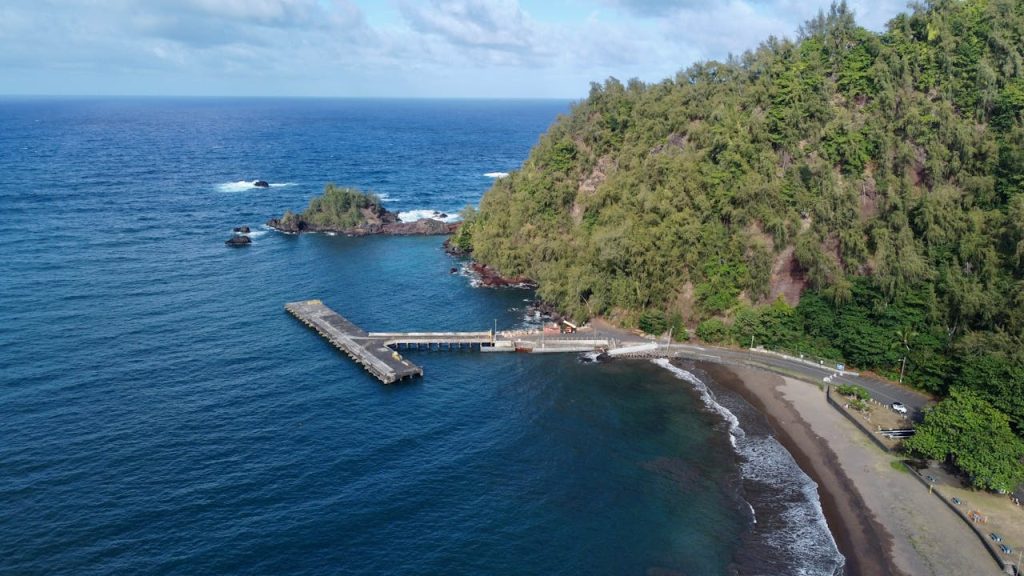
Travel guides celebrate the Hana Highway for its waterfalls and rainforests, but Maui residents and safety officials increasingly view the road as a logistical nightmare. The highway features over six hundred curves and fifty-nine bridges, and many of these are only one lane wide. Park rangers report that the explosion of rental cars has made the drive nearly impassable at times. Tourists often stop illegally in the middle of the road to take pictures or block private driveways.
The congestion has become severe enough that local government officials have implemented new parking restrictions and fines to manage the chaos. Emergency responders frequently struggle to navigate the clogged narrow lanes to reach residents in need. The consensus among island logistics experts is that the road has reached its carrying capacity. This leads to a tense environment where the slow pace of admiring tourists conflicts directly with the needs of locals trying to commute.
U.S. Route 1 In Wiscasset
Department of Transportation officials in Maine recognize the village of Wiscasset as one of the most stubborn traffic bottlenecks in the state. Often referred to as The Prettiest Village in Maine, the town center forces the primary coastal route down to a two-lane street with crosswalks and street parking. During the peak summer season, traffic analysts record backups that can extend for miles in both directions. Thousands of cars wait to inch through the historic downtown.
The delay is frequently exacerbated by pedestrians crossing the street to visit famous lobster shacks. This halts the flow of vehicles repeatedly. State planners have proposed bypasses in the past, but business owners and preservationists have debated the economic impact of diverting traffic. For now, drivers heading up the coast must factor in significant wait times. The charming village infrastructure creates a severe constriction point on the primary route to Acadia National Park.
Delaware Route 1 Near The Beaches
The coastal highway serving Rehoboth, Dewey, and Bethany Beaches transforms into a gridlocked corridor during the summer months according to regional traffic reports. Delaware transportation authorities manage a roadway that must handle both local beach traffic and heavy streams of visitors arriving from Washington D.C. and Pennsylvania. The highway is lined with outlet malls and commercial centers. This creates a friction of turning vehicles that slows the main line of traffic to a crawl.
Police frequently utilize traffic signal timing adjustments to flush vehicles through, but the volume often overwhelms these measures on weekends. Congestion is particularly acute during the transition from the high-speed highway to the stop-and-go conditions of the beach towns. Urban designers note that the strip-mall development pattern along the route adds to the chaos. Constant merging and exiting disrupts the flow and causes frustration for drivers just miles from their destination.
Highway 12 In The Outer Banks

North Carolina emergency management teams view Highway 12 as both a vital lifeline and a precarious travel route. The two-lane road stretches along a thin barrier island. This renders it highly susceptible to sand drift, overwash, and flooding that can halt traffic without warning. Even in fair weather, the summer rental turnover creates massive congestion. Thousands of vacationers attempt to navigate the singular road that connects the northern beaches of Duck and Corolla to the mainland.
Ferry operators and bridge authorities coordinate closely to manage the flow, but the physical limitations of the road mean delays are inevitable. Traffic often backs up for miles at the Wright Memorial Bridge, which is the primary access point. Coastal geologists emphasize that the shifting sands and rising tides constantly threaten the integrity of the roadway. This leads to frequent construction and maintenance delays that further complicate the drive for those seeking a seaside escape.