8 Scenic Routes That Are Statistically More Dangerous Than They Look
Scenic drives promise memorable views and relaxed pacing, yet beauty often hides genuine danger. Across the United States, several famous routes record higher accident rates than comparable roads. Sharp curves, elevation changes, unpredictable weather, and distracted sightseeing all increase risk. Drivers frequently underestimate these hazards because surroundings feel calm and inviting. Understanding which scenic roads demand extra caution helps with safer planning and better decisions. These routes remain beloved and visually stunning, but statistics show they require patience, focus, and respect rather than casual cruising through breathtaking American landscapes during modern travel seasons nationwide today.
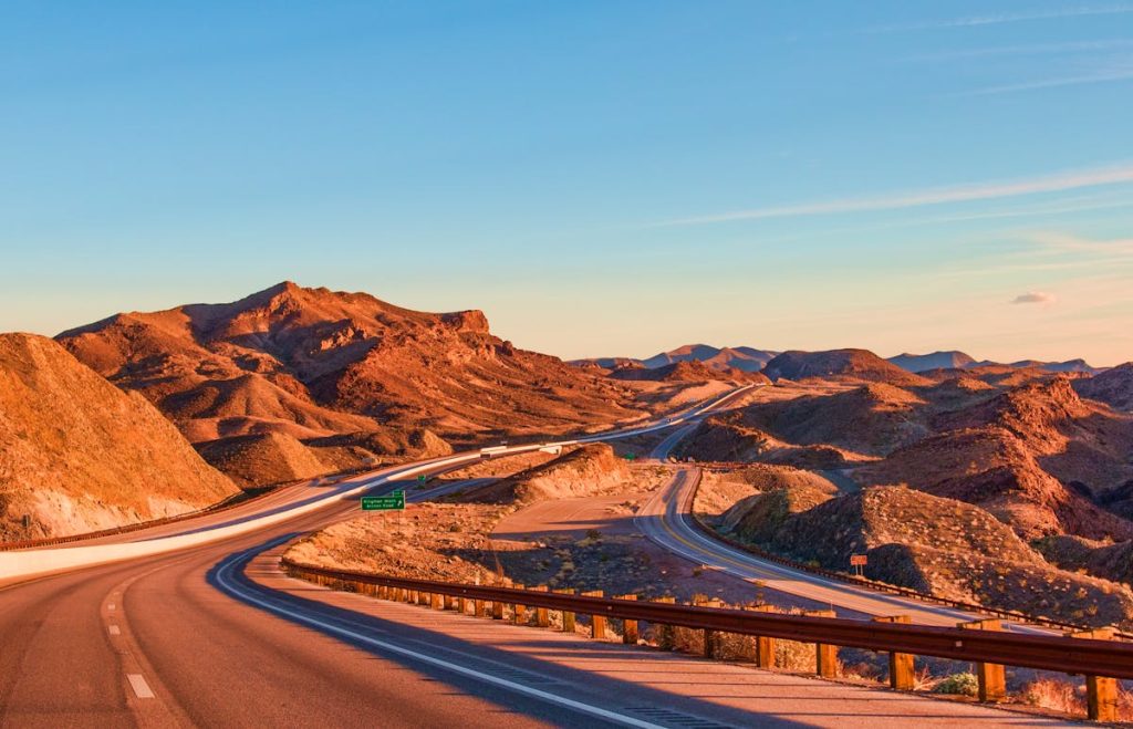
Tail Of The Dragon
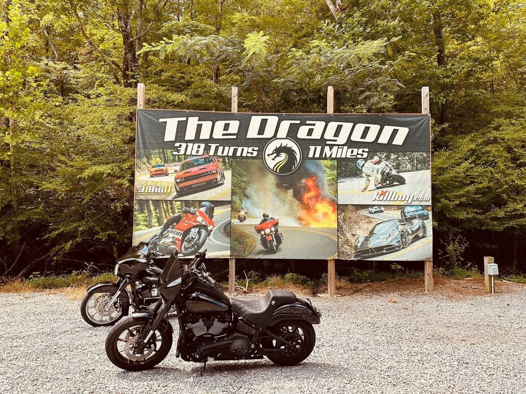
The Tail of the Dragon along US 129 near the Tennessee and the North Carolina border packs 318 curves into eleven miles. The road attracts motorcyclists and performance car drivers seeking challenge, adventure and scenery road. Accident data shows elevated crash rates caused by blind curves, steep grades, and misjudged speeds. Narrow lanes and minimal shoulders leave little room for recovery. Traffic mixes tourists with experienced riders, increasing unpredictability. Despite forest views and mountain surroundings, the route demands constant attention, controlled speed, and technical driving awareness rather than relaxed sightseeing behavior during busy summer travel periods annually statewide.
Pacific Coast Highway
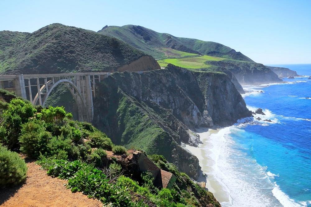
The Pacific Coast Highway, officially California State Route One, runs along cliffs overlooking the Pacific Ocean. Narrow lanes, sharp turns, and limited guardrails contribute to higher accident rates on several segments. Fog frequently reduces visibility, while landslides and erosion can change road conditions quickly. Drivers often slow suddenly to admire views, creating speed inconsistencies. Tourist traffic peaks seasonally, increasing congestion and impatience. Transportation studies consistently identify coastal sections as higher risk, making caution essential despite the route’s iconic beauty for drivers unfamiliar with cliffside coastal highways during peak travel months each year across California statewide.
Going To The Sun Road
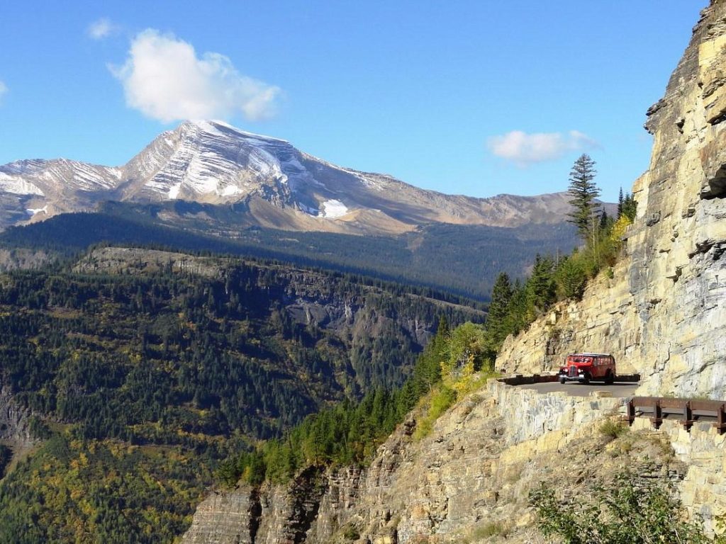
Going to the Sun Road crosses the Glacier National Park in Montana through dramatic alpine terrain. The narrow roadway includes tight curves, steep drop offs, and limited guardrails. Sudden weather changes bring snow, ice, or fog even during summer. Wildlife frequently crosses the road, adding unpredictability for drivers. Traffic includes large recreational vehicles navigating confined spaces. National Park Service records show consistent incident patterns. Low speed limits reflect genuine danger despite breathtaking views along this mountain corridor popular with tourists during busy visitation seasons each year when weather conditions shift rapidly without warning signs present nearby.
Road To Hana
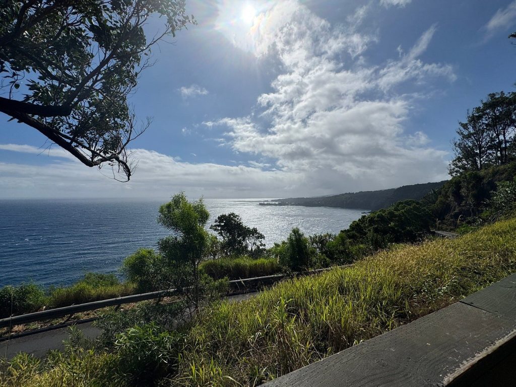
The Road to Hana winds along the Maui’s northeastern coastline through rainforests and cliffs. Hundreds of curves and numerous one lane bridges challenge drivers continuously. Rain creates slick pavement and sudden runoff across the roadway. Visitors often stop unexpectedly for waterfalls, increasing collision risk. Local authorities report steady accident numbers tied to congestion and unfamiliarity. Limited shoulders reduce recovery space. Despite lush scenery, this drive requires patience, low speeds, and constant alertness from rental car traffic throughout the day, especially during peak tourism seasons on the island, where road etiquette differs greatly from mainland driving norms.
Blue Ridge Parkway
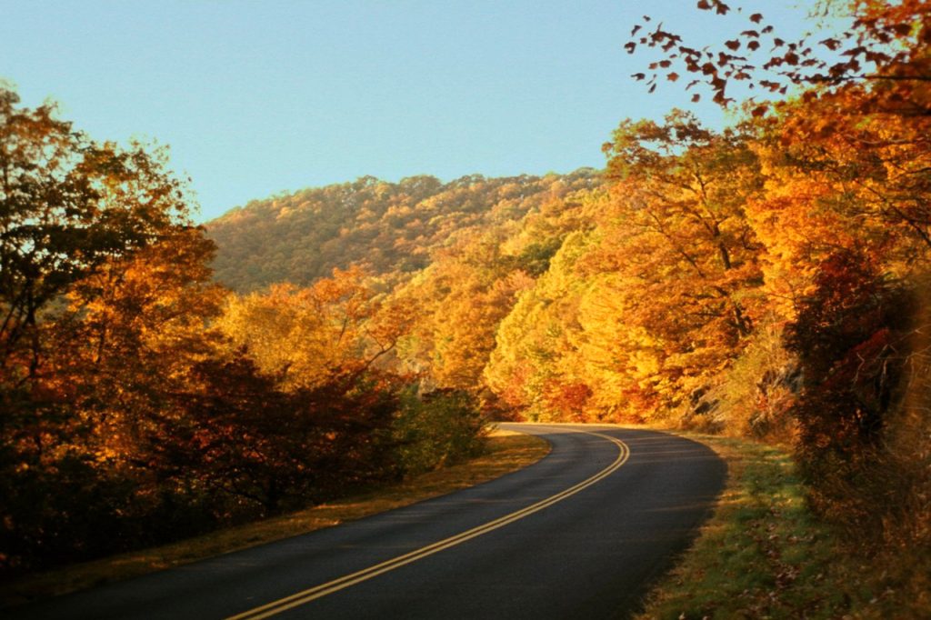
The Blue Ridge Parkway stretches across the Virginia and the North Carolina with sweeping mountain views. Its gentle appearance hides sharp curves, steep drop offs, and frequent foggy weather. Wildlife crossings increase collision risk, especially at dawn and dusk. Seasonal tourism adds congestion near scenic overlooks. Weather changes quickly at higher elevations. Crash data shows higher incident rates than similar rural roads. Reduced speeds and vigilance remain essential for safe travel along this protected corridor managed by the National Park Service throughout heavily visited months each year, when distracted driving becomes more common among sightseers, photographers, motorcyclists alike.
Million Dollar Highway
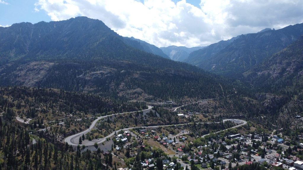
The Million Dollar Highway, part of US 550 in Colorado, winds through the San Juan Mountains. Narrow lanes, sheer cliffs, and minimal guardrails define the route. Steep grades challenge braking, particularly for unfamiliar drivers. Weather can shift rapidly, bringing snow or ice outside winter months. Transportation data highlights elevated crash risk compared with nearby highways. Fear, hesitation, and overcorrection contribute to incidents. Mountain driving experience is essential here due to exposure along cliffside stretches between Ouray and Silverton, where elevation, weather, and driver anxiety intersect unexpectedly throughout the year, especially during tourism season months annually.
Overseas Highway
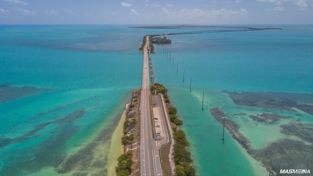
The Overseas Highway carries US 1 across the Florida Keys using long bridges over open water. Limited shoulders, strong crosswinds, and sudden storms increase crash risk. Traffic congestion peaks during holidays and tourist seasons. Ocean views contribute to distracted driving. Emergency access remains limited on certain stretches. Safety studies note higher accident severity due to bridge exposure. Constant lane discipline and attention are critical for drivers navigating narrow infrastructure connecting islands, especially during heavy rain, wind, and evacuation traffic periods when visibility drops and response times increase significantly across the Keys region annually statewide reported.
Denali Park Road
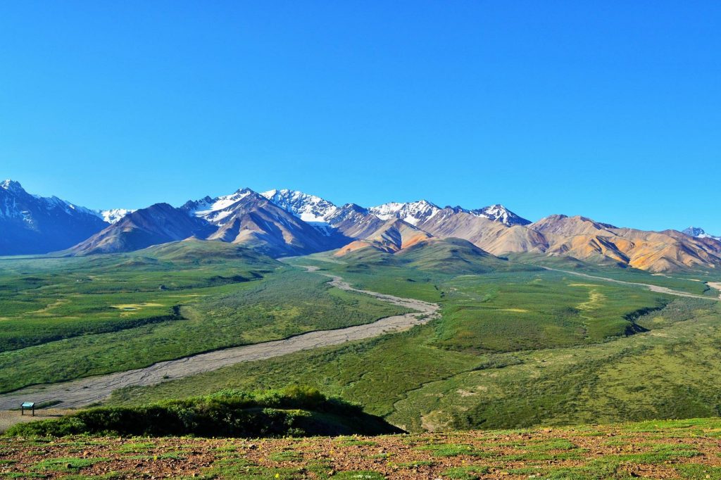
Denali Park Road travels through remote wilderness inside the Denali National Park in Alaska. Much of the route remains unpaved, with steep drop offs and minimal guardrails for protection. Weather conditions shift rapidly, bringing fog, rain, or snow. Wildlife frequently crosses the road. Limited vehicle access means emergency response times are longer. National park data shows notable incident rates despite controlled traffic. Isolation magnifies consequences of mistakes because of distance, terrain, and changing conditions during summer visitor seasons, when buses, wildlife, and weather combine to test safety limits across this iconic Alaskan landscape each year consistently documented publicly.