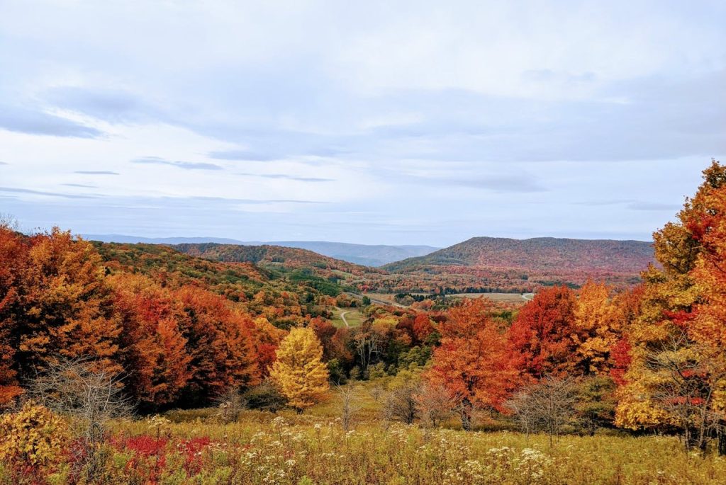
9 U.S. Spots Like Michigan’s Upper Peninsula That Feel Real Over Polished
Some American places still feel ruled by weather, distance, and daily life instead of aesthetics. They do not hurry to impress, and that restraint reads as relief. Main streets look built for locals first, visitors second, with diners, marinas, and small groceries doing steady business. Like Michigan’s Upper Peninsula, these spots lean on cold water, long horizons, and communities that keep showing up when the forecast changes. Beauty lands in practical details, and the mood stays steady, not staged. Even in peak season, the best moments come from simple routines: a ferry line, a weathered trail sign, and a lake that keeps its chill.
Minnesota’s North Shore and Grand Marais
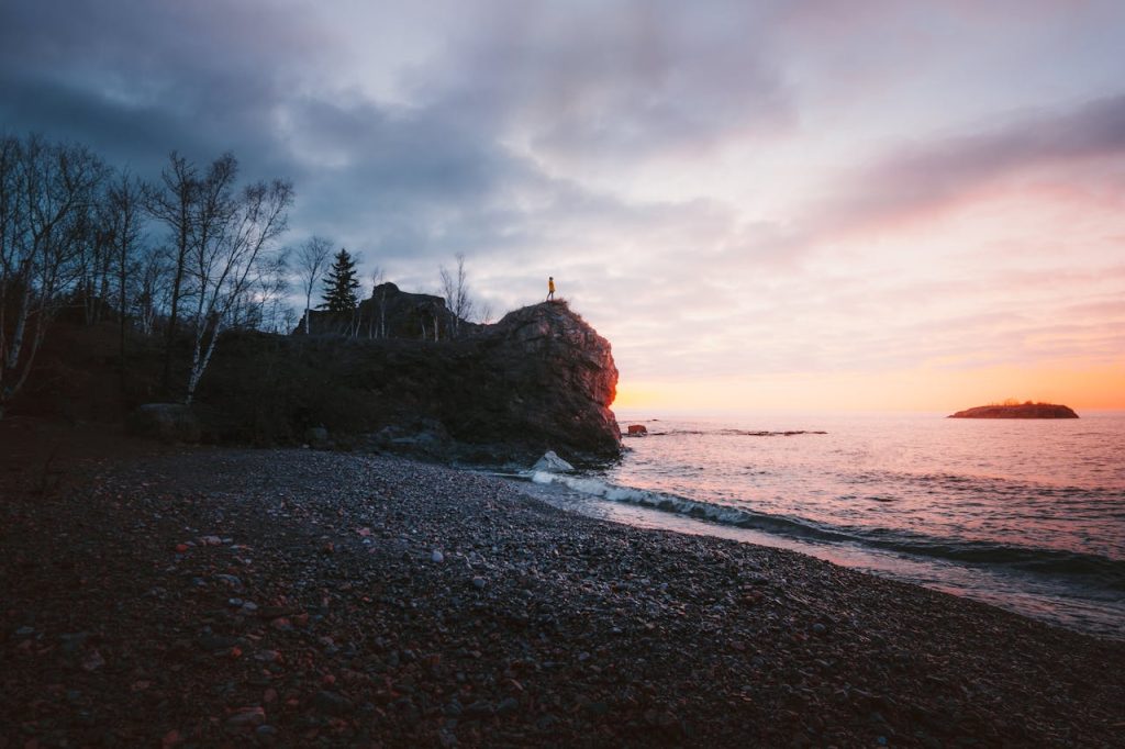
Minnesota’s North Shore carries the same Lake Superior attitude as the U.P.: dark rock, cold spray, and towns that plan for long winters. The Superior Hiking Trail threads ridges, cedar stands, and waterfalls, so the payoff comes from steady walking, not spectacle. Split Rock Lighthouse sits above the cliff line, a storm-tested landmark that keeps the shoreline’s history in view. Grand Marais stays rooted in harbor routines, with practical cafés and gear shops that serve hikers and locals in the same breath. In late Sept., waves slap the breakwall, and the lake keeps its chill, even when the sun looks friendly.
Wisconsin’s Apostle Islands and the Bayfield Peninsula
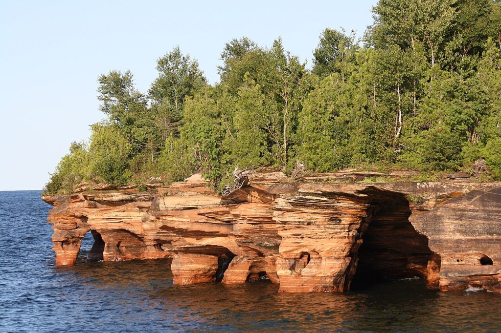
The Apostle Islands and the Bayfield Peninsula feel like a working coast that happens to be beautiful. Ferries, charter boats, and quiet docks set the rhythm, and the islands’ sandstone edges look carved by cold seasons, not by design. Bayfield still acts like a real gateway town, where supplies and weather reports matter as much as any sunset. When the wind picks up, plans shift, and nobody takes it personally. In winter, the shoreline can turn into ice-framed caves, proof the lake still runs the show. Lighthouses and berry farms add a steady, useful charm that never feels staged. It stays practical year-round.
The Driftless Area’s Bluff Country
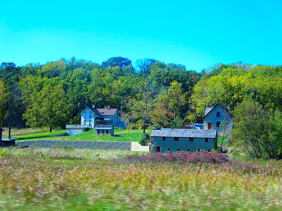
The Driftless Area feels unusually textured for the Midwest because glaciers did not smooth it the way they shaped nearby regions. That leaves limestone bluffs, tight valleys, and back roads that curve with the land instead of cutting through it. Spring-fed creeks run clear past barns and small river towns, and the Mississippi corridor nearby adds a slow, grounded backdrop. Trout streams and small bike routes stitch it together, and the pace stays unforced. The beauty is quiet, not polished, and it holds up on gray days. In October, fog settles into the coulees while hardwood ridges turn copper, then supper clubs fill up without any fuss.
Maine’s Downeast Coast Around Lubec and Eastport
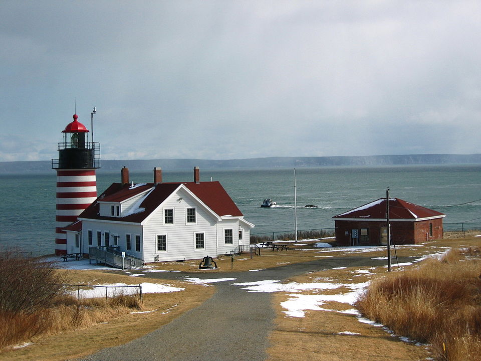
Downeast Maine, especially around Lubec and Eastport, keeps things plainspoken, with tide charts and working docks doing most of the storytelling. Days start early, often in fog, and the coastline feels shaped by routine more than by trend. Eastport sits out on Moose Island, and the waterfront still reads as a place with jobs to do, not just views to sell. Nearby Lubec carries the same edge-of-the-map calm, with Canada just across the channel and the sea setting the pace. A lighthouse, a bait shop, and a seafood counter can feel like the whole plan. On big-tide days, water swings fast, and the current becomes background music.
West Virginia’s Monongahela Highlands
West Virginia’s Monongahela high country trades Great Lakes shores for ridgelines, but the realism is the same: weather, work, and distance call the shots. Seneca Rocks rises sharply above the valley, dramatic in shape yet still part of a lived-in landscape of forests and small roads. Dolly Sods adds open highland terrain, with wind, wide skies, and trails that can feel raw in any season. Towns lean practical, not performative, and a forecast can change the day fast without changing the welcome. Old logging grades and boardwalk stretches hint at the land’s working past, and woodsmoke often rides the evening air near cabins.
New Mexico’s Gila Country
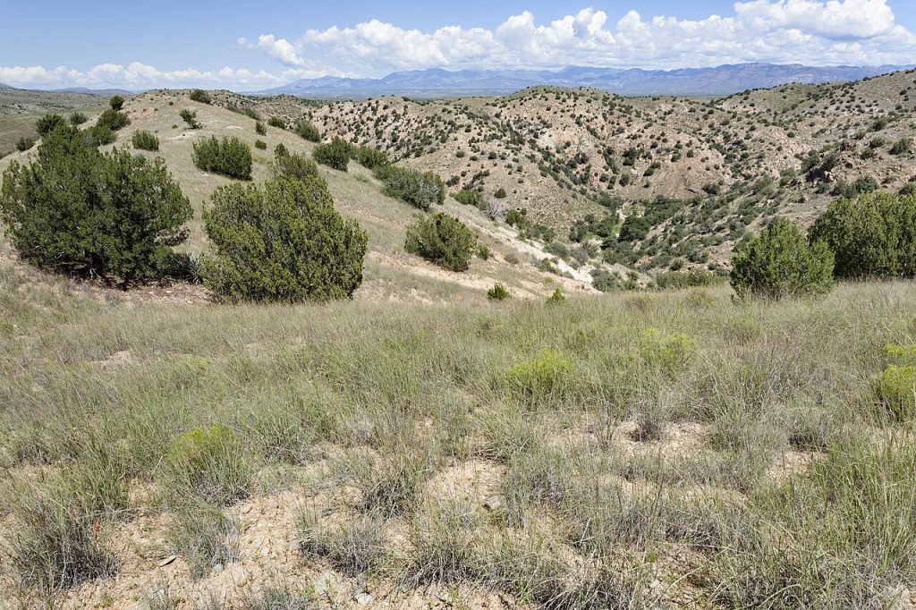
New Mexico’s Gila Country filters out pretense with distance alone. The roads thin, the trailheads get simpler, and the land shifts from pine ridges to deep canyons without warning or apology. The Gila Wilderness holds a long conservation legacy, and it still feels like a place where quiet is the default, not a luxury add-on. Silver City and nearby towns act like supply points, where maps, groceries, and a hot meal matter more than any curated vibe. Hot springs, the Gila River’s bends, and the cliff dwellings near the forest remind visitors that history and wildness are both close at hand after rain.
Washington’s Olympic Peninsula: Hoh and Cape Flattery
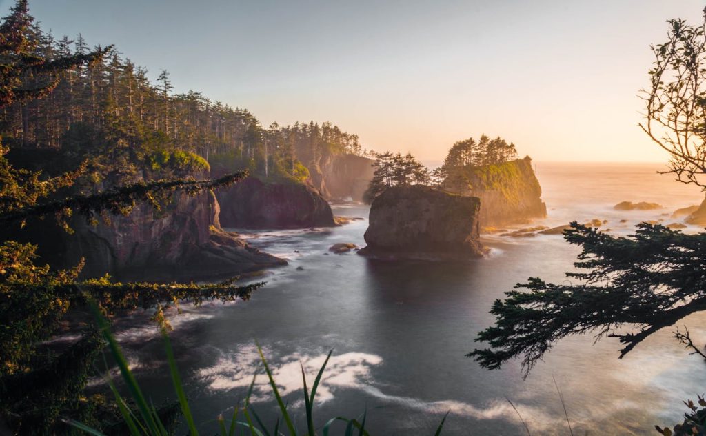
Washington’s Olympic Peninsula can look cinematic, but it stays grounded in rain, cedar, and salt. The Hoh Rain Forest feels less like an attraction and more like a living system, with moss, dark water, and quiet that settles in once the road ends. Along the outer coast, driftwood piles, tidepools, and sea stacks keep the scenery rough-edged, especially when the light turns silver. Cape Flattery adds a clear line of respect, sitting on Makah land with rules that remind visitors this is a homeland, not a backdrop. Even a sunny forecast can end in mist off the Pacific. Port towns and logging history linger in the margins.
Texas Big Bend Country
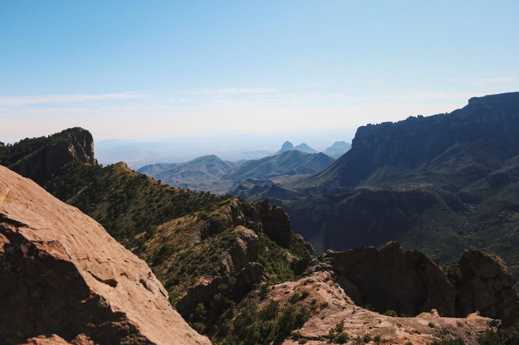
Big Bend Country in West Texas carries Upper Peninsula-style remoteness in desert form: far apart, quietly proud, and better understood without rushing. The Chisos Mountains rise from the basin like an island, giving cooler air and long views above the Chihuahuan Desert. Trails and back roads make the day feel earned, and the emptiness is part of the point, not a problem to solve. Nearby settlements function as supply stops, not showpieces, so the mood stays practical. After dark, the sky often takes over, with stars sharp enough to make conversation slow down. The landscape does not pose. Even at noon, silence holds.
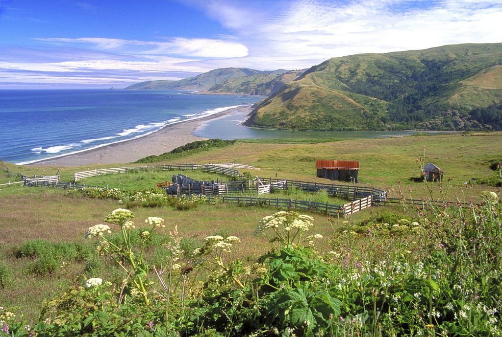
California’s Lost Coast and the King Range
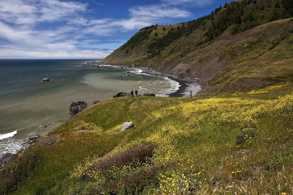
California’s Lost Coast stays real because the terrain never agreed to be convenient. The King Range rises straight out of the surf, and the coast feels like a place the highway system politely gave up on. With no major road tracing the shore, small communities keep an outpost rhythm, and trail plans tend to revolve around tides and weather. Fog rolls in fast, beaches stay empty, and footprints disappear quickly. Inland, fir and redwood pockets hold steady shade, and the quiet feels earned by effort. The King Range National Conservation Area keeps it wild, with steep trails that climb from beach to forest in a hurry.