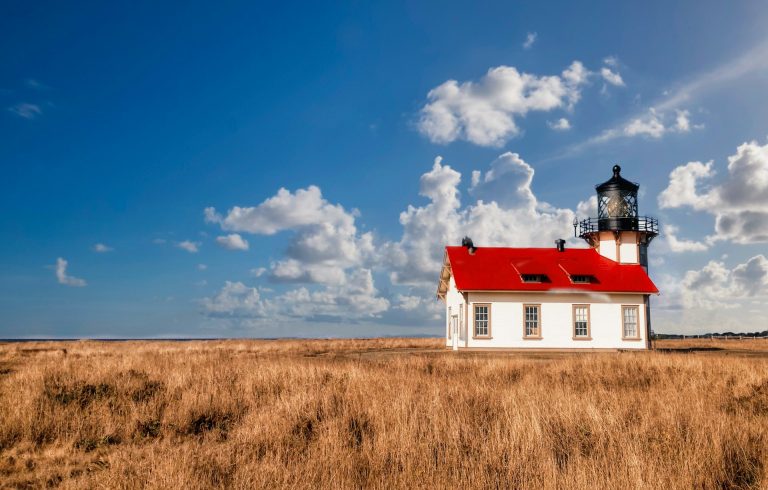
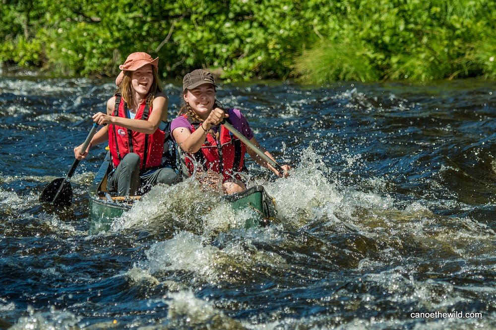
9 Wild U.S. Rivers Women Paddle Before Tourists Take Over
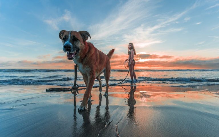
Hydrologists and wilderness river guides report a significant shift in the demographics of backcountry paddling, with women increasingly leading expeditions into the most remote waterways in the United States. While marquee rivers like the Colorado through the Grand Canyon face decades-long waiting lists and heavy commercial traffic, a distinct network of wild rivers offers the same level of geological drama and biological diversity without the crowds. Experts at American Rivers and various state conservation agencies emphasize that these specific rivers provide a rare opportunity for profound solitude and “blue silence,” a term researchers use to describe the restorative psychological effects of undisturbed aquatic environments.
Conservation biologists and riparian ecologists note that the preservation of these wild rivers relies on their relative obscurity and the logistical challenges required to access them. Unlike managed recreational reservoirs, these free-flowing streams are subject to seasonal water levels and natural obstacles that demand a high degree of technical skill and self-reliance. Professional guides suggest that the appeal of these nine destinations lies in their raw, unedited state, where the absence of motorized noise allows for a deep connection with the landscape. Understanding the unique hydrology and environmental value of these rivers is essential for any traveler seeking an authentic wilderness experience.
Smith River In California
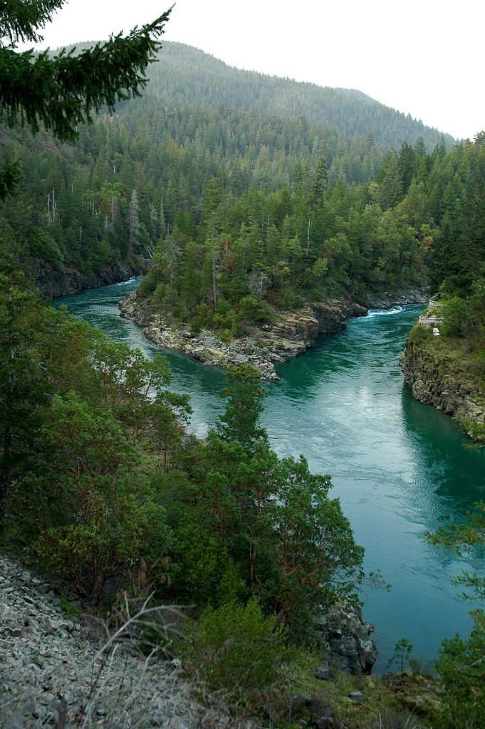
National forest rangers and fisheries biologists identify the Smith River as the last major free-flowing river system in California, completely devoid of dams for its entire length. This lack of obstruction allows for a pristine aquatic environment that attracts salmon and steelhead in numbers rarely seen elsewhere on the West Coast. Experts explain that the river’s stunning emerald-green clarity is a result of the unique serpentine geology of the Siskiyou Mountains, which filters the water and prevents the typical siltation found in other coastal streams.
River safety consultants and local guides recommend the North Fork for those seeking a challenging and secluded paddling experience through ancient redwood groves. The absence of commercial development along the banks ensures that the only sounds heard are the rushing water and the calls of kingfishers. Because the river is entirely dependent on rainfall and snowmelt, navigating its rapids requires a keen understanding of seasonal flow patterns. Women who master these waters find a sense of empowerment in the Smith’s raw, unpredictable energy and its deep, shadowed canyons.
Buffalo National River In Arkansas
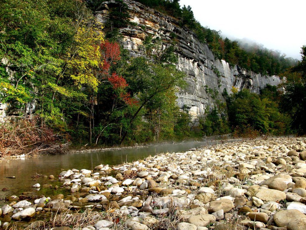
National Park Service rangers and Ozark historians celebrate the Buffalo National River as the first designated national river in the United States. Protected from damming in 1972, the river meanders through towering limestone bluffs that rise over five hundred feet above the water. Geologists point out that these cliffs are among the highest in the interior of the country, offering a dramatic vertical scale that creates a sense of profound enclosure. The river is divided into distinct sections, with the upper reaches offering technical whitewater and the lower sections providing a slow, meditative drift through hardwood forests.
Wilderness educators note that the best time to experience the Buffalo without the seasonal crowds is during the early spring when the water levels are high and the redbuds are in bloom. The lack of cell service and the minimal road crossings foster an environment of total disconnection from modern distractions. Paddlers often encounter bald eagles and river otters in the quieter reaches, where the clear, turquoise pools invite long pauses for reflection. Experts emphasize that the Buffalo remains a vital sanctuary for biodiversity, serving as a living museum of the Appalachian-Ozark highlands.
Noatak River In Alaska
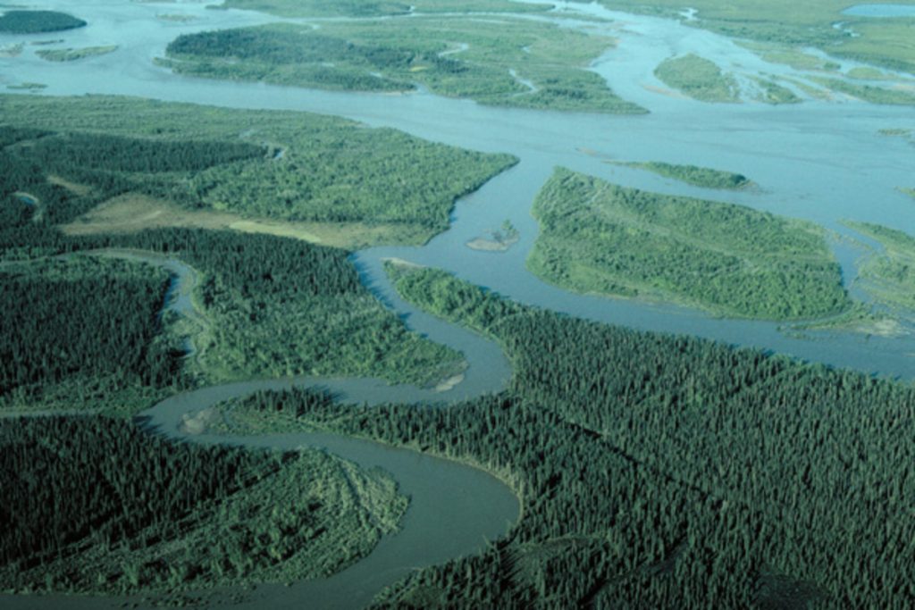
Arctic wilderness guides and ethnobotanists describe the Noatak River as one of the most expansive and undisturbed ecological corridors in the world. Flowing entirely above the Arctic Circle within the Noatak National Preserve, the river traverses a vast tundra landscape that remains virtually unchanged since the last ice age. Wildlife biologists monitor the Western Arctic Caribou Herd, which utilizes the river valley as a primary migration route, offering paddlers the chance to witness thousands of animals crossing the water in a spectacle of ancient movement.
Environmental scientists emphasize that the Noatak is a river of immense scale and silence, where the lack of trees provides a three-hundred-sixty-degree view of the Brooks Range. Reaching the headwaters requires a bush plane drop-off, a logistical hurdle that ensures only the most dedicated explorers venture into this territory. For women seeking the ultimate expression of space and solitude, the Noatak provides a landscape where the sun never sets in summer and the concept of time is dictated solely by the current and the wind.
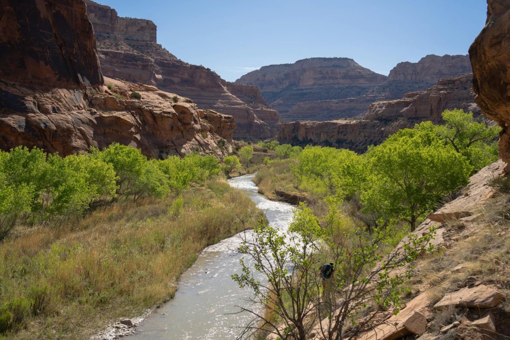
Rio Grande In Texas

Big Bend National Park rangers and transborder ecologists identify the Santa Elena and Boquillas canyons of the Rio Grande as some of the most striking geological features in North America. The river carves through massive limestone blocks, creating vertical walls that reach fifteen hundred feet in height. Geologists explain that these canyons serve as a natural thermometer of the Chihuahuan Desert, where the deep shade of the rock provides a cool refuge from the intense Texas sun.
River conservationists highlight the delicate balance required to manage this shared international waterway. Paddling through the “Rockslide” in Santa Elena Canyon requires technical precision and a deep respect for the river’s changing moods. During the low-flow seasons of winter and early spring, the river provides a quiet, slow-motion journey through some of the most remote territory in the lower forty-eight states. Experts suggest that the true magic of the Rio Grande lies in the contrast between the harsh, arid desert and the lush, green ribbon of the riparian zone that supports a diverse array of migratory birds.
Selway River In Idaho

United States Forest Service rangers and whitewater specialists regard the Selway River as one of the most exclusive and difficult-to-access rivers in the country. Situated within the Selway-Bitterroot Wilderness, the river is managed under a strict permit system that allows only one private group to launch per day during the peak season. This intense regulation preserves the “primeval character” of the river, ensuring that paddlers never encounter another group during their multi-day journey through the rugged Idaho mountains.
Hydrologists note that the Selway is a fast-dropping river with continuous technical rapids that require expert-level navigation. The water is exceptionally cold and clear, reflecting the granite boulders and dense cedar forests that line the banks. Wilderness therapists often point to the Selway as a premier destination for those seeking a “hard reset,” as the combination of physical challenge and absolute isolation creates a powerful environment for mental clarity. The memory of the sun hitting the granite walls while the river roars through a narrow chute is a permanent souvenir for those who secure the coveted permit.
Allagash Wilderness Waterway In Maine
North Woods historians and Maine wilderness guides describe the Allagash as a legendary route that follows the paths of ancient indigenous populations and early timber explorers. Spanning ninety-two miles of interconnected lakes and river sections, the waterway is protected by state law to maintain its wild and scenic character. Forestry experts emphasize that the surrounding timberlands are managed to ensure that no modern development is visible from the water, preserving the illusion of an endless, prehistoric forest.
Wildlife biologists value the Allagash as a prime habitat for moose, which are frequently seen feeding in the shallow coves at dawn. The journey through the waterway involves several portages around falls and dams, requiring a high degree of physical stamina and teamwork. Experts suggest that the best way to experience the Allagash is in a traditional canoe, which allows for a stealthy approach to the diverse birdlife and mammals that inhabit the shoreline. The experience of camping on a remote island while the loons call across the water is a quintessential North Woods ritual that remains remarkably unchanged by time.
Green River In Utah
Canyonlands National Park rangers and sedimentary geologists identify Stillwater Canyon on the Green River as a masterpiece of desert erosion. The river winds through layers of red and orange sandstone, creating massive meanders that have been carved over millions of years. Unlike the nearby Colorado River, the Green in this section is entirely flat, allowing paddlers to drift silently past ancient Ancestral Puebloan ruins and intricate rock art panels that are inaccessible by any other means.
Conservationists emphasize the importance of the river’s “quiet” sections, where the lack of rapids encourages a slower pace and more thorough exploration of the side canyons. The silence in the canyon is so profound that the splash of a paddle or the cry of a hawk echoes for miles. Experts recommend a late autumn trip when the cottonwoods turn a brilliant gold and the intense desert heat has subsided. For women seeking a meditative and visually stunning journey, the Green River offers a sanctuary of color and stone where the only clock is the movement of the sun across the canyon rim.
Owyhee River In Oregon
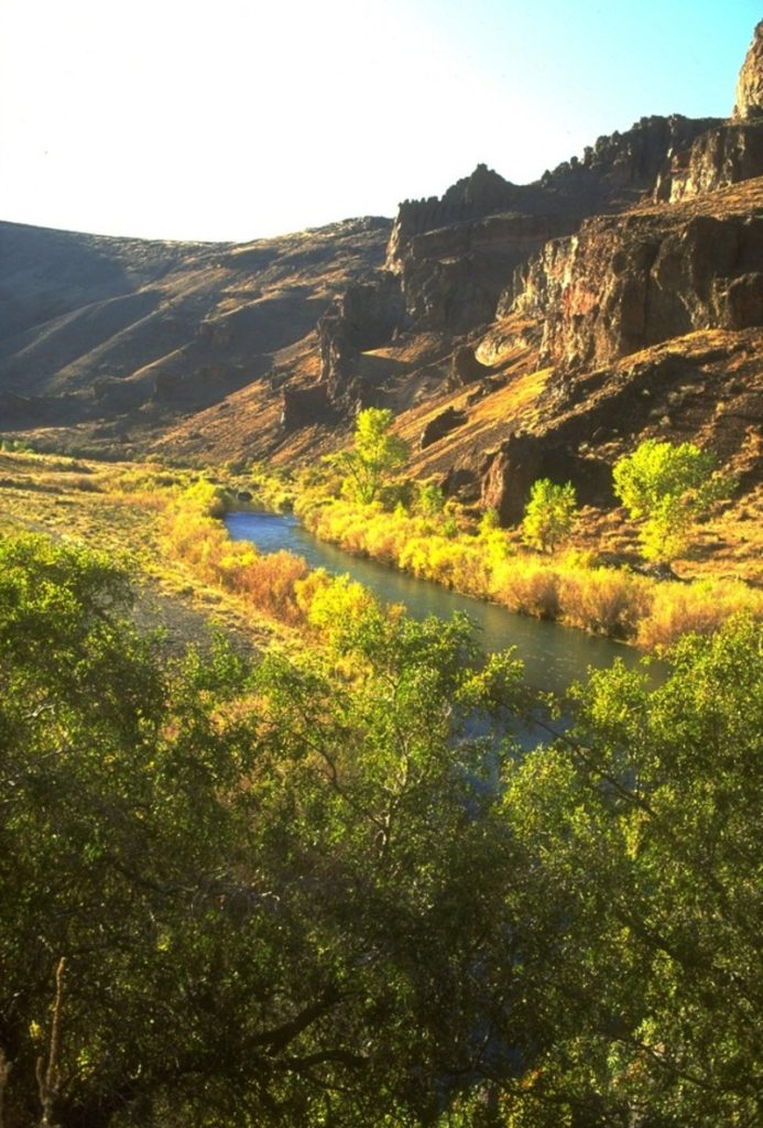
Arid land ecologists and Bureau of Land Management rangers describe the Owyhee River as the “Oregon Grand Canyon,” a remote and rugged waterway that traverses a volcanic landscape of immense beauty. The river has cut deep into layers of rhyolite and basalt, creating jagged spires and hidden hot springs that are a highlight for backcountry travelers. Experts explain that the Owyhee is a seasonal river, with a short paddling window that depends entirely on the winter snowpack in the surrounding mountains.
Wilderness guides note that the Owyhee offers a rare combination of technical whitewater and serene flatwater sections through towering cathedral-like walls. The area is home to one of the largest herds of California bighorn sheep in the country, often seen perched on the precarious ledges high above the water. Because the river is located in one of the least populated regions of the lower forty-eight states, the night skies are exceptionally dark, offering unparalleled stargazing opportunities. The feeling of being completely untethered from the modern world is a defining characteristic of an Owyhee expedition.
Black Canyon Of The Gunnison In Colorado
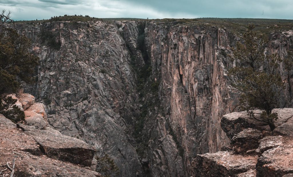
Geologists and river rescue experts identify the Gunnison River as it flows through the Black Canyon as one of the most intimidating and dramatic vertical landscapes in the world. The canyon walls are composed of dark, Precambrian rock and rise nearly three thousand feet directly from the riverbed. Experts explain that the canyon is so narrow and deep that sunlight rarely reaches the bottom, creating a somber and powerful atmosphere that is unique among American rivers.
Professional guides emphasize that the “inner canyon” experience is reserved for those with a high degree of physical fitness and a tolerance for vertical terrain. The river itself is a series of powerful drops and deep pools, requiring a portage around the most dangerous sections. National Park Service naturalists highlight the unique microclimates found at the river level, where the constant shade and cool water support plant life that is distinct from the arid plateau above. Standing at the bottom of the Black Canyon, looking up at the jagged granite spires, provides a visceral sense of the earth’s raw power and ancient history.