The 8 U.S. Volcano Viewing Sites Prone to Eruptions and Evacuations
Volcano overlooks in the United States offer a rare mix of calm beauty and real rules: steam on cold air, black rock underfoot, and snowy cones that still breathe.
On most days the risk is managed quietly, yet access can change fast when quake swarms build, gas levels spike, or a slope turns unstable. Roads close, trails shift, and rangers move people back without debate.
These eight viewpoints sit close enough to active systems that eruptions, lahars, or sudden access failures can trigger evacuations and quick closures, even when the sky looks perfectly clear, the parking lots are full, and cameras are already out for sunset.
K?lauea Summit Overlooks, Hawai?i Volcanoes National Park
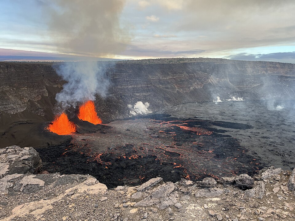
K?lauea’s summit overlooks above Halema?uma?u can feel calm, then flip to cones and closures when wind shifts and vog thickens near the rim. The park treats access like a dial, because small changes in gas, tremor, or falling cinders can make a familiar pullout suddenly unsafe.
When activity rises, rangers narrow viewing zones, redirect traffic, and clear the rim fast, often without much notice beyond a quick announcement. Night viewing draws crowds, so closures can tighten even quicker to keep everyone farther back. The scene stays spectacular from a distance, but the best visits lean on posted updates and a willingness to step back.
Mauna Loa Lookout, Hawai?i Volcanoes National Park
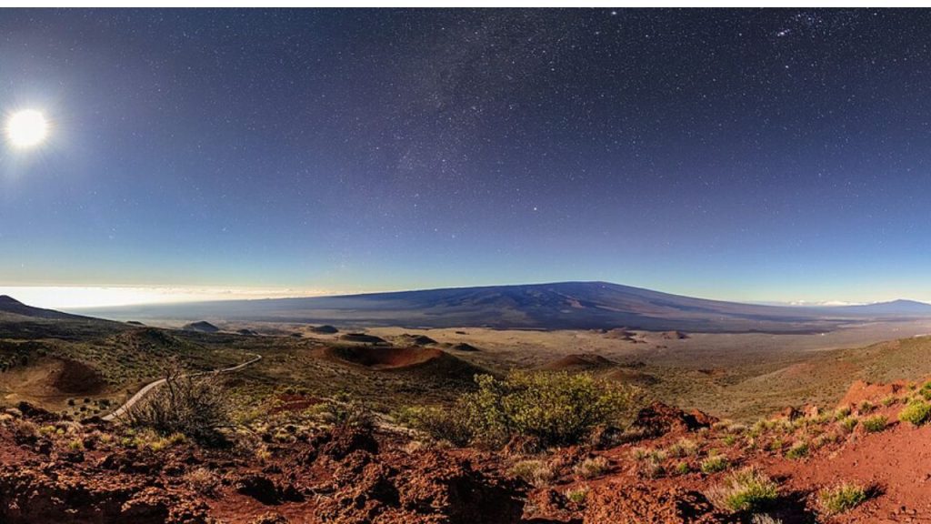
From Mauna Loa Lookout, the mountain looks steady and remote, yet it is the planet’s largest active volcano, and unrest can tighten access before any glow appears. Managers watch quake rates and ground swelling closely, because high elevation weather and long distances make quick response harder.
When Mauna Loa woke in late 2022, advisories and closures shifted with air quality, road conditions, and crowd surges chasing a night view. Even when lava stays far from visitor pullouts, officials plan for fast reroutes and clear communication, keeping parking, overlooks, and backcountry use aligned with what monitoring shows each day.
South Coldwater Viewpoints, Mount St. Helens, Washington
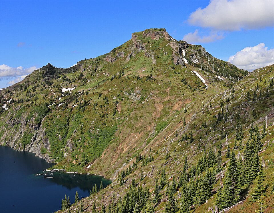
Mount St. Helens delivers drama even from South Coldwater viewpoints, where the blast zone opens wide and the crater’s broken rim reads clearly across ridges. Access can change quickly here, not only from volcanic unrest, but from fragile roads cut through steep, slide-prone terrain.
After the 2023 landslide damaged State Route 504, the Johnston Ridge approach became unreachable, funneling visitors to alternate stops and tighter services. St. Helens is monitored closely because it remains one of the Cascades’ most active systems, so officials stay ready to close trails or move people back if seismicity rises or ash hazards return.
Paradise And Sunrise Overlooks, Mount Rainier, Washington
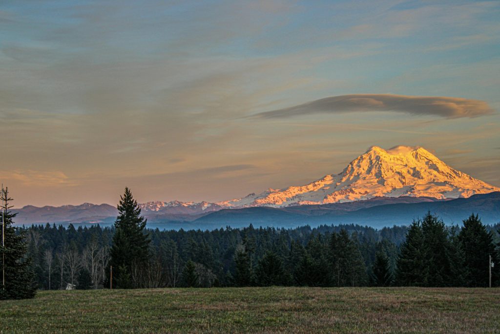
Paradise and Sunrise frame Mount Rainier as alpine calm, with glaciers catching light above meadows and long views into the Cascades. The evacuation story sits downstream. Rainier’s steep, ice-covered slopes can generate lahars that follow river valleys far from the summit, turning distance into a false comfort.
Communities practice leaving early through siren tests and route drills, including large school evacuations in the Puyallup watershed. Those rehearsals keep plans familiar when roads could clog. From the overlooks, the mountain feels timeless, yet the posted hazard maps and clear exits quietly underline what is being planned for.
Lassen Peak Corridor, Lassen Volcanic National Park, California
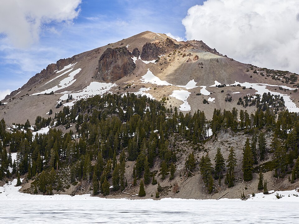
Along the Lassen Peak corridor, pullouts sit among steaming basins, shattered lava, and forests that still show the mark of the 1914 to 1917 eruption period. The landscape feels friendly, yet heat sits close to the surface, and the park treats unstable ground, rockfall slopes, and gas-prone areas with strict boundaries.
Closures here often arrive without drama: a hydrothermal boardwalk rerouted, a trail closed for thin crust, or the highway shut by early snow. If unrest rises, scientists look for quakes and deformation, and managers focus on keeping narrow roads from becoming choke points. Lassen rewards patience and respect, not rushing.
Timberline And Government Camp Views, Mount Hood, Oregon
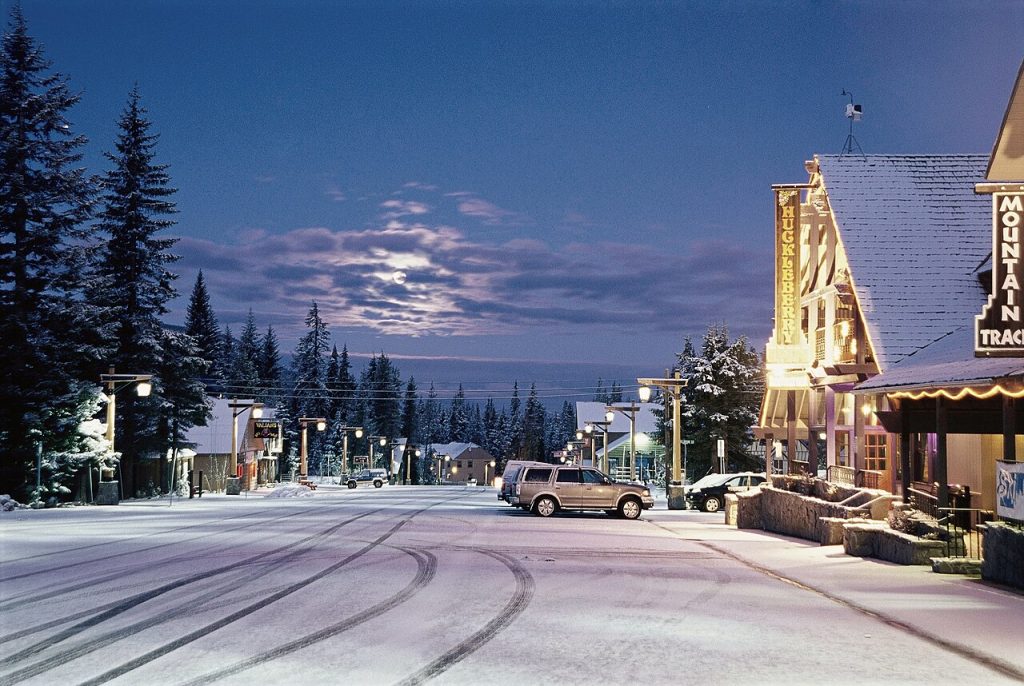
Timberline Lodge and Government Camp make Mount Hood feel close and familiar, with ski runs, tree lines, and the summit filling the southern sky. The main concern is usually not lava on trails, but debris and mud moving fast in river valleys when snow and ice melt or slopes fail.
That is why warnings and closures often focus on drainages, bridges, and highway crossings, not just the upper mountain. Maps and signs emphasize lahar pathways, and planning assumes some corridors would be hard to outrun if a flow starts suddenly. On clear days the views feel relaxed, yet the safety framing keeps attention on routes and timing, too.
Bunny Flat And Shasta Valley Views, Mount Shasta, California
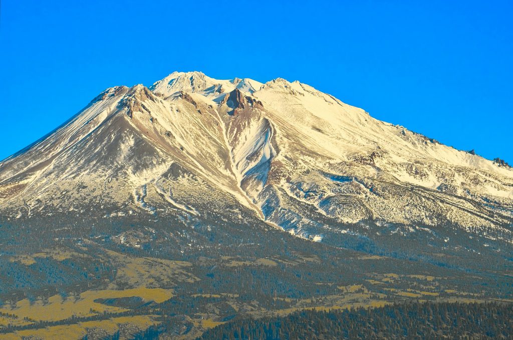
From Bunny Flat and Shasta Valley pullouts, Mount Shasta rises like a triangle over forests and highways, inviting long looks in every season. It is also an active volcano with a history of domes, ash, and debris deposits that radiate down its drainages, shaping where managers focus warnings.
Access shifts quickly with weather, rockfall, and spring melt. Trailheads sit above narrow gullies that funnel both water and loose material, so closures can follow storms even when skies return to blue. Monitoring and posted hazard maps keep attention on where a flow would travel, not just where the summit sits, helping visits stay calm and orderly.
Artist Point And Baker Lake Corridor, Mount Baker, Washington
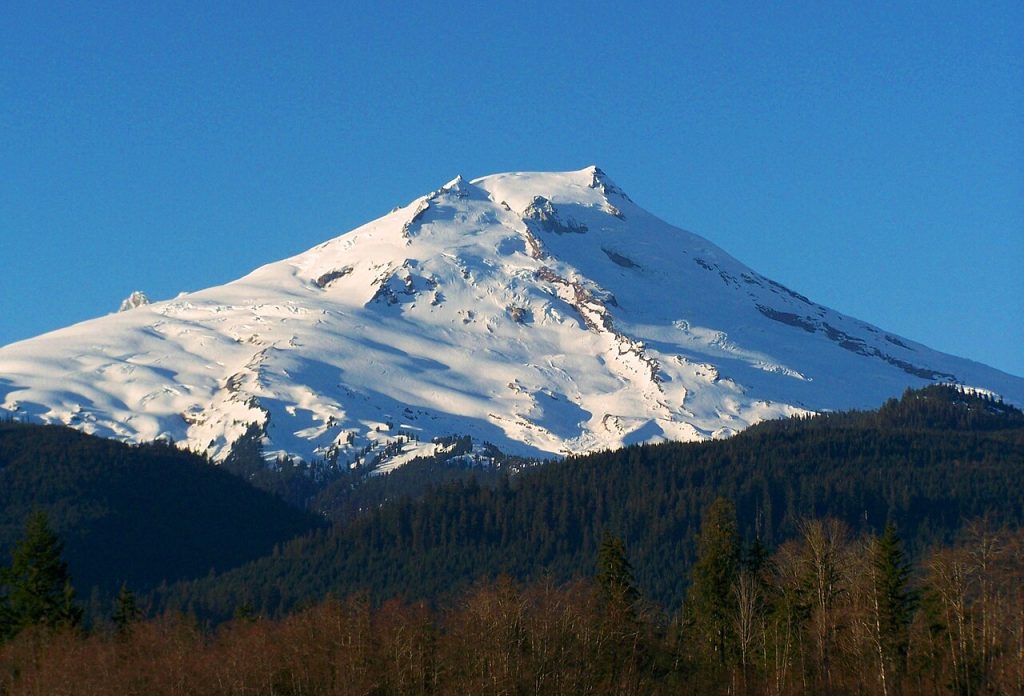
Artist Point and the Baker Lake corridor frame Mount Baker with glaciers stacked above dark forest, a view that looks calm. The hazard story involves water and steep terrain. Ice, loose rock, and subsurface heat can set up debris flows that follow drainages quickly, even without visible eruption.
History keeps officials attentive. In 1975, increased heat at Sherman Crater raised concern about flows into the Baker River system, and planners still treat those valleys as primary pathways. Closures track roads, trailheads, and lake access, because the same corridor that delivers the view could also be the route a lahar would take.