This Island Appeared on World Maps for Over a Century and When Scientists Finally Went to Find It There Was Nothing There
Maps still shape how people understand distant places, from airline routes to weather forecasts and classroom globes. In November 2012, that broader story narrowed to Sandy Island, a supposed landmass in the Coral Sea between Australia and New Caledonia that scientists went to inspect and found was not there.
Australian scientists checked the coordinates and found no island
The event happened during a research voyage aboard the RV Southern Surveyor, operated by Australia’s Commonwealth Scientific and Industrial Research Organisation, or CSIRO. On November 22, 2012, the team reached the charted position of Sandy Island, which had appeared on some maps as a black polygon roughly 15 miles long and 3 miles wide, according to reports from the expedition and media interviews with scientists on board.
Instead of land, the ship found open water. Maria Seton, a geologist with the University of Sydney who was aboard the voyage, told reporters at the time that the vessel’s depth sounder showed water more than 4,600 feet deep, a reading inconsistent with any island at that location.
The discrepancy affected more than one map source. Sandy Island had appeared on some historical maritime charts and on Google Earth before the finding drew global attention in 2012, while the French government’s nautical charts reportedly did not show the island in the same way.
The map error centered on the Coral Sea near New Caledonia
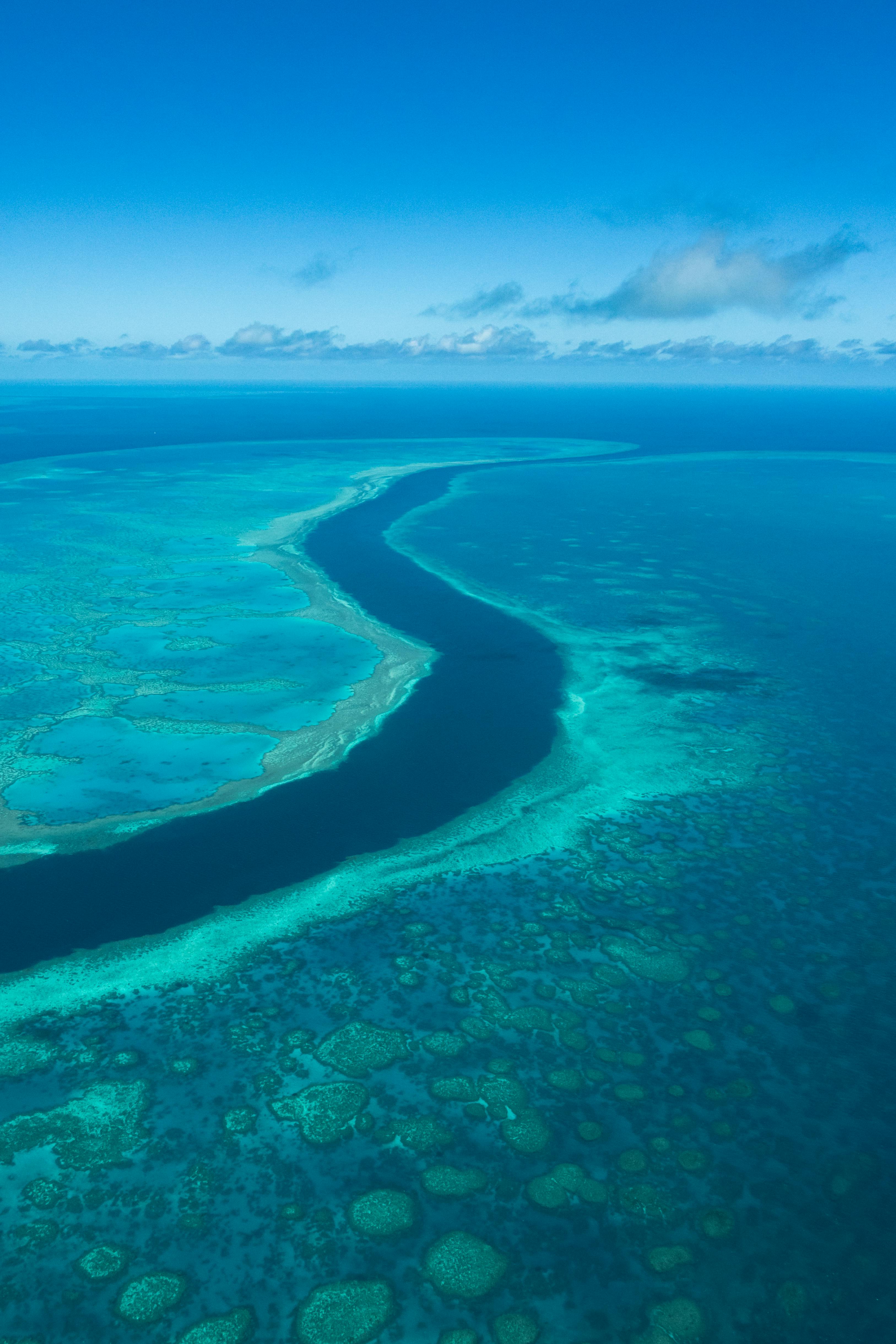
The location at issue sits in the Coral Sea, northwest of New Caledonia and east of Australia’s Queensland coast. That geography matters because the area is used in marine research and shipping, and the supposed island had been carried forward in some reference materials for more than a century.
What is confirmed is that the CSIRO-linked voyage did not find land at the recorded coordinates in November 2012. What remains less certain is the original source of the mistake, because different historical records point to older charting practices, possible transcription errors, and reports dating back to the 19th century.
The UK Hydrographic Office said after the discovery that it would review the relevant charts, and mapping databases were updated after the finding received attention. Google removed Sandy Island from Google Maps and Google Earth after the 2012 reports, according to company statements cited by multiple news outlets.
The case shows how old chart data can survive into modern digital maps
Researchers and hydrographic agencies have said the error likely reflects the long life of inherited cartographic data. The Guardian reported in 2012 that one possible origin was a 1876 whaling or merchant report, while other accounts pointed to confusion with pumice rafts, which can temporarily resemble land after volcanic activity.
That context helps explain why an island could persist through the paper-chart era and into digital products. Modern map platforms often combine government datasets, legacy records, and third-party information, and when one error enters that chain it can remain visible for years unless a survey, like the 2012 voyage, checks the site directly.
For travelers and everyday map users, the practical takeaway is simple: not every remote feature on a screen has been recently verified on the water. In Sandy Island’s case, the correction was straightforward after the 2012 survey, and the episode is still cited by cartographers as a reminder that even 21st-century maps can carry 19th-century mistakes.