The Best Waterfall Hikes in the Great Smoky Mountains National Park

The Best Waterfall Hikes in Great Smoky Mountains National Park
Great Smoky Mountain National Park is located in the state of Tennessee. The best waterfall hikes in the Great Smoky Mountains National Park are focal points that draw visitors all year round to nature. Over 2,000,000 visitors a year hike along beautiful trails to the Rainbow, Laurel, Abrams, Grotto, and other popular falls. If waterfall hiking trails aren’t enough for you there are 850 miles of trails and unpaved roads in the park for hiking, including a 70-mile stretch of the famous Appalachian Trail.
Fun Fact: waterfalls generate negative ions which make people feel good!
Negative ions are negatively charged air molecules created by a number of natural and electronic processes, including ocean surf and waterfalls. Negative ion levels at large waterfalls are estimated to be 50 times higher than at other rural sites. Brighter moods, increased energy, improved physical performance, and better health are just some of the benefits of high exposure concentrations of negative ions.

The Best Waterfall Hikes in Great Smoky Mountains National Park
Never had I imagined a forest landscape would be so mysterious, wild, and stunning. There are no other Smokies in the world- so I shouldn’t have been too surprised. This hiking guide will take you through all the unique waterfall hikes that are in the park.
PARK INFORMATION
Currently the park does not charge a fee for entry – unlike most of the United States National Parks. Starting next year fees for the Smokies are listed below.
Effective March 1, 2023
- Valid parking tags will be required for any vehicles parking in the park starting March 1, 2023.
- Display of physical parking tags in each vehicle will be required.
- Three tag durations will be available for purchase for all vehicle sizes and types:
- Daily – $5
- Up to 7 Days – $15
- Annual – $40
- Each tag will be valid for a single vehicle.
- Parking tags will be available for purchase both online and onsite.
- Not required for motorists who pass through the area or who park for less than 15 minutes.
- Parking tags will not be location-specific. A parking tag will be required to park in any designated parking spot anywhere within park boundaries.
The only two trails in the park that allow pets are the Gatlinburg Trail near the Sugarlands Visitor Center and the Oconaluftee River Trail near the Oconaluftee Visitor Center. Learn more about pet restrictions in the park.
The Best Waterfall Hikes in Great Smoky Mountains National Park
The crest of the Great Smokies runs in an unbroken chain of peaks that rise more than 5,000 feet for over 36 miles. Elevations in the park range from 876 to 6,643 feet. The mountain range rises along the Tennessee–North Carolina border in the southeastern United States. They are a subrange of the Appalachian Mountains and form part of the Blue Ridge Physiographic Province.
Most waterfalls are more dramatic to view when a recent rain has boosted their flow. Try to choose times to waterfall watch when the falls are at their most voluminous. The best time to see the waterfalls in Smoky Mountains National Park is December, February, March, and July. The flow rates in winter and early spring are greater because deciduous plants are not using that much water.
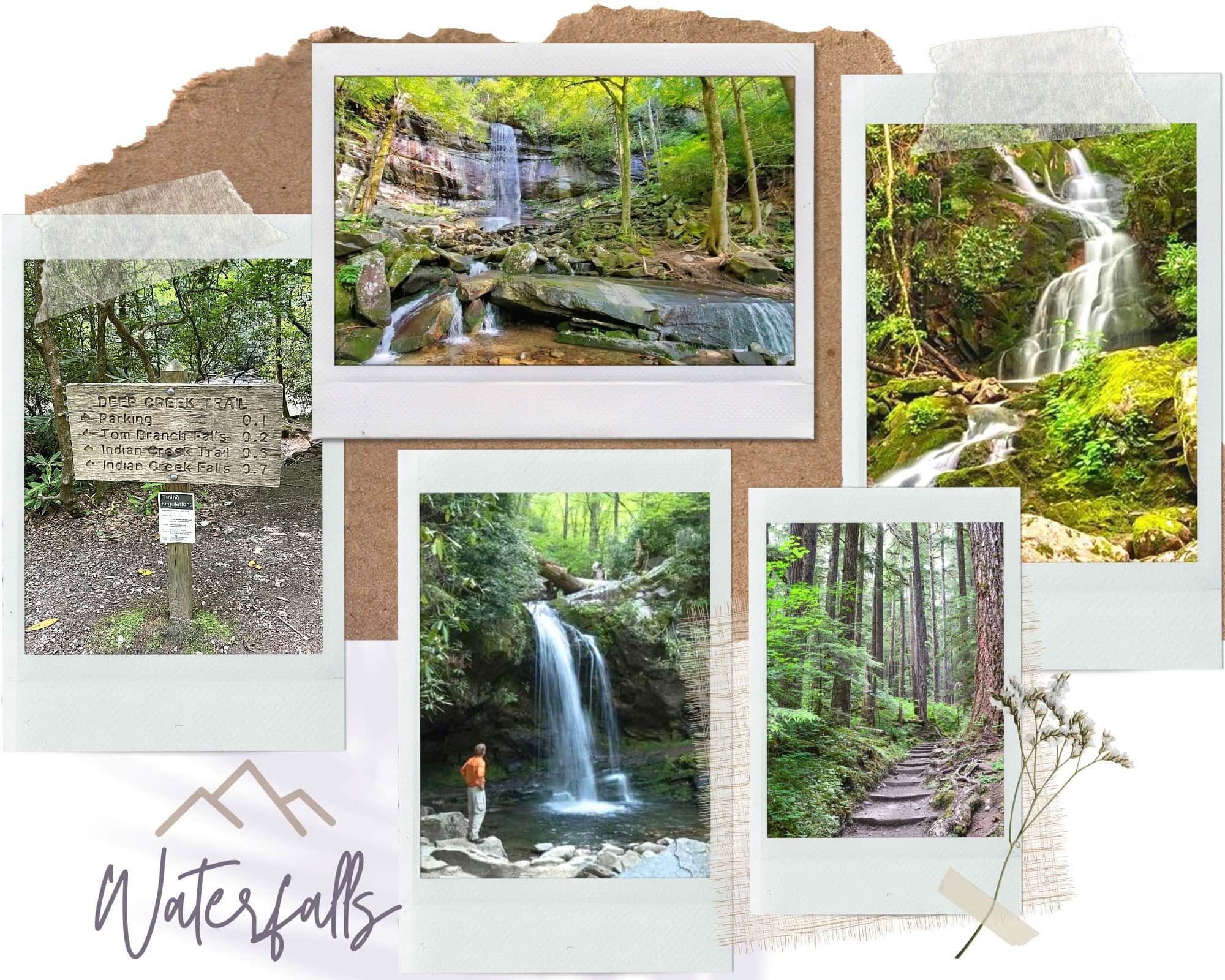
waterfall trails in the Smokies
| Destination | Roundtrip Mileage | Difficulty | Height of Falls |
| Abrams Falls trail | 5.0 | Moderate | 25′ |
| Grotto Falls trail | 2.6 | Moderate | 25′ |
| Hen Wallow Falls trail | 4.3 | Moderate | 95′ |
| Deep Cr: Waterfalls Loop trail | 2.4 | Moderate | 25′-80′ |
| Juney Whank Falls Loop trail | 0.6 | Easy | 80′ |
| Laurel Falls trail | 2.5 | Easy | 80′ |
| Mingo Falls trail | 0.4 | Moderate | 180′ |
| Mouse Creek Falls trail | 4.0 | Moderate | 50′ |
| Rainbow Falls trail | 5.5 | Strenuous | 75′ |
| Tom Branch Falls trail | 0.5 | Easy | 80′ |
| Cataract Falls | 0.2 | Easy |
Waterfalls You Can Drive To
Meigs Falls
Easily missed by car, this hidden waterfall is at the Meigs Falls pull-off at signpost #6. The falls are tucked away on the far side of Little River.
The Sinks
This waterfall might be short in stature but its volume includes the entire flow of Little River. The parking area to view the falls is along Little River Road 12 miles west of Sugarlands Visitor Center.
Place of a Thousand Drips
During the wet season, this waterfall is dramatic and beautiful. From the parkway in Gatlinburg, turn at traffic light #8 and follow Historic Nature Trail Road into the park. Take the Roaring Fork Motor Nature Trail. The waterfall is at stop #15
Waterfall Hiking Trails on the North Carolina Side
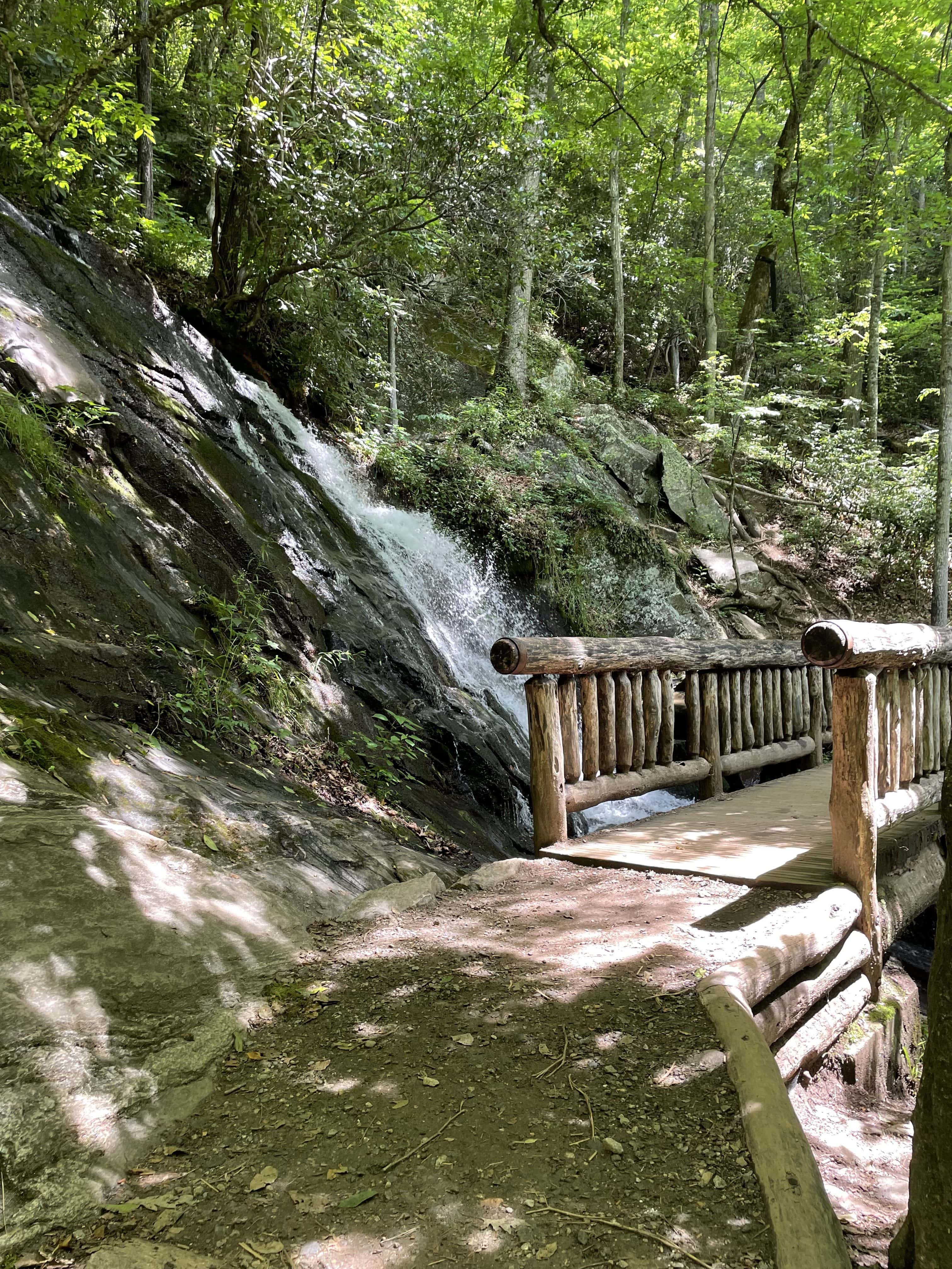
juney whank Waterfalls Trail Loop
- Juney Whank Falls
- Indian Creek Falls
- Tom Branch Falls
Access trail: Juney Whank Falls Trail (8-F)
Trailhead: Follow the signs through downtown Bryson City to Deep Creek Campground. Continue past the campground over where the trailhead starts. There is parking at the trailhead and additional down the road.
Walk the short Juney Whank Falls trail to the first waterfall (Juney Whank). Cross the falls on a footbridge and continue to the trail junction. Follow Deep Creek Horse Trail toward Deep Creek Trail. At the junction proceed 0.1 miles to Indian Creek Trail, which will lead you to the second set of falls. Then backtrack and follow the hiking trail back to the trailhead where you started, you’ll pass Tom Branch Falls 0.5 miles from Indian Creek Falls.

Mingo Falls Trail
Access Trail: Pigeon Creek Trail (10-E)
Trailhead: from Oconaluftee Visitor Center, drive south on U.S. 441 and take the second left onto Big Cove Road. At the first stop sign make a left and drive 5 miles to Mingo Falls Campground where the trailhead begins.
Mingo Falls is on the Cherokee Indian Reservation, just outside the national park. No permits are required. The falls are one of the tallest and most spectacular in the southern Appalachians.
Mouse Creek Falls Trail
Access Trail: Big Creek Trail (11-B)
Trailhead: Exit I-40 at Waterville Road (#451). Turn left after crossing the river and proceed 2.3 miles to an intersection. Continue straight, past the ranger station, to a large parking area at the road’s end.
Waterfall Hiking Trails on the Tennessee side
Abrams Falls
Access Trail: Abrams Falls (3-D)
Trailhead: the turnoff for the trailhead is located past stop #10 on the Cades Cove Loop Road
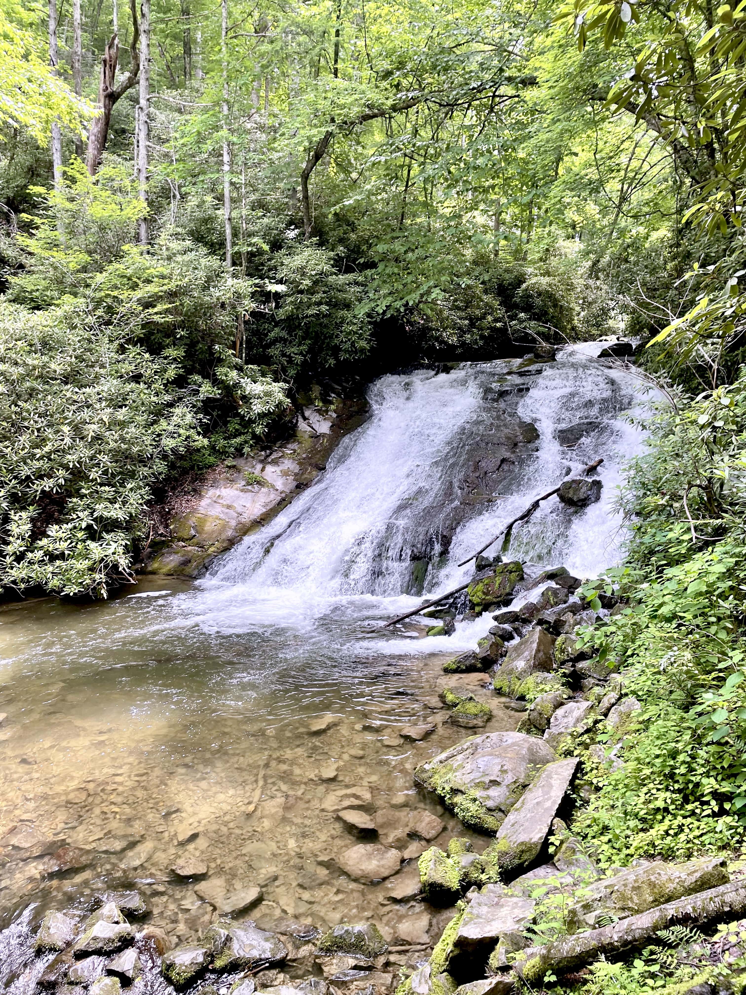
Highlights of Abrams Falls include its large volume of water and the long, deep, picturesque pool at its base. Due to the undertow, swimming in the pool at the base of the falls is extremely dangerous and forbidden. The trail to the falls traverses pine-oak and hemlock forest on the ridges and runs along the creek. The trail is 5 miles round trip with elevation changes making it a bit challenging for new hikers but totally worth it.
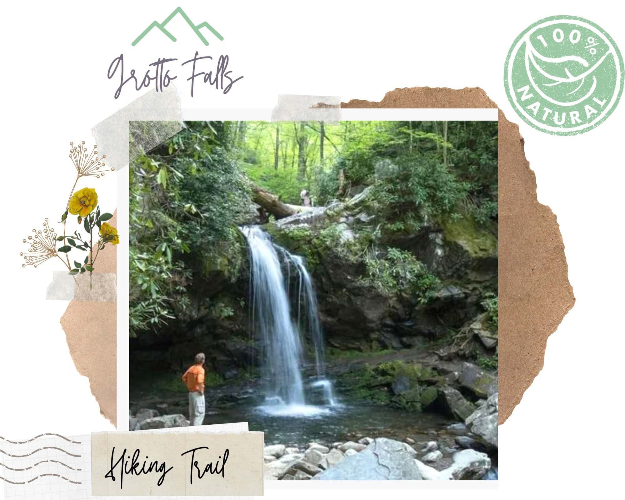
Grotto Falls
Access Trail: Trillium Gap (7-C)
Trailhead: From the parkway in Gatlinburg, turn at traffic light #8 and follow Historic Nature Trail/Airport Road. Take Roaring Fork Motor Nature Trail to stop #5
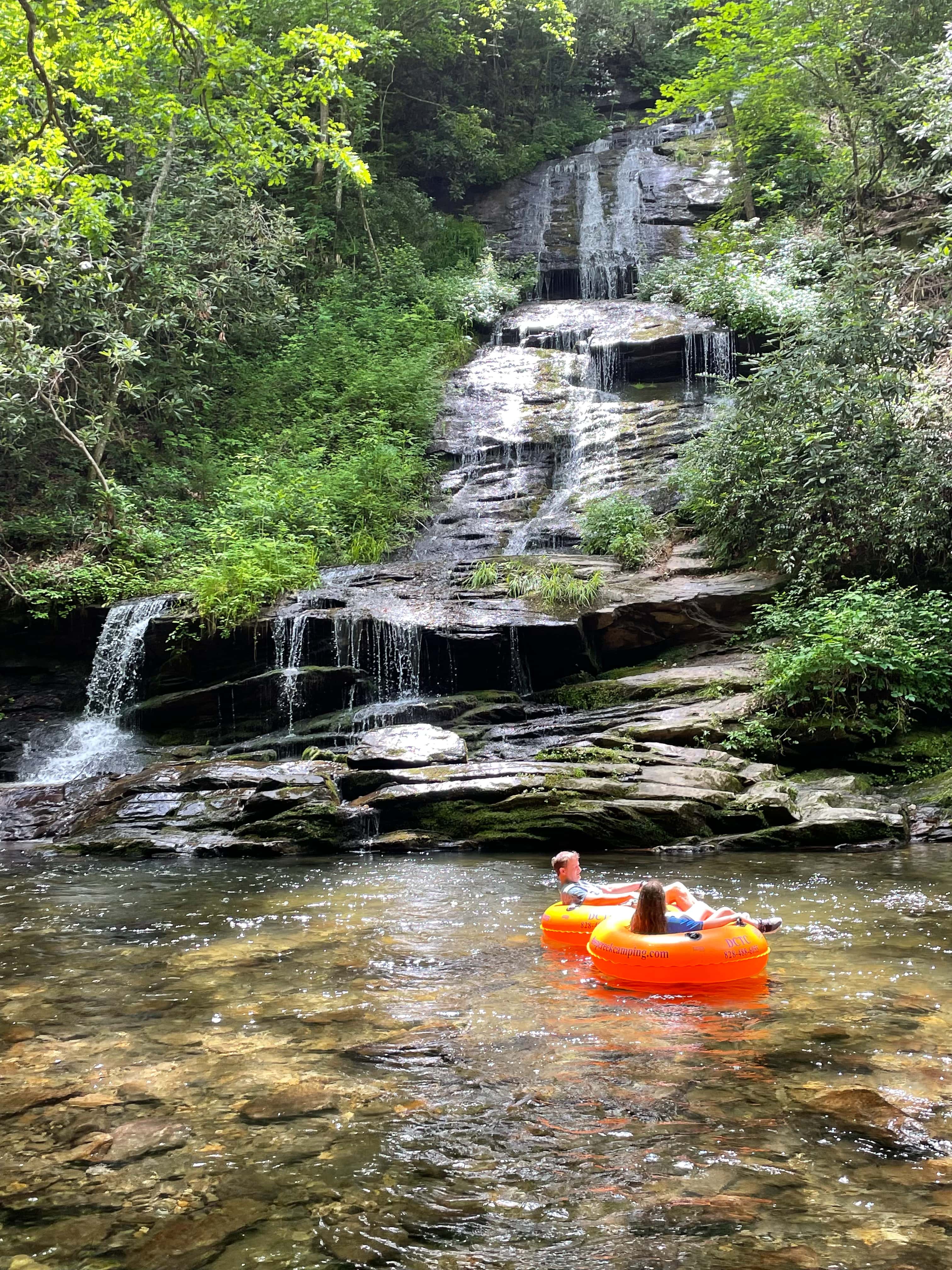
The roundtrip distance to the waterfall is 2.6 miles and the hike is generally considered moderate in difficulty. It took about 3 hours to hike to the waterfall and back. Trillium Gap Trail meanders through an old-growth hemlock forest and actually continues behind the 25-foot-high waterfall. The cool, moist environment near the falls is ideal for salamanders and a great spot for summer hikers to cool down.
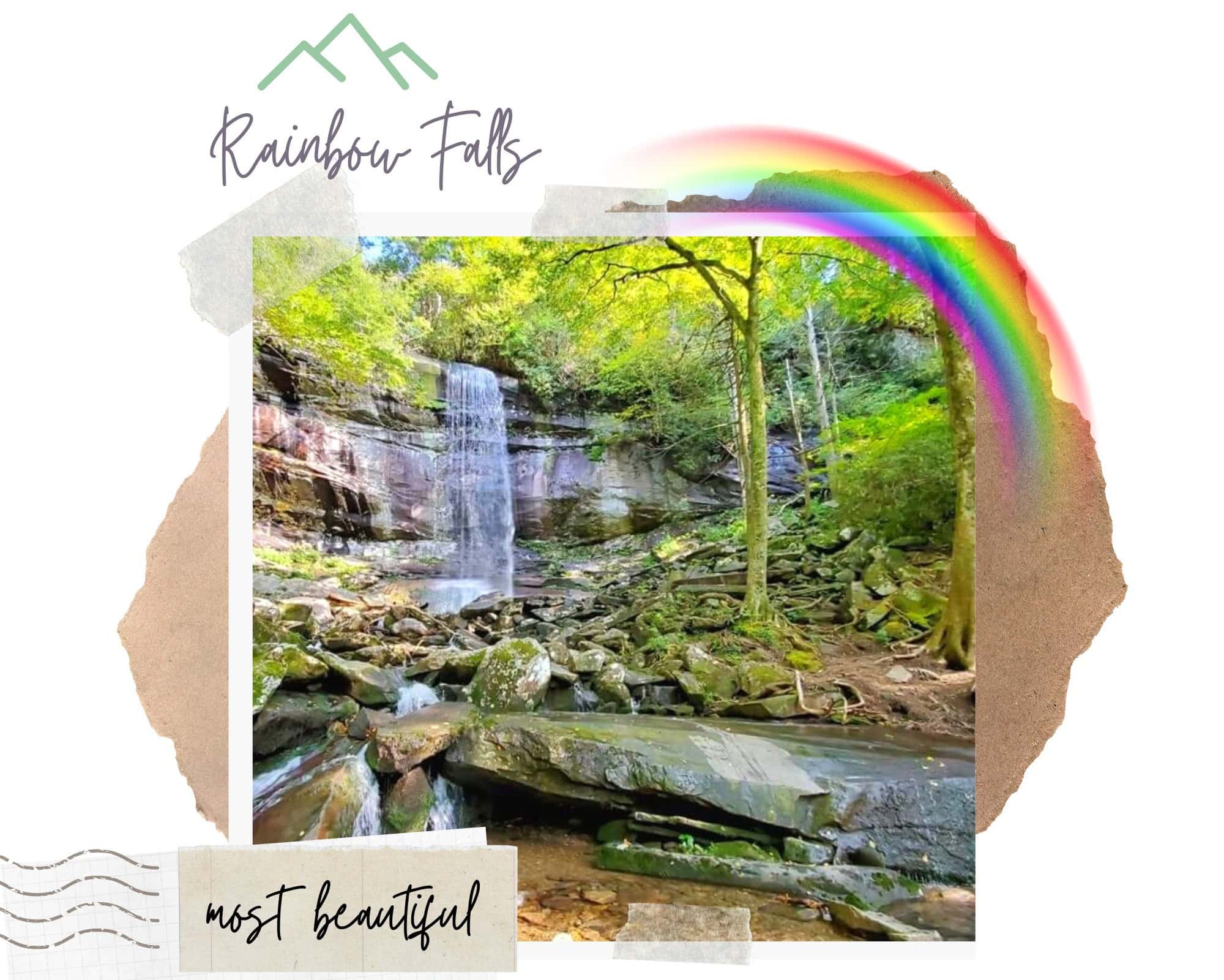
Rainbow Falls
Access Trail: Rainbow Falls Trail in the Roaring Fork area
Trailhead: From the parkway in Gatlinburg, turn at traffic light #8 and follow Historic Nature Trail into the Great Smoky Mountains National Park. Continue past the Noah “Bud” Ogle homesite to the clearly signed Rainbow Falls parking area.
The waterfall got its name from the rainbow it makes with the mist from this 80-foot high waterfall. The rainbow is visible on sunny afternoons so plan accordingly. If you visit in the winter, an impressive ice formation builds around the falls.
From the trailhead to the falls, Rainbow Falls Trail gains about 1,500′ in elevation. The 5.4-mile roundtrip hike is considered moderate in difficulty. Once you reach the falls you have the option to continue for another 4 miles beyond the falls to the summit of Mount Le Conte.

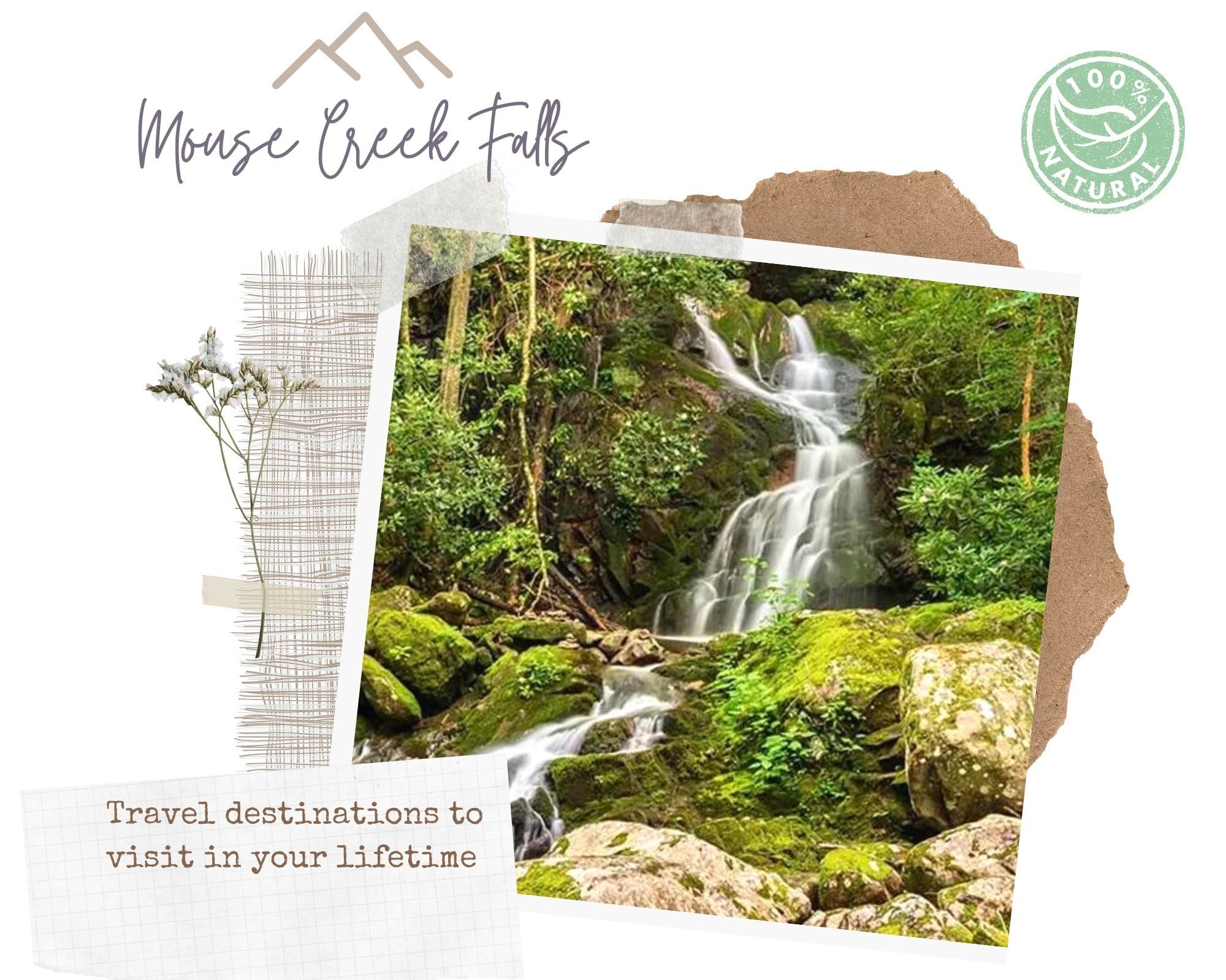
Mouse Creek Falls
Access Trail: Big Creek Trail
Trailhead: Exit I-40 at Waterville Road (#451). Turn left after crossing the Pigeon River and proceed 2.3 miles to an intersection. Continue straight, past the ranger station, to a large parking area at the road’s end.
Big Creek Trail follows an old railroad grade that was used to haul lumber out of the mountains during the logging boom at the start of the 20th century. At 1.4 miles the trail passes Midnight Hole, a deep, picturesque pool below a 6′ falls. At 2.1 miles a short side trail on the left leads to a bench where hikers can rest and view Mouse Creek Falls.
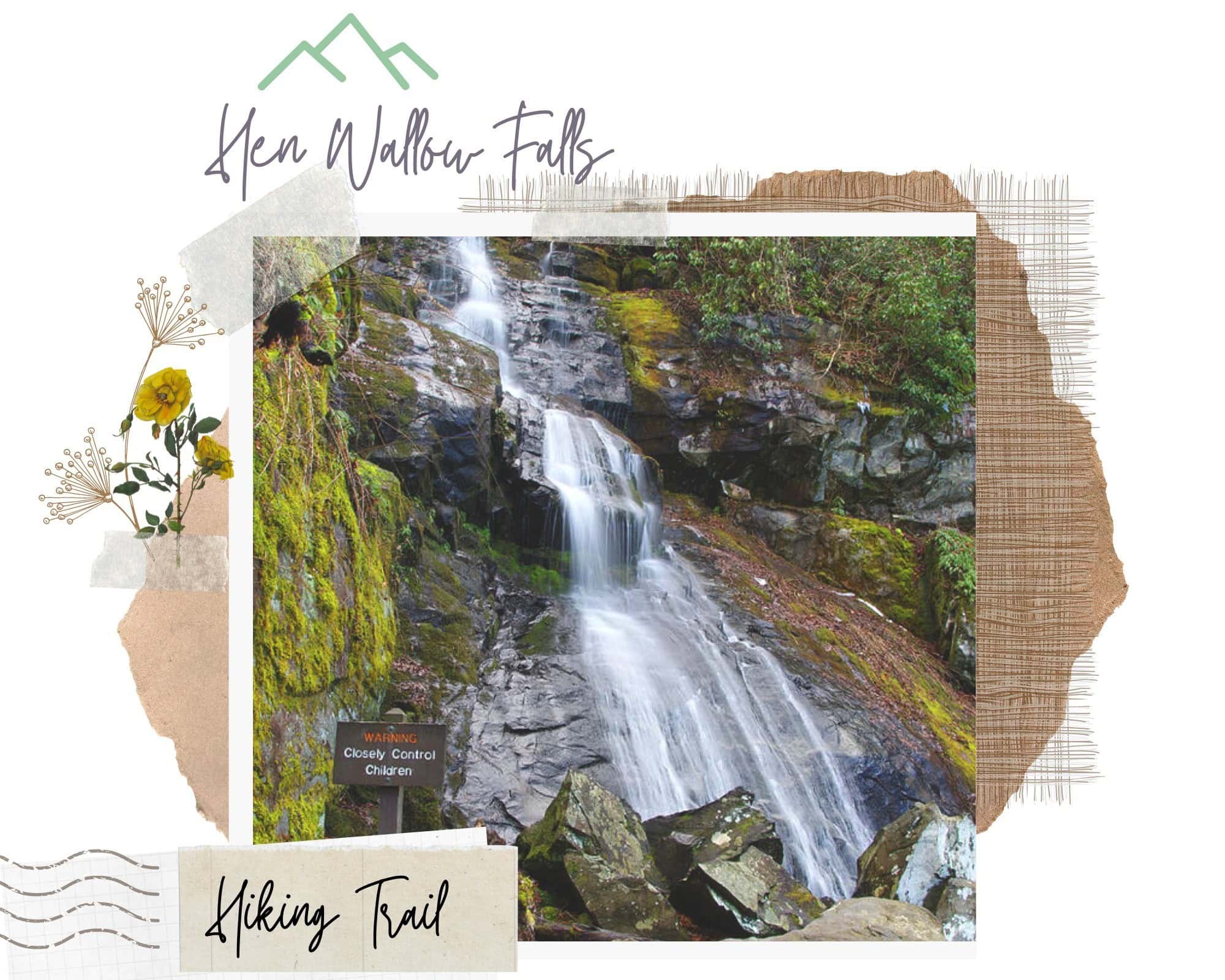
Hen Wallow Falls
Access Trail: Cabes Mountain (10-B)
Trailhead: park in the designated hiker parking area at Cosby Picnic Area near the entrance to the campground
To reach Hen Wallow Falls take the Gabes Mountain Trail 5 miles out and back. Generally considered a moderately challenging route, it takes an average of 2 h 18 min to complete. This is a very popular area for hiking, so you’ll likely encounter other people while exploring your way to the 90 feet tall waterfall.

Laurel Falls
Access Trail: Laurel Falls Trail (6-C)
Trailhead: From Sugarlands Visitor Center turn towards Cades Cove on little river dr and drive 3.8 miles to the trailhead.
Laurel Branch and the 80-foot-high Laurel Falls are named for mountain laurel, an evergreen shrub that blooms along the trail and near the falls in May. The waterfall consists of an upper and a lower section, divided by a walkway that crosses the stream at the base of the upper falls.
The trail ascends Cove Mountain, leading past Laurel Falls, one of the most popular waterfalls in the national park, en route to the summit of Cove Mountain and the Cove Mountain fire tower.
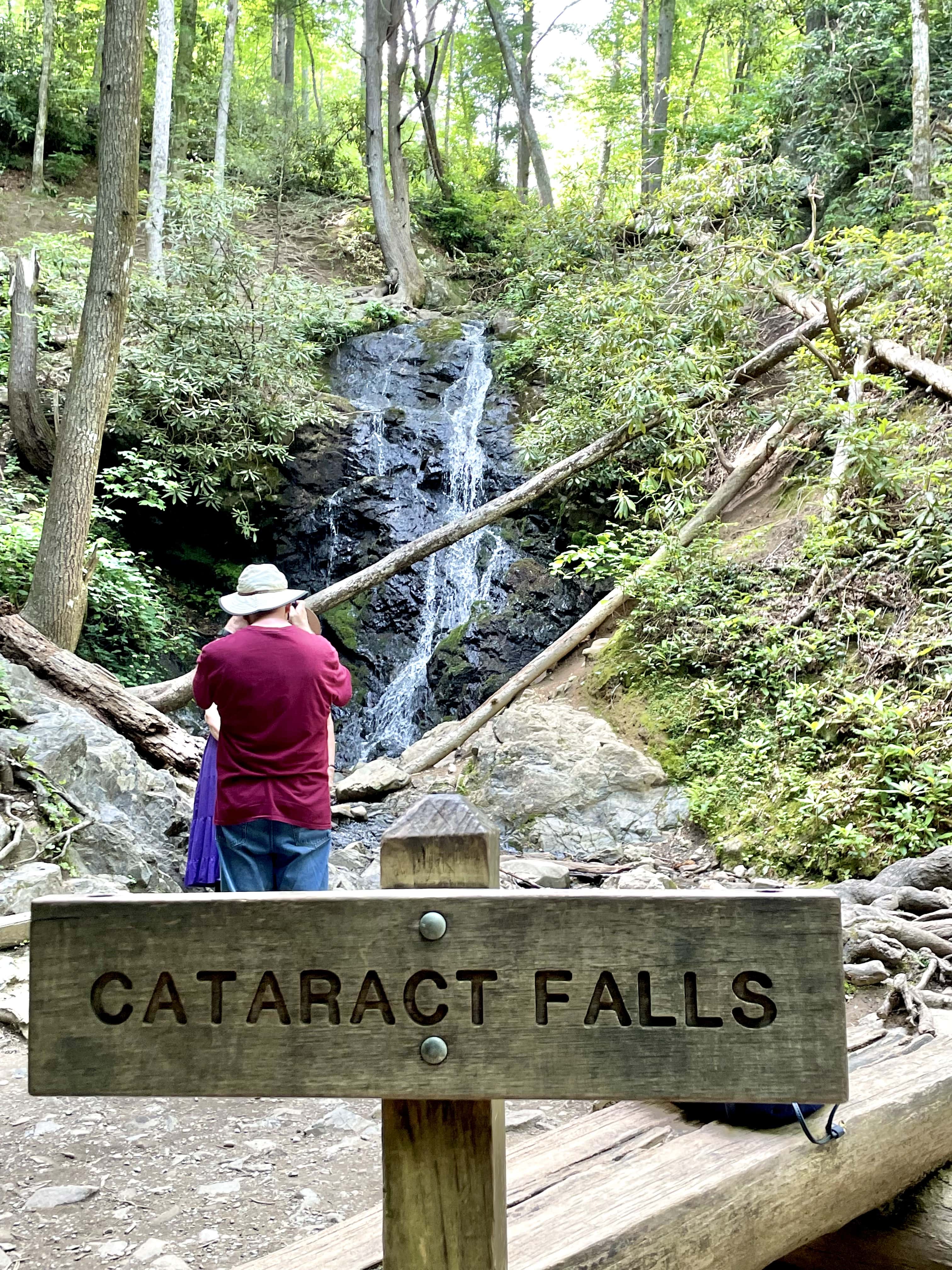
cataract falls
Head out on this 1.1-mile out-and-back trail near Gatlinburg, Tennessee. Generally considered an easy route, it takes an average of 21 min to complete. This is a very popular area for hiking and walking, so you’ll likely encounter other people while exploring. The best times to visit this trail are May through November. You’ll need to leave pups at home — dogs aren’t allowed on this trail.


Oh these look incredible. Thank you so much for sharing.
Yeees! I flipping love trails to waterfalls. Great Smokey Mountains National Park looks like waterfall heaven! I love that there are a range of levels of effort so you can attempt an epic hike, or just an easy walk. 🙂
Rainbow falls and Mouse Creek falls both look brilliant.
Love this guide to the best waterfall hikes in the Great Smoky Mountains National Park. We did a quick drive through last summer and I definitely want to return and go hiking.
The Smokey mountains is on my “to do” list. I look forward to visiting and checking out some of these waterfall. Thanks providing the great content and helpful information to help me out!
Thanks a lot for also adding in the waterfalls you can drive to. My partner sometimes does not feel like hiking, so this is super helpful for both of us
Oh my goodness we would LOVE to visit Great Smokey National Park. It is so high on our list and I hope that in the next year or two it works out. We love waterfalls and this has really been motivating to push this up the list, haha!
These lovely waterfall hikes are perfect for a weekend trip with the whole family! I can’t wait to visit the Great Smoky Mountains National Park and explore all these beautiful trails.
The views are to die for, it looks like a gorgeous hole